By Vicky · Published Mar. 8th, 2021 · Updated Nov. 23rd, 2022
When you buy through links highlighted with an asterisk (*) on this site, we may earn a small affiliate commission at no cost to you.
Cataract Valley hike in the Central Drakensberg is one of the best trails in this region. It’s not too difficult, yet you get up close to the mountains, see waterfalls, and come back via large caves.

Location
This walk starts from Injisuthi Camp in the Central Drakensberg. For more information about Injisuthi Camp and how to get there, read our Injisuthi Camp guide. We camped here, though if you’re on a day visit there is space to park your car.
Cataract Valley Hiking Map
Get the route by downloading the .gpx or .kml file below. For navigation with Maps.me on your mobile phone, simply download the .kml file and open to add it to the Maps.me bookmarks.
Tips
- Make sure to sign the mountain register outside reception before you leave & make sure to sign it again when you get back!
- We used the Cicerone hiking guide: Walking in the Drakensberg*, to plan this hike. It also suggests other hikes here, and elsewhere in the Drakensberg.
- The vegetation is slightly scratchy in summer, so consider wearing trousers if you think you won’t like this.
- Start this hike early, especially in summer. Afternoon thunderstorms are common, and you should get back to camp to shelter from the lightning.
- If it’s been raining a lot (often in summer), there are a few stream crossings where you might get your feet a bit wet. These shouldn’t be too challenging, apart from in times of full flood.
- Poacher’s Stream is another beautiful but shorter hike in the area
- Read more about Injisuthi Camp or our Drakensberg Road Trip.
After signing the mountain register outside reception, continue across the grassy area, heading between two chalets, towards the mountains. Most of the trails start here.
The trail heads upwards and soon becomes flatter. Keep going straight, ignoring the paths heading off to the left (you will come back this way). There’s a handy bench with beautiful views to sit and recover your breath.
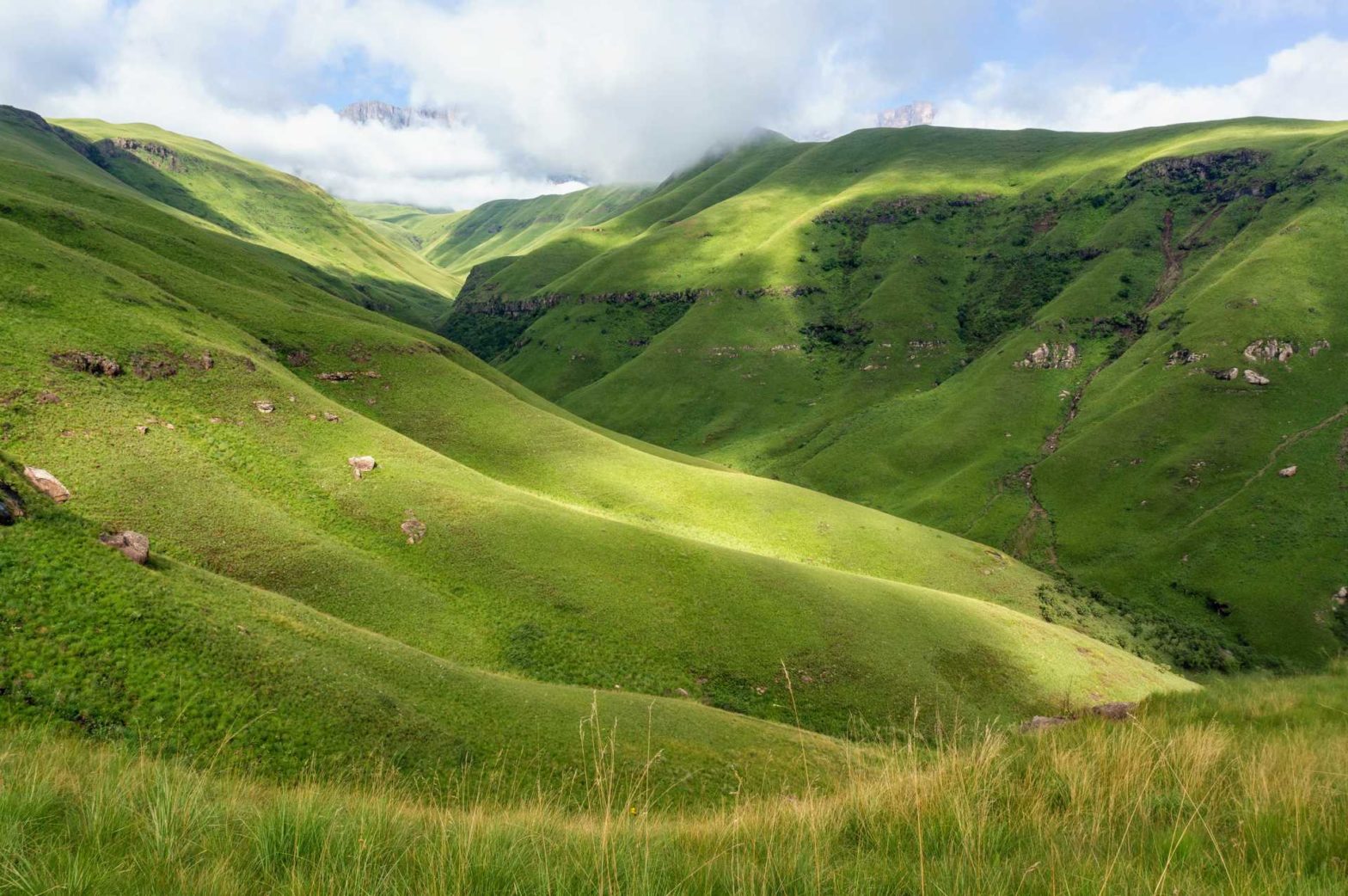
As you continue along the path, views of the steep rocky cliffs of the high berg will come into sight. For us, these were initially covered by clouds, but they soon began to lift. The sun shining on the mountains was beautiful.
Cataract Valley
After 2.5 km from the start, you cross a stream and turn sharply left, up into Cataract Valley itself. This is a much narrower valley off the broader one you have been walking in up until now. There’s a little bit of vegetation overhanging the path, but the path itself is mainly clear. There are a few stream crossings, but none are too difficult (unless the streams are in flood when the snow melts).
The path heads left, zigzagging up a fairly steep slope and leading you out of the valley to the hills above. This is the highest point on the walk, and there are fantastic views from here. Soon after we reached this point, the clouds descended, and we couldn’t see the high mountains for the rest of our hike.
The trail then heads down, into a new valley. The trail cuts across the valley slope, heading upstream to the centre of the valley. There is a small trail that leads only towards the waterfall (above right). This isn’t the right way, it’s a dead end. The slope towards the waterfall is slippery and overgrown, so I wouldn’t recommend trying to reach it.
Continuing along the valley sides, you round a corner, and soon the Grindstone Caves start to appear. There are two of these, both similar overhangs. They are both a cosy place to have lunch and admire the view.
After the caves, there are a series of parallel paths leading along the hillside. Try to keep on the highest one, near the sandstone cliffs, as this is the largest and has the easiest walking.
Flora and Fauna
All the little creepy crawlies seemed to have the same red and black colour scheme. We saw many caterpillars, millipedes and locusts.
Beautiful flowers and insects lined the paths and it was also a great time of year to see a huge variety of mushrooms and fungi.
After 3 km, you’re almost back at camp. First you have to cross a stream, where we found a dilapidated bridge. Luckily, it was easy enough to cross the stream anyway. To cool off, paddling would be an option here.
The trail continues along the other side of the stream, and round back to the bench just by Injisuthi camp. Head right and in a few minutes, you’ll be back at reception where you should sign back in on the mountain register.
Click to find out more about Injisuthi Camp, our Drakensberg Road Trip, or Hluhluwe-iMfolozi Park (coming soon) where we went next on our two-month road trip around South Africa.
Related Posts


