By Vicky · Published Mar. 30th, 2022 · Updated Sep. 9th, 2023
When you buy through links highlighted with an asterisk (*) on this site, we may earn a small affiliate commission at no cost to you.
The Singapore Coast to Coast Trail is a long walk along streets with some short, interesting highlights. The hiking trail goes from Jurong Lake to Coney Island, 38.5 km in total.
Coast to Coast Trail Map
Get the route by downloading the .gpx or .kml file below. For navigation with Maps.me on your mobile phone, simply download the .kml file and open to add it to the Maps.me bookmarks.
Page Contents:
Location
The Coast to Coast Trail starts at Jurong Lake Gardens. Take the metro to Lakeside MRT Station on the green East-West Line. The Coast to Coast Trail ends at the West Entrance to Coney Island which isn’t the easiest place to reach. From here the nearest public transport is the bus station at Punggol Road End, 1 km away on the opposite side of Punggol Point Park. Alternatively, take a Grab.
Tips for hiking the Coast to Coast Trail
- If you want to hike the Coast to Coast Trail all in one go, it’s advisable either to start very early in the morning (3-4am) or in the late afternoon (5pm) and continue through the night. This is to avoid the maximum heat of the day from 2-5pm, bearing in mind the hike takes at least 8 hours to complete and probably more like 10-11 hours. Alternatively, wait for a rainy, cloudy day.
- If you’re hiking at night, remember a head torch as there are some dark sections, and wear light-coloured, reflective clothing so cars can more easily see you.
- If you want to spread the hike over two or more days, it’s still advisable to start early morning or late afternoon as the route does not have much shade and it can be very hot.
- Wear a GPS Watch* to impress your friends on Strava!
- Some sections of the route may be closed, check the NParks website for trail closure details.
- Remember to take water, snacks, sunglasses and a sunhat.
- For another challenging hike, try Gunung Pulai, just across the causeway in Malaysia.
- Check out other great hikes on our Singapore Hiking Page
Coast to Coast Trail Overview
The Coast to Coast Trail is a long route linking several parks in Singapore, such as Jurong Lake Gardens, Bukit Batok, Bukit Timah, MacRicthie Reservoir, Bishan-Ang Mo Kio Park, Sengkang Riverside Park and Coney Island.

However, the Coast to Coast Trail route itself does not enter any of these parks. Instead, it mainly follows busy roads along pavements and sometimes park connectors. This makes the walk not very scenic and means you often have to wait at road crossings, breathing in car fumes. Hiking the coast to coast trail at nighttime reduces wait times and pollution.
How long is the Coast to Coast Trail?
The official distance of the Coast to Coast Trail is 36 km, but we walked 38.5 km on the trail. This includes the walk from Lakeside MRT station to the first checkpoint (which I think the official guide forgot to count, but it is part of the official trail). At the end of the trail you have to walk an additional 1 km to reach any public transport, so the route might be more like 39.5 km in total.
There are 10 Coast to Coast checkpoints, but only 9 are on the trail – the 10th is about 7km off route and optional (I’m not sure why it’s even included in the official Coast to Coast brochure…). There’s also an official Coast to Coast App (download from Google Play or App Store) but it currently (April 2022) doesn’t work.
Is hiking the Coast to Coast Trail worth it?
The Coast to Coast Trail is one of the least scenic trails in Singapore, though it gets better towards the end. You walk tantalisingly close to many parks but always just stick to the roads. As purely exercise, it suffers from the problem of pollution and long wait times to cross the road. The main reason to hike this trail is to say that you’ve hiked this trail. If you complete it all in one day it will feel like an achievement, though the souls of your feet will be very sore from all the concrete and you will have breathed in a lot of pollution.
What time of day should I hike the Coast to Coast Trail?
Since it is very hot and humid in Singapore, it’s best to avoid hiking during the peak heat of the day, roughly 2-5 pm. The most pleasant times for hiking are before 11 am and after 5:30 pm.
Hiking the Coast to Coast in One Day
Hiking during the day
Since the hike takes at least 8 hours and probably more like 10, if you hike during the day it’s hard to avoid the scorching heat of mid-afternoon (2-5pm). The heat and humidity tire you out very quickly, and on such a long hike you can easily become dehydrated and exhausted. If you are set on hiking during the day, wait for a day that will be cloudy and slightly rainy (but you also don’t want it to be heavy rain all the way!).
Hiking overnight
Hiking the trail overnight is a popular option because it is much cooler than during the day. Additionally, there are fewer cars on the road so there’s less pollution and you don’t have to wait so long at all the road crossings. The drawback is that you miss a night’s sleep!
If you start at 7 pm you’ll probably finish between 4 am and 7am. The first bus from Punggol Road End (the nearest bus stop to the end of the hike, 1 km away) is around 5:30 am. If you finish earlier, you can get a Grab.
There’s a McDonald’s with long opening hours (24-hours Fri-Sat, 6am-2am Sun-Thu) roughly two-thirds of the way along the route, one of the only eating places to be open throughout the night.
Hiking the Coast to Coast Trail in Two Days
Hiking the route in two days is a good option. Splitting the hike over two days means you won’t be so tired at the end and don’t have to carry so much water or as much food. It’s possible to start hiking each day at 5 pm and finish by 9:30 – 11 pm, when public transport is still working. Alternatively, starting to hike at 6 or 7 am and finishing at 10:30 am-1 pm also avoids the heat of the day.
If you hike the trail in two days, MacRitchie Reservoir Park is a convenient halfway stop. There is a bus stop at the edge of the park. It’s 20.3 km along the route for the first day, with 18.2 km (plus 1 km to the bus stop near the end) for the second day.
Hiking the Coast to Coast Trail in Three Days
If you prefer hiking the trail in three days, it’s convenient to stop at Tan Kah Kee MRT Station after the first day, and at a bus stop near Ang Mo Kio Town Garden West after the second day. This divides the hike into manageable sections of 14.5 km, 11 km and 13 km (plus 1 km to the bus).
What to Take on the Coast to Coast Hiking Trail
The hiking trail passes shops and restaurants along the way so it’s possible to buy water and food en route. There are also several toilets along the route, all signposted on the C2C signs.
Clothes to Wear
- Trainers with cushioning e.g. road runners (men*, women*)
- Anti-Blister Socks*
- Breathable Top (men*, women*)
- Sunhat & Sunscreen
Things to Bring
- Small Hiking Backpack*
- Water & snacks
- Umbrella*
- Sunglasses
- GPS Watch*
Coast to Coast Trail Hiking Route
Below, the 38.5 km route is divided into four roughly equal segments of about 10 km each. There are convenient public transport links from the end of each segment, but there are equally convenient bus and MRT stops fairly often along the entire route.
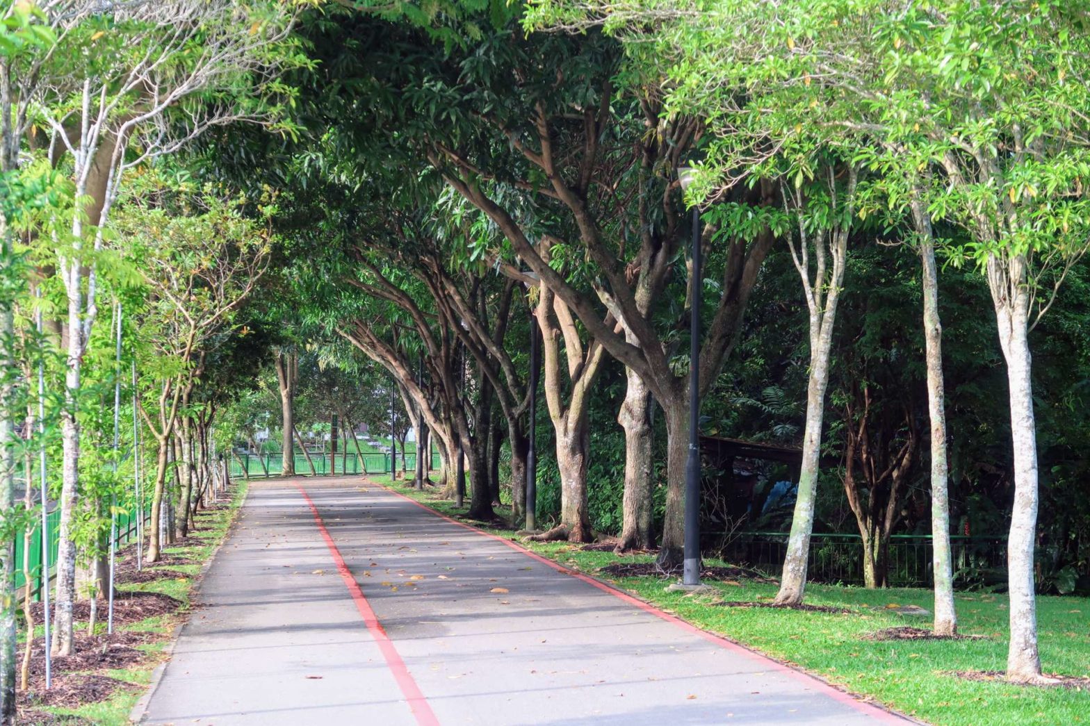
Jurong Lake Gardens to Bukit Timah (9.8 km)
Summary: Gardens, park connectors and roads.
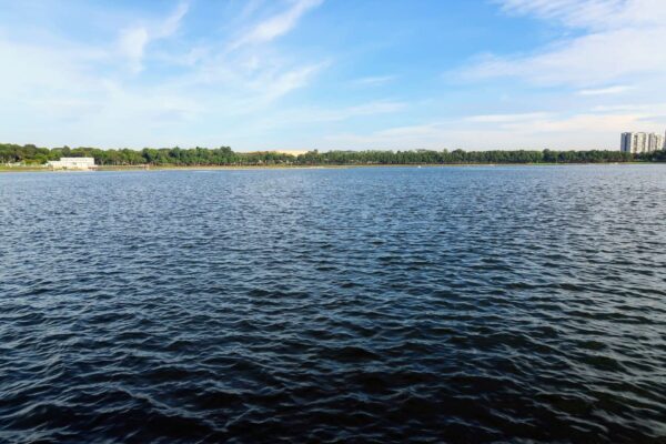
Jurong Lake Gardens
From Lakeside MRT station, take Exit B. Follow the path across the grassy area, then head left and cross over the road into Jurong Lake Gardens. Once in the gardens, head left. The Jurong Park Connector around the northern end of the lake is currently closed (April 2022) for renovation, so head to the road and walk left beneath the MRT track.
Shortly after the bridge over the Jurong River, cut right where it’s signed Coast to Coast Trail, and continue. You’ll reach the edge of the lake where there are nice views over the grass, water and Chinese Pagoda. This short section is one of the nicest bits of the hike. The Park Connector bends around to the left, following a small water channel, and then you take a pedestrian bridge over the road.
Roads and Park Connectors
The next few kilometres are a mix of walking along the pavement by roads, and along park connectors next to concrete river channels. The Coast to Coast Trail is generally well-signed. At each road junction you can scout around and find the distinctive three-panel signs marking the Coast to Coast Route, and head for that. Part of this trail is on the Ulu Pandan Park Connector, which we hiked previously to reach Pandan Reservoir.
Bukit Batok and Bukit Timah
Eventually, you reach the edge of Bukit Batok Nature Park. The trail follows around two sides of the park before reaching a large highway. Cross over the highway and follow Bukit Timah Park Connector to Hindhede Drive and the entrance to Bukit Timah Nature Reserve. Beauty World MRT station is only a few hundred metres away if you want to stop the hike here.
Bukit Timah to MacRitchie Reservoir (10.5 km)
Summary: Busy roads, quiet roads, and park connectors.
Instead of following the nicer route along the Rail Corridor, the official Coast to Coast Trail sticks to the side of the busy road. You cross over a busy junction, head right and reach Bukit Timah Road. There follows a long, straight stretch of walking along this road, for about 5 km. The most exciting thing was the impressive grounds of Hwa Chong Institution on the right-hand side of the road.
If you want to stop for the day, there are several MRT stops on the blue Downtown Line that you pass while walking along Bukit Timah Road. The first is King Albert Park MRT, and the last is Botanic Gardens MRT. For something to eat, there are many restaurants along the side of the road between Tan Kah Kee and Botanic Gardens MRT Stations.
Botanic Gardens Onwards
Just before Botanic Gardens, the Coast to Coast route turns left along Adam Road. On a separate hike in this neighbourhood, we visited the black-and-white houses of Adam Park and the Bukit Brown Cemetery. The Coast to Coast trail misses these sights but continues along the road to the tiny Kheam Hock Park. You pass right by Adam Road Food Centre if you want a quick, cheap bit to eat.

Just after this park the route heads under a bridge and up a nice road through tall trees and some of the Bukit Brown Cemetery. Walk over Lornie Highway on a pedestrian bridge and turn right along the edge of MacRitchie Reservoir. This road is quiet and the jungle is just on your left so it’s fairly nice. Soon you reach the main entrance and car park for MacRitchie Reservoir. If you want to stop for the day, there’s a bus stop here, just over halfway through the hike.
If you want to explore MacRitchie Reservoir, we have two previous hike reports, one looping around the reservoir, and one heading straight through.
MacRitchie Reservoir to Punggol River (9.5 km)
Summary: Busy roads, a park, and park connectors by the road.
Marymount Road/Ang Mo Kio Avenue 6
Continue onwards along the road from the main MacRitchie entrance and car park. At a junction with many concrete flyovers, the route bends left. After 300 metres there’s an underpass to the right and you reach Marymount Road/Ang Mo Kio Avenue 6. The trail heads 3.5 km along the side of this road, plus a short out-and-back detour into Ang Mo Kio Park to reach Checkpoint 5 (near the water playground).
Ang Mo Kio Park is very nice, and we visited it previously while hiking along Kallang River, but walking along the road is not very exciting and there are quite a few construction projects here.
Just before turning right onto Ang Mo Kio Avenue 5, you pass Ang Mo Kio Town Gardens. There’s a Mcdonald’s on the edge of the park that’s open 24 hours Fri-Sat and until 2am Sun-Thu, a convenient rest point if you’re hiking during the night. There are also plenty of bus stops around the junction of Ang Mo Kio Avenue’s 5 and 6 in case you want to stop for the day here.
Ang Mo Kio Avenue 5
After turning right, it’s another long stretch along Ang Mo Kio Avenue 5, roughly 3.5 km by the road. The nicest part is near the end when you walk along the edge of a grassy slope bordering Ang Mo Kio Linear Park.
Shortly after this park, you cross a small river and then immediately turn left up Yio Chu Kang Road. In a couple of hundred metres you’ll see the river again, this time on your right. Cross the road here and head down to the river for the final part of the hike. There is a convenient bus stop here in case you want to stop here for the day.
Punggol River to Coney Island (8.7 km)
Summary: Park connectors by waterways.
Punggol River
The final stretch of the Coast to Coast Trail is the nicest. You no longer follow a road, but a river, and then a waterway. We did a similar hike previously, with a slightly different route that additionally explored Sengkang Riverside Park and finished at Punggol Point Park.
The route for this section is very simple. Head up the east (right) side of Punggol River for roughly 4 km until the Jewel Bridge. There are lovely views of the river and across the water, especially near Sengkang Floating Wetlands and Riverside Park.
Punggol Waterway
Near the Jewel Bridge there are also nice views along the riverbank, and of the bridge itself. The route continues over the bridge, after which you turn immediately right to follow Punggol Waterway. There are some adventurous bridges over the water in this area, and you walk through Punggol Waterway Park, with lots of grass and trees.
The Final Stretch
After about 3 km your reach Wave Bridge, and here head left along a small, straight waterway towards the coast. It’s now less than 2 km until Coney Island and the end of the Coast to Coast Trail hike. When you reach the coast, turn left to walk through the trees along the edge of the water.
You’ll soon see your final destination, and it’s just a bit further until you reach Serangoon West Dam. Walk the few hundred metres across this dam and you’ll end up at the Western Entrance to Coney Island. Find the last checkpoint just in front of the gate, take a photo of the famous sign, and congratulate yourself on reaching the end of the Coast to Coast Trail.
If you want to explore Coney Island itself, check out one of our previous hikes on the island.
If you’re now hungry, get a discount voucher for House of Seafood* at Punggol Point.
Getting back from the end of the Hike
There is not much public transport from near here. The closest bus stop is at Punggol Road End, on the opposite side of Punggol Point Park. Alternatively, take a Grab. There are several eateries in the nearby The Punggol Settlement if you want to refuel before leaving.
Check out the complete list of hiking gear needed for Singapore:
If you want to explore the parks on this hike, check out Jurong Lake Gardens, Bukit Batok, Bukit Timah, MacRicthie Reservoir, Kallang River and Ang Mo Kio Park, Punggol River and Sengkang Riverside Park, or Coney Island. For another long and challenging hike, try Gunung Pulai, just across the causeway in Malaysia, or for other hiking ideas see our Singapore Hiking page.
FAQS: Coast to Coast Hiking Trail
It takes between 8 and 12 hours to complete the Coast to Coast Trail. If you are a fit hiker and walk roughly 5 km per hour including stops, you’ll take only 8 hours. If you walk 4.5 km per hour and have a few breaks, you’ll take 10 hours. If you walk slower and have longer breaks you might take up to 12 hours.
The Coast to Coast Trail starts at Jurong Lake Gardens. To get there, take the metro to Lakeside MRT station, on the green East-West line.
The Coast to Coast Trail is 38.5 km long. The official website says 36 km, but this is wrong (for some reason it misses out the distance between the official start at Lakeside MRT station and Checkpoint 1).
The Coast to Coast Trail ends at the Western Gate to Coney Island. To get back from there, the closest bus stop is at Punggol Road End, on the opposite side of Punggol Point Park.
Related Posts


This is exactly the blog I was looking for!! Perfectly done! Thanks for writing it.
thanks! 🙂