By Tom · Published Nov. 13th, 2021 · Updated Nov. 28th, 2022
When you buy through links highlighted with an asterisk (*) on this site, we may earn a small affiliate commission at no cost to you.
The Northern Explorer Loop connects Lower Seletar Reservoir to Woodlands Waterfront. Although the parks on the route are quite scenic, especially the reservoir in the early morning, the remainder of the route is on park connectors next to busy roads.

Page Contents:
Location
On the Diwali holiday in November 2021, we took the red North-South MRT line to Khatib. Our hike starts from this MRT station as it is closest to Lower Seletar Reservoir Park. The Northern Explorer Loop is a one-way hike despite the name and we took a bus and the same MRT back home from the end.
Northern Explorer Loop Map
Get the route by downloading the .gpx or .kml file below. For navigation with Maps.me on your mobile phone, simply download the .kml file and open to add it to the Maps.me bookmarks.
Tips for Northern Explorer Loop
- This hike goes through three parks:
- All parks and park connectors on this hike are open 24hrs.
- There is shade from the trees for a considerable part of the hike, but quite a few sections are open and sunny.
- Take a sun hat, sunscreen and plenty of water along.
- All paths on this hike are paved, so wear appropriate shoes.
- Navigation offline maps app Maps.me works well for this hike.
- Check out other hikes in Singapore with our interactive map.
The majority of this hike is part of the official Northern Explorer Loop (link). For some reason they call it a loop but it is a one-way hike from Lower Seletar Reservoir Park to Admiralty Park. We added the walk to and in Lower Seletar Reservoir Park and a loop in Woodlands Waterfront Park.
Lower Seletar Reservoir Park
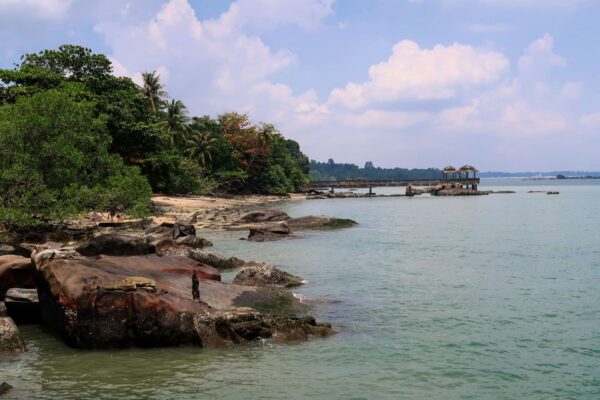
The Lower Seletar Reservoir Park is a short walk from Khatib MRT, alongside an HDB complex. Since we got up quite early, the views over the Lower Seletar Reservoir with the rising sun were rather beautiful. This was probably our favourite part of this hike.
Lower Seletar Reservoir Park is rather small, but the views make up for the size. There are two jetties to explore in this park, of which one seems to be a favourite fishing spot. After making our way along the reservoir shore through the park, we ended up at the busy Lentor Avenue.
Mandai, Ulu Sembawang & Woodlands PC
The Mandai Park Connector (PC) starts from the opposite side of Lentor Avenue. Unfortunately, that means crossing three times as they didn’t create a crossing from the park directly to the Mandai PC. This park connector follows Mandai Avenue/Road. It is quite a busy road and the PC is just next to it, so the atmosphere is not amazing.
Only once you cross the Seletar Expressway there are sometimes nice views to the left of the jungle and Upper Seletar Reservoir. We were happy to finally reach Ulu Sembawang PC.
The Ulu Sembawang Park Connector goes through a foresty area, with on one side a restricted area. The noise from the busy road is replaced by jungle sounds. The second half of this park connector is less nice however, as you are fenced in on two sides directly on the sides of the path.
After crossing the Seletar Expressway again, you reach The Woodlands Park Connector. While the first stretch along the Seletar Expressway is a bit away from the road surrounded by some greenery, the remainder until Admiralty Park is nothing more than a normal walkway next to another busy road. There is also a lack of shade on this section of the walk.
Shoes for Paved Paths
The majority of hikes in Singapore are on paved paths, so your hiking shoes need good damping. For hikes that are entirely on pavement like this one, you may prefer to wear trainers with reasonable grip. We really like the fit and feel of Salomon shoes. Their running shoes give you plenty of damping on paved paths:

Salomon Men‘s Sonic 4 Balance Running Shoes on Amazon*.

Salomon Women‘s Sonic 4 Balance W Running Shoes on Amazon*.
Check out the complete list of hiking gear needed for Singapore:
Admiralty Park
In contrast to the park connectors, Admiralty Park is rather nice. The Southern end of the park can be busy with families, enjoying the extensive playgrounds, but further north it is quite a serene park, with lots of trees, a few ponds and a mangrove section.
The mangrove is unfortunately not too clean, with plastic trash trapped in the trees. Despite this, it was interesting to see, especially when a monitor lizard made its way over to us. Not much further you have to cross the road towards Woodlands Waterfront Park. This is where we took the bus back from to the MRT at the end of the walk.
Woodlands Waterfront Park
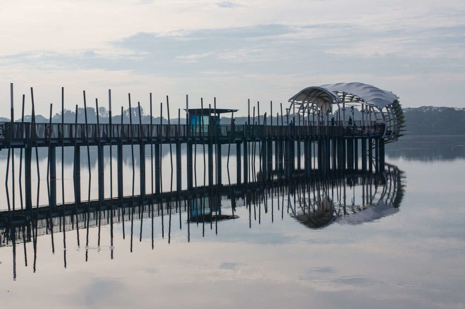
But first we explored Woodlands. We started with a quick lunch on one of the many benches. The main attraction of this park is the large jetty, that ‘almost’ reaches Malaysia. You at least have a good view of Johor Bahru in Malaysia. While the Northern coast of Singapore is quite green, the opposite bank is much more developed.
After visiting the jetty, we walked a loop through the park. It is not a very special park, but there are tree-covered paths lined with grassy fields, perfect for a picnic. After that stroll, we made our way to the bus stop and took the 856 to Marsiling MRT station.
If you would like to walk more interesting and longer hikes, check out the Southern Ridges Hike and Coney Island Hike in the south and east of Singapore. Or, check out our interactive map of hikes in Singapore.
FAQ: Northern Explorer Loop
The official Northern Explorer Loop is 11km long one-way but we extended it to 16.7km. It takes 4-5 hours to walk our hike.
Related Posts