By Vicky · Published Feb. 3rd, 2022 · Updated Nov. 29th, 2022
When you buy through links highlighted with an asterisk (*) on this site, we may earn a small affiliate commission at no cost to you.
Hike along Ulu Pandan Park Connector for a loop of breezy Pandan Reservoir before continuing by the side of a luscious green river.
Pandan Reservoir & Ulu Pandan Park Connector Hiking Route Map
Get the route by downloading the .gpx or .kml file below. For navigation with Maps.me on your mobile phone, simply download the .kml file and open to add it to the Maps.me bookmarks.
Page Contents:
Location
This hike starts near the northern end of the Ulu Pandan Park Connector near Bukit Batok. To get there, bus stop Blk 288c or Keming Pr Sch is the most convenient. We got the metro to Beauty World MRT and from Exit C there are several buses (61, 66, 77, 157, 174) to bus stop Blk 288c and the start of this hike.
This hike ends at Buona Vista MRT (orange Circle Line and green East-West Line), though Dover MRT (green East-West Line) is another convenient endpoint.
Tips for Pandan Reservoir and Ulu Pandan PC
- Pandan Reservoir and the Park Connectors are open 24/7.
- The routes are lit between 7 pm and 7 am.
- Pandan Reservoir has no shade, a sunhat is essential. Also bring plenty of water.
- Navigation offline maps app Maps.me works well.
- Check out other hikes on our Singapore Hiking Page
From a nearby bus stop, head to the southern corner of Bukit Batok East Avenue 3 and 6. Head along the pavement and you can see the start of a river. A few metres later you will see signs for the park connector and the path down along the river.
Ulu Pandan Park Connector: Bukit Batok to Pandan Reservoir
The first section of this hike involves walking roughly 4 km down Ulu Pandan Park Connector, along the Pandan River. The River has mainly concrete banks, with a few little waterfalls, before the greenery starts after you pass under an MRT line.

After 4km you reach a confluence of two rivers. At this junction, head over the pedestrian bridge across the AYE toll road. There is a very circular route that bicycles take or head to the steps for a more direct way to the bridge.
Pandan Gardens
As you cross the road on the bridge you can see a temple ahead, Yang Tao Yuan Sheng Hong Temple, sticking out from among the trees. Once over the highway take the steps down and continue along the edge of the river. You’re now in Pandan Gardens, and the temple entrance is now just on your right-hand side.
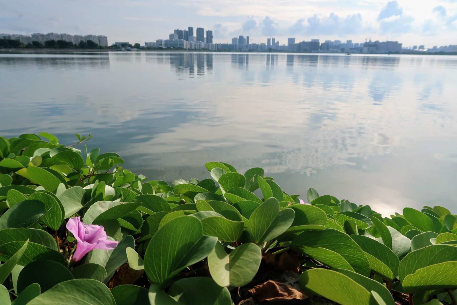
Roughly 500 metres later, cross over a small road and you’ll see the grassy banks of the reservoir. Head up here to get your first view of the open water.
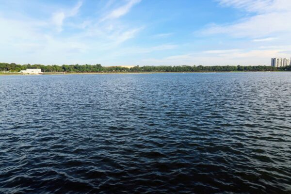
Pandan Reservoir Loop
The walk around Pandan Reservoir is 6 km. There is no shade and it can be very hot in the middle of the day, but luckily sometimes there’s a bit of a breeze across the water. Another positive is that it’s also a relatively quiet loop with few people about. Make sure to take a sunhat. If you want to shorten the hike, you can just come for the view from the wooden pontoon just in front of you and then return back to the Ulu Pandan Park Connector.
To walk around the loop, head right. The trail is gravel for most of the way, a nice change from tarmac. There are some ok views across the water and some minor points of interest on the route. The nicest part is nearer the end, as the track bends towards the middle of the reservoir and palm trees flank the route. We were lucky enough to see two otters sleeping on the banks of the water here.
Once back around the reservoir loop, go back up along the Pandan Gardens PC and take the same pedestrian bridge across the highway. Now instead of heading back up the river where you came from, head right over a small bridge across the river onto the second part of the Ulu Pandan PC.
Bring a Sun Hat
Besides sunscreen like this SPF 30 Nivea Sun Lotion*, you can protect your face against the harsh sun with a sun hat. We always throw hats in our backpack*, and use them regularly. They are not very useful in the jungle, but once you get to the open sections you are happy to carry one along. I’ve got this airy sun hat from a great American outdoor brand called Outdoor Research:

Outdoor Research Swift Sun Hat on Amazon*.
You may prefer something with a wider brim, like:

Outdoor Research Sombriolet Sun Hat on Amazon*.
Check out the complete list of hiking gear needed for Singapore:
Ulu Pandan Park Connector: Pandan Reservoir to Buona Vista MRT
Green Section through Clementi
This part of the Park Connector is one of the nicest sections of this hike. There is a lot of greenery surrounding the river, with flowers, trees and many birds. Some people come here specifically for bird watching. When we were there we saw a grey-headed fish eagle, a few herons and a pair of egrets.
Jurong Railway Line Bridge
Towards the end of the Clementi section, you’ll see an old railway bridge across the River. This bridge was part of the Jurong Railway, a section of track that led to Malaysia from Jurong Industrial Estate. The railway operated from 1966 to the 1990s.
About 600 metres after the bridge you have to cross a highway. On the other side of the road, you can choose either side to walk along the banks of the river, though the right-hand side is on the edge of Dover Forest so is more green.
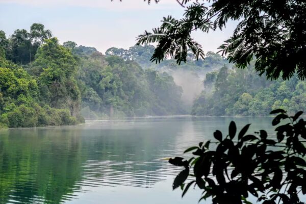
Dover Forest
The final section through Dover Forest is almost 3 km long. If you only want to walk half this distance, there is a connecting path straight to Dover MRT from the righthand side of the river. Either way, it’s initially straight on along the river, which is now mainly concrete.
On the righthand bank, you can see the edge of Dover Forest, a narrow strip of jungle. On the lefthand bank, you can see Mount Sinai Estate, with large mansions that look like they are from Paris. Take the well-signed route to the right to reach Dover MRT or head straight on and soon you’ll reach Buona Vista MRT.
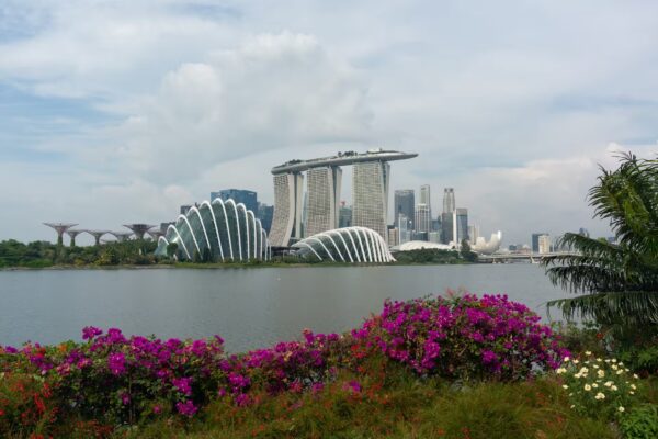
Want to walk other routes in the West? Check out the Southern Ridges Hike, nearby Bukit Timah or the Jurong Lake Gardens Hike. For other hiking ideas check out our Singapore Hiking page.
FAQs for Pandan Reservoir and Ulu Pandan PC
Pandan Reservoir is open all the time. It is lit between 7 pm and 7 am.
The loop around Pandan Reservoir is 6 km.
The Pandan Park Connector is roughly 10 km long. It stretches from Bukit Batok area to Buona Vista along the banks of two rivers.
There are no MRT stations near Pandan Reservoir. You have to get a bus to a nearby station. There are convenient buses from Haw Paw Villa MRT straight to a bus stop by the reservoir, such as the 30 or 176. Another alternative is to take the bus from Jurong East MRT. Or, hike there like on our route.
The reservoir was built in 1974. Before that, it was a swampy area of land that became the reservoir once a dam was constructed.
Related Posts