By Vicky · Published Dec. 11th, 2021 · Updated Nov. 28th, 2022
When you buy through links highlighted with an asterisk (*) on this site, we may earn a small affiliate commission at no cost to you.
Take a hike from Rochor Canal to East Coast Park via many pleasant parks and pedestrianized trails. There’s a wide variety of scenery and you end up at a beach for swimming and Joon Chiat Road for a tasty cafe.
Page Contents:
Location
This hike starts from Rochor MRT station, on the Blue Downtown line. Take Exit B from the metro. Alternatively, many buses stop at Rochor station. This is a one-way hike and we caught a bus from Parkway Parade bus stop to get back.
Rochor Canal to East Coast Park Hike Map
Get the route by downloading the .gpx or .kml file below. For navigation with Maps.me on your mobile phone, simply download the .kml file and open to add it to the Maps.me bookmarks.
Tips for Rochor Canal to East Coast Park Hike
- The parks on this hike are all open 24hrs.
- There is some shade, but many sections are fairly sunny.
- Take a sun hat, sunscreen, and plenty of water along.
- Almost all of the paths are paved apart from a few gravel in East Coast Park, so wear appropriate shoes.
- This hiking trail finishes at the end of Joon Chiat Road, a historic street full of colourful shophouses and hipster places to eat. A great place for a post-hike snack.
Rochor Canal

From Rochor MRT station head down to the start of Rochor River Canal. Walk along either side of the canal on a nice pedestrianized way. It’s pleasant and quiet as the nearby roads are not at all busy.
If you look to the right, you can see some interesting cultural sites from this part of the walk, including Our Lady of Lourdes Church, some old Malay gravestones and the strikingly blue Malabar Mosque. These are also all sites on our Kampong Glam Walking Trail which explores the area to the south of this river.
You sometimes have to deviate slightly from the river to cross the roads, but soon the river widens and you see Kallang Basin and a bridge.
Kallang Park
Cross the footbridge into Kallang Park. Suddenly the feeling becomes more tropical, with lovely palm trees and huge figs by the side of the path. There are also splendid views across Kallang Basin to the national stadium and the city itself.
The trail crosses another bridge, Sir Arthur’s Bridge, and continues around the edge of the water before nearing the stadium. You have to walk by the side of a road for a short while before you reach the stadium riverside walk.
Stadium Riverside Walk
A boardwalk and concrete trail passes between the stadium itself and the water. There are some cafes and refreshments here if you need a break, and nice spots to have a sit-down. The stadium is fairly impressive and there’s also a Sports Museum here if that tickles your fancy and you want some air-con (there’s a 45-minute tour on weekdays at 11 am and 3 pm).
Shortly after the stadium, cross over the water on Tanjong Rhu pedestrian bridge.
Tanjong Rhu Promenade
There are some great views from the bridge and a fun observation tower on the other side.
The path continues by the water and after you round the corner you soon reach the large East Coast Parkway Bridge. Walk under this and turn immediately left, on the connector to East Coast Park.
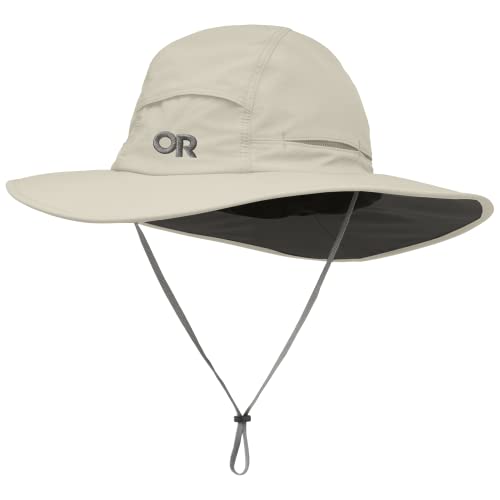
Bring a Sun Hat
Besides sunscreen like this SPF 30 Nivea Sun Lotion*, you can protect your face against the harsh sun with a sun hat. We always throw hats in our backpack*, and use them regularly. They are not very useful in the jungle, but once you get to the open sections you are happy to carry one along. I’ve got this airy sun hat from a great American outdoor brand called Outdoor Research:

Outdoor Research Swift Sun Hat on Amazon*.
You may prefer something with a wider brim, like:
Outdoor Research Sombriolet Sun Hat on Amazon*.
Check out the complete list of hiking gear needed for Singapore:
East Coast Park
Once you turn left after the bridge and find the Bay East path, you stay on this all the way until the end of the hike so navigation is rather easy. The path is wide, concrete and used mainly by cyclists when we were there. We were lucky and saw a colourful kingfisher sitting in a tree near the water.
Soon you’ll come across an interesting feature, the water garden by the side of a desalination plant. There’s also a garden on the roof! We saw quite a few birds fishing in the clean water here.
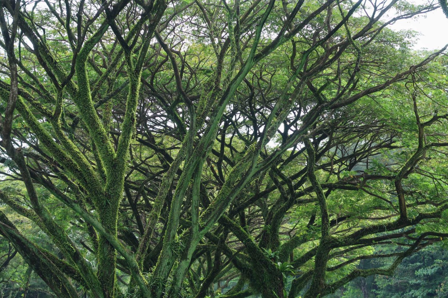
The hiking route continues through groves of majestic fig trees, along the side of a canal.
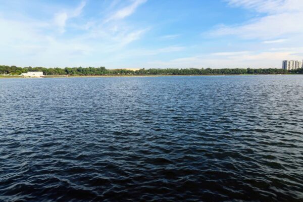
Eventually, the canal turns a corner and you reach the ocean and the beach. There are palm trees, the beach is clean and not so crowded, and the atmosphere here in East Coast Park is very pleasant and relaxed. When we were there, many people were swimming in the sea. The only drawback is the ocean view, which is full of very large cargo ships!
You could continue for many kilometres further, but we decided to stop in line with Joon Chiat Road. There is a convenient underpass under the road and a bus stop close by. We also found a bakery selling delicious Portuguese egg tarts just by the bus stop which made a great snack after this hike.
We continued to the Parkway Parade Bus Stop, and took Number 48 back to Rochor Station where we started.
Want to hike some more? Check out a map of great hikes in Singapore.
FAQs: The Rochor Canal to East Coast Park Hike
Rochor Canal starts near Rochor MRT station and ends at Kallang Basin, covering a stretch of roughly 1.2 km.
The trees that look like pines are actually Casuarina trees, not pines. You can see many more on Coney Island!
East Coast Park is open 24 hrs.
Yes, you can swim at East Coast Park and it is fairly popular. The beaches are clean and there is plenty of shade.
Related Posts