By Vicky · Published Oct. 17th, 2022 · Updated Nov. 22nd, 2022
When you buy through links highlighted with an asterisk (*) on this site, we may earn a small affiliate commission at no cost to you.
Instead of taking the cable car, hike the Pfänderbahn from the lower to upper station for amazing views of the Alps and good exercise.
Get the route by downloading the .gpx or .kml file below. For navigation with Maps.me on your mobile phone, simply download the .kml file and open to add it to the Maps.me bookmarks.
Location
This walk starts from the lower station of the Pfänderbahn cable car. There is a car park here, but it’s also very close to the centre of Bregenz and the seafront so you can start from anywhere in town.
Tips for Pfänderbahn Hike
- The Pfänderbahn cable car runs from 8am to 7pm every day, check here for more details.
- There are a few restaurants/biergartens at the top, check here for opening hours – some are only open in summer.
- It’s best to do this hike when the weather is clear so you can enjoy the views from the top.
- Hiking poles* are useful full the steep up and down.
- Offline maps app Maps.me works well for this walk.
- After or before this hike, why not stroll around the Bregenz Walking Tour or Lindau Walking Tour nearby.
- For a gentler walk in the countryside, check out the Lindau Four Hills Walk.
- Find other great hikes on our Germany Hiking Page.
From the Pfänderbahn lower cable car station, head out of the car park at the back and turn right to walk up the road. Keep walking up this road as it gets steeper, then turn left along a track through the forest. It should be signed Gschliefweg (the name of this specific route of the hill) and Pfänder, or Pfänderspitze (Pfänder Peak).

At the next junction, take the upper dirt path which heads up steeply through an open area in the middle of the wood. In 200 metres you’ll come to a clearing. Follow the path to the left to continue on the Gschliefweg hike up the Pfänderbahn. The path is slightly less steep now and cuts across the wooded hillside.
Continue Hiking Upwards
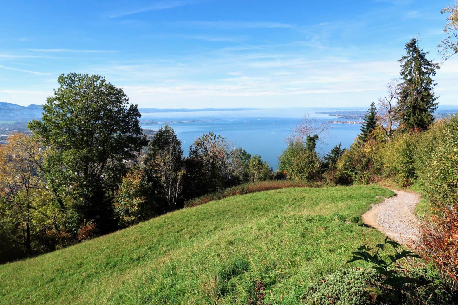
The route steepens again and turns left before crossing a river and then coming out beneath the cable car. There’s a bench here and some nice views back down to the lake.
Continuing onwards, the path bends around and reaches Hintermoos. This is a small hamlet with a few typical Austrian chalets looking out over the lake. Turn right on the road in this town and then take the first left along a track heading upwards through the forest.
This track soon leaves the trees and enters a large open grassy area near the top of the Pfänder. The track becomes very large here and soon you’ll be at a main junction with a small road. There may be many more people here – those who took the easy route up the Pfänderbahn in the cable car rather than hiking.
At the top of the Pfänderbahn
Straight across the junction is Pfänderdohle restaurant, but the top of the hill and the top cable car station is to the left up the road. There’s another restaurant here (Berghaus Pfänder) and several benches, together with a children’s playground and an animal park.
The animal park is free to walk around (though it does involve some down and up again), and you can see typical Alpine animals such as ibex, red deer and wild boar. There are two terraces on top of the cable car station building itself which you can also visit.
Walking back down to Bregenz
When you’re ready to leave, set off at the far side of the children’s playground. When we were there (in 2022) the path to the very top of the Pfänderspitze was closed. If this path is open, you can walk over here, though we had to detour around the road.
The initial section of the route we hiked back down from the far side of the Pfänderspitze was along a fairly small path and we didn’t see any other people. This was a good benefit, as it was very crowded at the top and there were also quite a few people hiking on the main trails. The path we took is not signed but is a clear small path almost opposite a road junction.
After heading down quite a long way, you reach a road in a little village. Turn right along the road and then take the next path to the left, which is now signed ‘Pfänderbahn Talst’. Talst is short for Talstation, which means valley, or lower station. The path heads down through an open field with lovely views of the lake.
Continue following the main route down until you reach an old little building, actually a chapel. The signage is unclear here and the main route down is slightly hard to see. It’s a small path that heads down a gully just to the left of the chapel and it’s easy to miss because it looks just like a gully.
Keep along the path and soon you’ll reach the edge of Bregenz town. The small roads continue steeply downwards and signs mark the route. Eventually, you’ll reach a flat main road in town. Turn left and at the next junction, you’ll see the car park around the back of the Pfänderbahn and the end of this hike.
Guidebooks for Hiking in the Alps


After or before this hike, why not stroll around the Bregenz Walking Tour or visit the nearby town of Lindau. There’s another lovely hike over four small hills near Lindau, with more lake views. If you enjoy hiking, check out our other hikes in Germany.
Related Posts
