By Vicky · Published Jan. 20th, 2023
When you buy through links highlighted with an asterisk (*) on this site, we may earn a small affiliate commission at no cost to you.
The Crêt de la Perdrix & Trois Dents Hike is a moderately challenging walking route with beautiful views in Pilat Regional Natural Park not far from Lyon.
Crêt de la Perdrix & Trois Dents Hiking Map
Get the route by downloading the .gpx or .kml file below. For navigation with Maps.me on your mobile phone, simply download the .kml file and open to add it to the Maps.me bookmarks.
Location
The Crêt de la Perdrix Hike starts from a car park in the mountains of Pilat Natural Regional Park, about 1 hour south of Lyon.
Tips for Crêt de la Perdrix Hike
- Bring binoculars* if you want to see the Alps in more detail!
- In summer it can be quite warm, so bring a sun hat and sunglasses as well as plenty of water.
- In winter, snow can cover these mountains. In this case, hiking poles* are useful as are crampon micro-spikes* if the route is heavily trodden, making the route easy but slippery.
- For more hikes, check out our France Hiking Page.
Crêt de la Perdrix Hiking Route
From the car park, head up the hill towards the large radio tower on top of the hill. You have to walk around the left side of the building, and on the far side there are great views across the Rhone Valley and towards the Alps. You can also see down to Les Trois Dents (the Three Teeth), a distinctive broad ridge with three rocky peaks, where this hike leads next.

From the viewpoint, head down on the path to the left side of the rocks. At the first junction turn right on a small path which leads down through a forest to a road. Head straight on on the other side of the road, then almost immediately left down a rocky little path. This path is quite small, but soon you reach a flat track and path which heads right.
Walk along the path and soon you’ll leave the forest and come out into the open, surrounded by heather and some rocky outcrops. Just around the corner you’ll reach a junction. Later you’ll return to here and go right, but for now walk straight onwards out to Les Trois Dents.
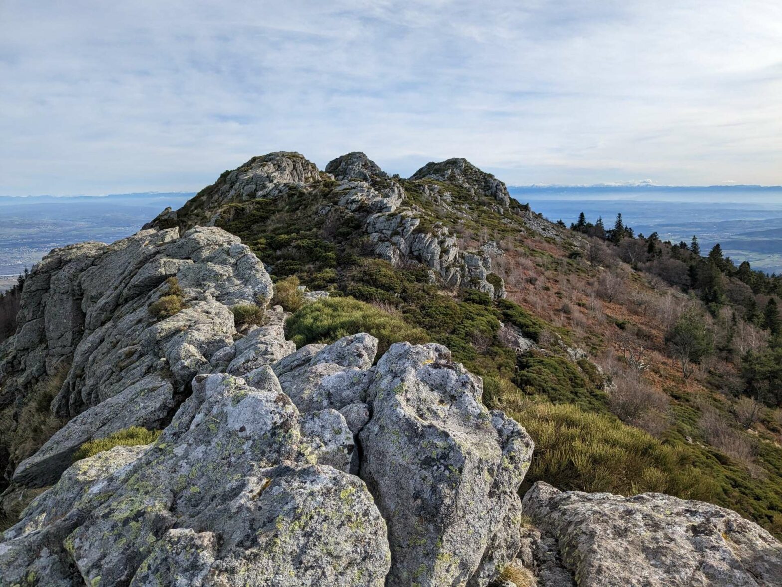
Les Trois Dents
About 200 metres later you’ll reach another path junction. The hike now leads around a narrow circular route to a viewpoint at the end of the Trois Dents. The northernmost (left-hand) path is slightly tricky and leads over the very top of the rocky ridge, while the southernmost (right-hand) path is easier and you can then climb up onto the rocks for a view at the far end. If you don’t feel like taking the slightly tricky path, then you can just use the same easier path to walk out and back.
We walked the loop clockwise, taking the rocky path along the ridge crest first. There are really nice views all around – over the Rhone Valley to the Alps and back up to the mountains of Pilat Natural Regional Park behind. From the viewpoint at the end of the ridge, head down the path to the left that then bends back to the right through a rocky area. Follow this path as it leads underneath the ridge and back to the path junction with a signpost.
Now, turn left to continue on the loop walk up to Crêt de la Perdrix. Soon this path reaches Col du Gratteau, a car park with a boardwalk, some information posts and good views. Head along the boardwalk and take the path leading into the wood at the other side. Turn right in the open, left, and then right again through a fence.
Hiking Upwards
This path leads downhill, surrounded by trees and then through a couple of fields to reach a quiet road. Turn right at the road to walk past a cluster of buildings, then cross straight over the larger road to a track on the other side. This track bends around the corner before leading upwards through the forest. This section contains most of the climb on this hike. Luckily it’s shaded from the sun if you walk here in summer.
When you reach a corner of the track near the top, head onto the path that leads straight onwards. Continue along the path and soon you’ll reach an open area and a hut, Chalet Bourguisan. Walk onwards through the lovely wood, then left and out onto the open moor. You’ll now be able to see the peak of Crêt de la Perdrix not too far away, at the end of the broad walking path.
Crêt de la Perdrix Peak
At the top of the mountain, there’s a large, broad cairn, or rather a collection of stones. There’s also a pillar with a map on top, labelling all the peaks and features of interest that you can see from here on a clear day. It really is a fantastic viewpoint, you should be able to see the Alps, including the towering Mount Blanc, and many more local hills and mountains of the Massif Central range.
After you’ve admired the view, return a few tens of metres through the fence, and now head left on the inviting flat path leading through the open land. You’ll soon reach a junction, where you turn right on a larger track. This leads through some beautiful moorland covered in heather and a smattering of pine trees.
Around the corner, the track reaches a junction at a slight low point. From here, take the smaller path to the right to keep on the edge of the ridge. You reach the best viewpoints along this trail. There are many ‘Crêts’, or ‘Crests’ along the ridge, with little rocky areas at the top and great views.
When you reach the hill with the funny rectangular, concrete tower, walk up the path around the right-hand side for some final views. At the top, the path reaches a road. Follow this down a short distance, then take the small path leading straight on where the road bends. At the larger path, head right and in a hundred metres you’ll be back at the car park. This is the end of the Crêt de la Perdrix & Trois Dents Hike.
Guidebooks for Exploring & Hiking in Southern France


For other nearby hikes, see our France Hiking Page.
Related Posts
