By Vicky · Published Jan. 21st, 2023 · Updated Sep. 21st, 2023
When you buy through links highlighted with an asterisk (*) on this site, we may earn a small affiliate commission at no cost to you.
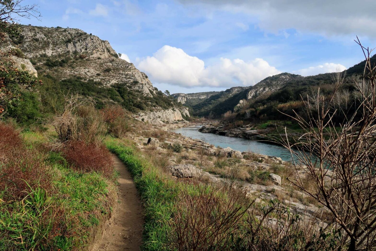
This great walk leads along a river through the Gorges du Gardon, then up and back along the cliffs at the top of the gorge.
Get the route by downloading the .gpx or .kml file below. For navigation with Maps.me on your mobile phone, simply download the .kml file and open to add it to the Maps.me bookmarks.
Location
The Gorges du Gardon Walk starts from a car park in the small town of Collias. The car park is gravel, and you have to pay for parking every day of the year (including Sundays and holidays), which is roughly €7. There is no free parking nearby.
Tips for Gorges du Gardon Walk
- Set off early in summer as the car park can get full (especially on weekends) and it can get very warm in the gorge.
- However, in summer you can swim in the river at many locations – a great spot is at the far end of the hike.
- There are no refreshments on this walk, so take enough water and snacks.
- For another nearby hike, walk to the Pont du Gard, or for more hikes, check out our France Hiking Page.
Gorges du Gardon Hiking Route
Head out of the far end of the car park and down to the road by the river. Turn right and soon a path starts, leading straight onward along the edge of the river. As you walk along, you can already see a few cliffs and nice swimming spots.
Navigation is very simple for the first part, as you just follow the path by the river. However, a few little paths detour to small beaches by the river, then back to the main path. The cliffs become more and more dramatic as you hike along and enter the Gorges du Gardon proper.
There are great views upstream and downstream, and soon you reach a slightly tricky section of the route. The path leads right down to the edge of the water where you have to walk along the edge of the rocks by the river. You’re just walking on rocks, so it can be slightly slippery if it’s rained.
The water is very close if you accidentally slip. If you’re careful it’s not too difficult. At most times of the year falling into the river would just mean getting wet and clambering out again. Don’t attempt this route if the river is in flood, in which case the path many even be covered by water.
Just around the corner the path is easier again and continues along the rocky beaches in the gorge. Not too much later, look out for the arrows on the rocks. These indicate that the path now leads slightly away from the river and up into the vegetation. It bends left and contours along the valley, through trees but with occasional glimpses of the river below.
La Baume Scenic Area
The path returns to the river and around the corner you’ll come to what’s called La Baume. Here you can see a few historic buildings on either side of the river. There used to be a kind of bridge here, but now there’s nothing and you can’t cross the river without getting wet.
You can enter the little old stone building on this side of the river and read the information signs about how it used to be a mill. Slightly further onwards, there’s a rather new-looking trail up to a little chapel on the hillside. Walk up here for great views of the cliffs and the big bend in the river below.
At certain times of the year, you can walk right through the St Vérédème grotto/tunnel just beyond the chapel and come on out on the hiking path up the hill. If you take this route, remember to bring a headlight or phone with a decent torch. Due to bat nesting, the tunnel is closed 15th Nov – 15th Mar and 1st May – 15th August.
When the tunnel is closed, head back down to the river. Return a few hundred metres to the hiking sign marking the path up the sides of the gorge. Turn left to walk steeply upwards. The path leading from the end of the tunnel soon joins this route. There are some nice views on the way up where you can pause to catch your breath.
Walking Back along the Clifftops
Walk straight onwards at the top and past a field to a track. Turn right in a few hundred metres to take the smaller path leading roughly straight onwards. Continue along this path, and it soon becomes a track again. There are some good views to the right over the Gorges du Gardon, and also to the left over the surrounding countryside.
Keep walking along the track, always sticking near to the edge of the Gorge. Eventually you’ll reach a great viewpoint over the gorge and down to the village of Collias where you parking. Turn left along the path here, leading down to the outskirts of the village.
Turn right at the first houses, then right at the first real road. Head left on one of the small streets to walk through the centre of the cute village and back to the car park. This is the end of the Gorges du Gardon walk.
For another nearby hike, walk to the Pont du Gard, or for more hikes, check out our France Hiking Page.


