By Vicky · Published Jan. 28th, 2023 · Updated Mar. 23rd, 2023
When you buy through links highlighted with an asterisk (*) on this site, we may earn a small affiliate commission at no cost to you.
The hike up to Kappeler Alp & Alpspitz Peak is a lovely walk up through forest to open fields and tracks with panoramic views. This route is also popular in the snow.
Kappeler Alp & Alpspitz Hiking Map
Get the route by downloading the .gpx or .kml file below. For navigation with Maps.me on your mobile phone, simply download the .kml file and open to add it to the Maps.me bookmarks.
Location
The Kappeler Alp & Alpspitz Hike starts from a large car park at the base of the Alpspitzbahn. It can get busy with skiers on snowy weekends in winter, so aim to arrive before 10 am.
Tips
- There are two huts near the top of this hike serving food and drinks, and another couple of options by the car park where this walk starts.
- If hiking in snow, hiking poles* are useful as are crampon micro-spikes* if the route is heavily trodden, making the route easy but slippery.
- For more hikes, check out our Germany Hiking Page.
Kappeler Alp & Alpspitz Hiking Route

From the car park head left and walk along the road past the large hotel. Turn right at the junction and follow the path straight on into the woods. You’ll soon reach a junction with a signpost. Continue onwards, ignoring the right turns, to walk first up to the Kappeler Alp.
Along this route up through the forest you’ll find the stages of the cross, a chapel and a large church called Wallfahrtskirche Maria Trost. There isn’t much route choice as you head up the hill, and there are signs pointing towards Kappeler Alp at most junctions.
If there’s a lot of snow, you can walk up the big track instead, or cut to it at several points as you head up the hill. In particular, it’s easy to divert onto the track at Maria Trost church, though the path is used fairly often so the route is obvious and it’s never too steep or difficult.
At Maria Trost church itself, it’s worth heading to the benches for the view. The path continues a little way around the track, and begins to head upwards more steeply. There are no more route choices until you suddenly arrive at Kappeler Alp at the top.
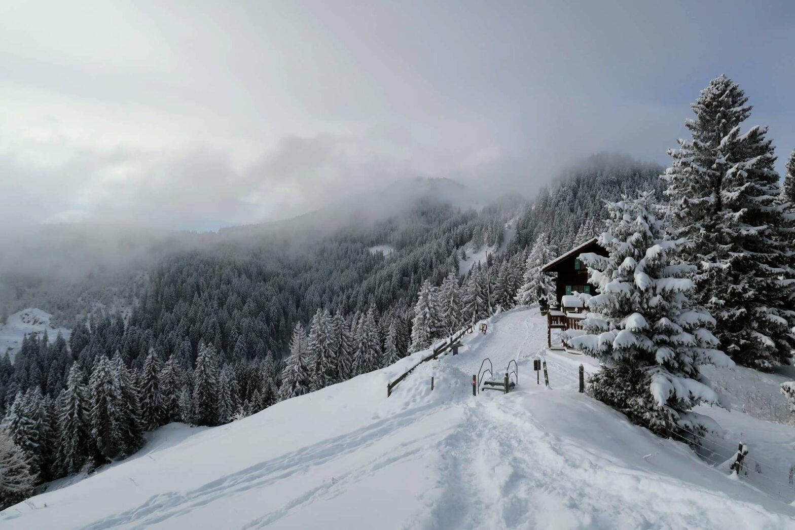
Kappeler Alp
Kappeler Alp is a hut that sells hot drinks and delicious food (the topfen strudel, or quark strudel, or highly recommended). In summer you can sit out on the terrace with brilliant views, while in winter it’s super cosy inside. There’s a little hill with a cross and another viewpoint on the valley side that’s worth walking up.
This hike then heads towards Alpspitz along the track behind the hut. The wide track heads gradually upwards through fields and a narrow stretch of forest. On the other side you’ll reach another field with several buildings, including another hut selling food and drinks. Walk through the field along the track, heading still gradually upwards around the back side of Alpspitz Peak.
Other Hikes in the Snow


Alpspitz Peak
When the track begins to bend left, a smaller path heads off to the right and up the hill. Take this path. You can walk a little loop here by first heading to the cross at the top, which is on the left side of the top ridge. If it’s clear there are great views from here, though for us the clouds had come in and we could only see mist and very snowy trees.
From the cross, continue along the ridge and in a short distance you’ll reach some benches at another viewpoint. From here, turn right down off the ridge and along the path back to the junction with the track before heading back down to the buildings.
At the edge of the forest you’ll see a large signboard with a map. From here, head along the smaller path behind the sign. This path leads fairly straight downwards, though is never too steep. It’s a popular path, so even in the snow the trail should be obvious. Keep on heading downwards, crossing over a couple of tracks and towards a stream near the bottom.
At some point you’ll reach a junction with a signpost. There’s a choice here of either walking on the right or left of the small stream. Either way takes the same time and both are equally pleasant. We chose the path heading straight on rather than crossing the bridge. From here you’ll quickly reach the junction with the path at the bottom where you were previously.
Turn left. Soon you’ll come out into the open again, walk across the field/ski-slopes and reach your car at the end of the Kappeler Alp & Alpspitz Hike.
Guidebooks to explore more of Germany


For another walk in the snow, try the walk to Kenzenhütte, climb the Seekarkreuz Peak or hike up Wolfkopf Peak. Alternatively, check out our Germany Hiking Page for more great hikes nearby and for walking tours of the famous Bavarian cities.
Pin it
Related Posts


