By Vicky · Published Jun. 10th, 2023 · Updated Aug. 13th, 2023
When you buy through links highlighted with an asterisk (*) on this site, we may earn a small affiliate commission at no cost to you.
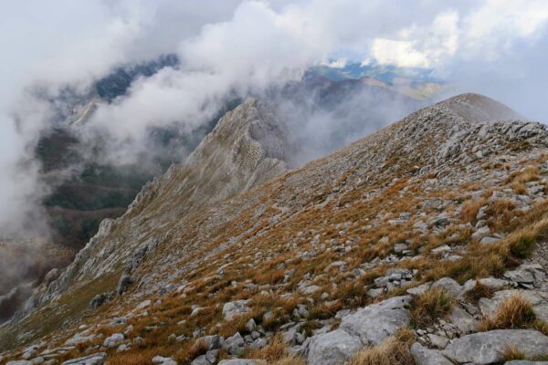
The relatively easy hike to the top of Lavinores Peak leads past a mountain hut then through a magical valley to a summit with amazing views.
Lavinores Peak Hiking Map
Get the route by downloading the .gpx or .kml file below. For navigation with Maps.me on your mobile phone, simply download the .kml file and open to add it to the Maps.me bookmarks.
Location
The hike up Lavinores Peak starts from Parkplatz Pederü. This is a 20 minutes drive up a scenic valley from Zwischenwasser (Longega in Italian), past the ski-resort tourist town of San Vigilio. In high season you have to pay a road toll of €12 to reach Pederü – it’s about 6.5 km from the road toll gate to the car park.
Alternatively, you can take the bus from either Zwischenwasser or San Vigilio to Parkplatz Pederü (€1.50 per adult each way, children half-price). Buses run roughly every 20 minutes and you can find the schedule on the SAD website (local public transport website).
Tips
- You can stay at Pederü Berggasthaus*, the lodge where this hike starts, or alternatively there are many accommodation options in San Vigilio*.
- About halfway to the top you pass Rifugio Fodara Vedla, a mountain hut serving food and drinks. It’s open from roughly mid-May.
- If it’s nice weather when you finish, you can stop off at Ciamaor Beach, about 15 minutes down the road. The water may be extremely cold!
- For more hikes, check out our Italy Hiking Page.
Lavinores Peak Hiking Route

From the car park at Pederü, head past the hotel and through the wooden gate on the rough gravel track. Continue on the track as it zigzags steeply upwards. You can be happy that you are completing a large part of the climb already!
After several zigzags and a longer section of slightly flatter track, you’ll see a path to the left leading up through the woodland. Take this to avoid the road for a few hundred metres. There are a couple more shorter sections of path that avoid the road, always signed, so take these if you see them.
Towards Rifugio Forada Vella Hut
Eventually you’ll come to a fork in the tracks, both heading fairly parallel but one slightly higher. Take the lower one, then continue straight on at the next hiking sign to follow the path towards the Rifugio Forada Vella hut. There’s some more uphill, but soon you round a corner to find a well-placed bench. From here there’s a lovely view of the collection of huts below and the mountains beyond.
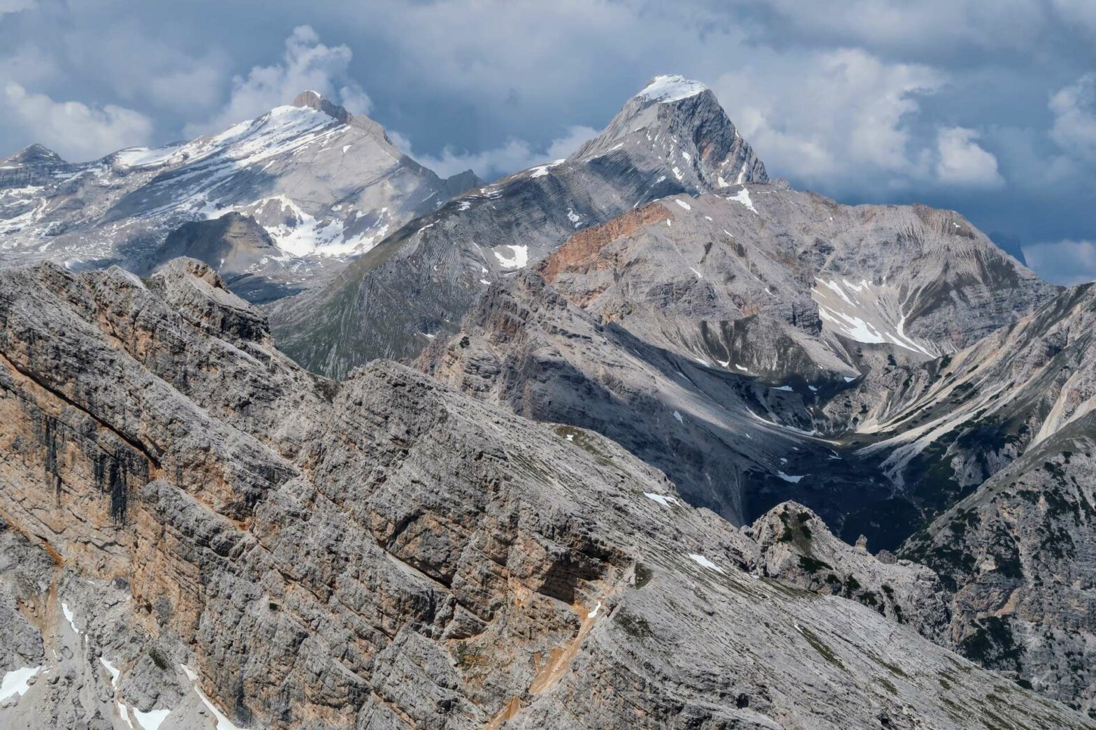
From the bench you can see Lavinores Peak behind and to the right of the hut. It’s the obvious mountain, fairly flat at the top, which looks extremely daunting and tall from here! We couldn’t believe we were really heading up such a tall peak. However, after double-checking the elevation gain, we realised we’d already done at least half of the climb, so the mountain couldn’t be as tall as it looked.
After the bench it’s a short downhill, then up again towards the Rifugio. Instead of heading to the rifugio itself, take the path on the left just beforehand. This leads through a field and slightly boggy meadow towards a track on the other side. At the junction here, take the right path, signposted for Lavinores Peak.
Hiking onwards to the Summit of Lavinores Peak
From here there’s no choice in routes, though sometimes the path passes over rocky ground so make sure to look out for the cairns. You can always see the path in the distance after the rocks, so if in doubt just head for that. When we hiked up Lavinores Peak in early June, there were a few small snow patches to cross. These were fairly flat and had many sets of footprints in them, so not at all scary.
The route continues to climb across the slopes, heading left and to a saddle. Once you’re at the saddle there are really great views of the other side and back where you came from. Look out for the larger cairn on the left – it’s a few metres off the path but an amazing point to stop and have a break and admire the scenery all around you.
After you’ve rested, continue up the path to the summit. Now there’s only about 200 metres of climb left to go, and fairly easy walking. Again the path isn’t super clear, but there are several cairns and it’s very grassy and quite rounded, so it doesn’t matter exactly where you walk.
Sooner than you think, you’ll see the summit cross (rather small) and you’ll be at the top of Lavinores Peak. There are 360-degree views from here, with beautiful, dramatic mountains all around. It’s probably one of the best panoramas in this section of the Dolomites. Head over to the second cairn with a wooden cross for slightly different views.
Hiking back down Lavinores Peak
After having a break and taking in the gorgeous panorama, the route back down is the same as you came up. Have a break at Rifugio Forada Vella to refuel and enjoy the splendid scenery some more. Then continue down the track and back down all the zigzags. Take care here as it can be slippery on the way down, especially if it’s rained.
Much quicker than you hiked up, you’ll be back at the car park and the end of the Lavinores Peak Hike. If it’s nice weather, why not stop off at Ciamaor Beach, about 15 minutes down the road. The water may be extremely cold, but at least you can dip your feet in to feel refreshed.
Guidebooks for Exploring the Dolomites


For more mountain hikes, check out our Germany Hiking Page or Italy Hiking Page.
Related Posts