By Vicky · Published Nov. 16th, 2022 · Updated Aug. 13th, 2023
When you buy through links highlighted with an asterisk (*) on this site, we may earn a small affiliate commission at no cost to you.
The hike up Monte Tambura starts at the hamlet of Campocatino and heads through beautiful mountains to a peak with views of the ocean.
Monte Tambura Hike Route Map
Get the route by downloading the .gpx or .kml file below. For navigation with Maps.me on your mobile phone, simply download the .kml file and open to add it to the Maps.me bookmarks.
Location
This hike starts from the car park in Campocatino, a 1hr30 minutes drive north of Lucca or east of La Spezia.

There’s no bus stop in Campocatino, but there is a bus stop in Vagli Di Sopra, the village below, and buses leave from Poggio in the main valley. It’s then a 1 km walk with 260 metres of climb from Vagli Di Sopra to Campocatino.
Tips
- Bring sunglasses and a sunhat, but also a woolly hat, gloves, and rainjacket as the weather can be very variable, and much colder at the top of Monte Tambura (1891 m high).
- Bring enough water and snacks as there’s no food on the route.
- Hiking Poles* are recommended for this route.
- There’s a restaurant in Campocantino (Rifugio Ristorante) that’s open in summer.
- We used the 4LAND Alpi Apuane 1:25,000 hiking map* for this hike. It covers the main section of the Apuan Alps and can be found in most bookshops in Lucca or Carrara.
- There is one difficult section near the end of the hike which involves climbing down a cliff while holding onto secured wires. It’s not that technically difficult but would be hard for children and is slightly scary.
- Offline maps app Maps.me works well for this walk.
- For another great mountain hike in the Apuan Alps, hike up Pania della Croce or Monte Sagro.
- Find other nearby hikes on our Italy Hiking Page.
Starting the Hike from Campocatino
From the car park head into the beautiful village of Campocatino. The cobbled lanes and stone cottages are reminiscent of a more peaceful time, picturesque in front of a dramatic mountain ridge rising up behind them. Turn right at the junction in the village to walk anticlockwise around the loop. Make sure to look out for the slightly out-of-place marble statue of David Bowie.
The path leads out of the village and up along a gentle grassy ridge. After just over 1km of hiking, you round a corner with an easy section of chains and views of the beautiful mountains across the valley appear. As you walk further, you’ll see several marble quarries cut into the cliffside, though they don’t scar the landscape too much.
Continuing onwards, you’ll see more mountains and more little quarries. The path is always clear and bends around the end of the broad valley well climbing gradually upwards. When the path bends sharply left, there’s a steep uphill section and then you’re on the Monte Tambura Ridge. It can be windy here, so if it’s cold and you want a break, take it before you reach the ridgeline.
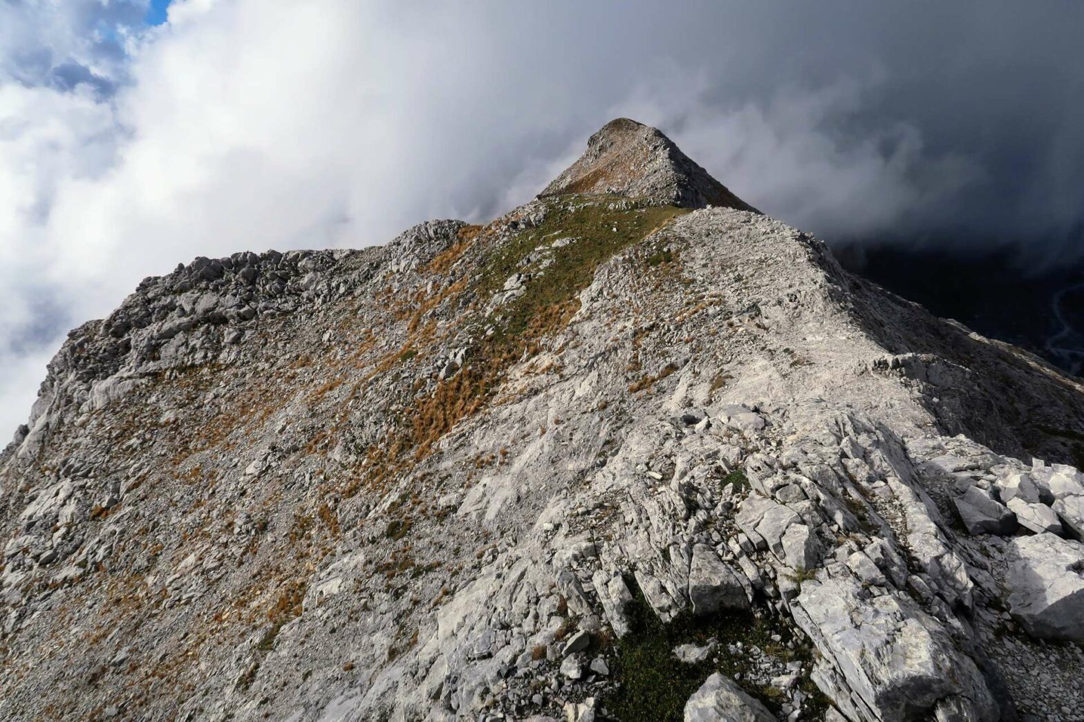
Hiking to the top of Monte Tambura
Turn left to hike up along the ridge, and in less than 1 km you’ll be at the top of Monte Tambura (1891 m). The route is slightly rocky but easy, and you get fantastic views from the ridgeline. If it’s clear, you’ll be able to see the Mediterranean Sea on one side and the ridge of the Apennines on the other.
The hike continues along the ridgeline, heading slightly right. After a short while the path steepens as it descends to a saddle on the ridge. The path downward is to the left just after the saddle. The path is easy and the landscape is rather beautiful, in a mountainous bowl.
Hiking down to the Quarries
Soon the path joins an old track, which zigzags further down the mountain. Eventually, you reach one of the marble quarries near the bottom of the valley. You can see the huge white blocks that have been carved out of the cliffs and the interesting patterns left behind.
The Difficult Section of the Hike
Head left at the junction and the track becomes a path again. You have to clamber over a few rocks, and then you reach the most difficult part of the Monte Tambura Hike. As you enter the woodland, there’s a slightly mossy-covered cliff you have to descend. There are two sections of chain, with the hardest being the first bit. We securely put away our hiking sticks to have both our hands free.
It’s not very technical but it is slightly scary, especially the first bit when you’re quite high above the ground below. The chain is well-secured and very useful. If you hold on tight to this and find good footholds, it is in the end not very difficult. There is no alternative route around this difficult section, and it would be a very long walk back, so you just have to make it down.
Hiking back to Campocatino Village
After the cliff, the hiking route is easy all the way back to Campocatino. The path roughly contours through the woodland and then descends to a real track with an area of picnic benches. Turn left at the track and it’s one quick kilometre walk back to Campocatino. Head through the village and back to the car park and the end of the Monte Tambura hike.
Guidebooks to explore more of Tuscany & the Apuan Alps


The Cicerone Walking in Tuscany Guidebook* describes three hikes in the southern end of the Apuan Alps, while their Walking in Cinque Terre Guidebook* has some great hikes at the coast nearby. The Lonely Planet Florence & Tuscany Guidebook* has a short section on the Apuan Alps focussed around Carrara.
Check out another mountain hike up Pania della Croce, or up Monte Sagro. For more hikes, check out our other walks nearby in Italy.
Related Posts


