By Vicky · Published Jun. 4th, 2023 · Updated Sep. 9th, 2023
When you buy through links highlighted with an asterisk (*) on this site, we may earn a small affiliate commission at no cost to you.
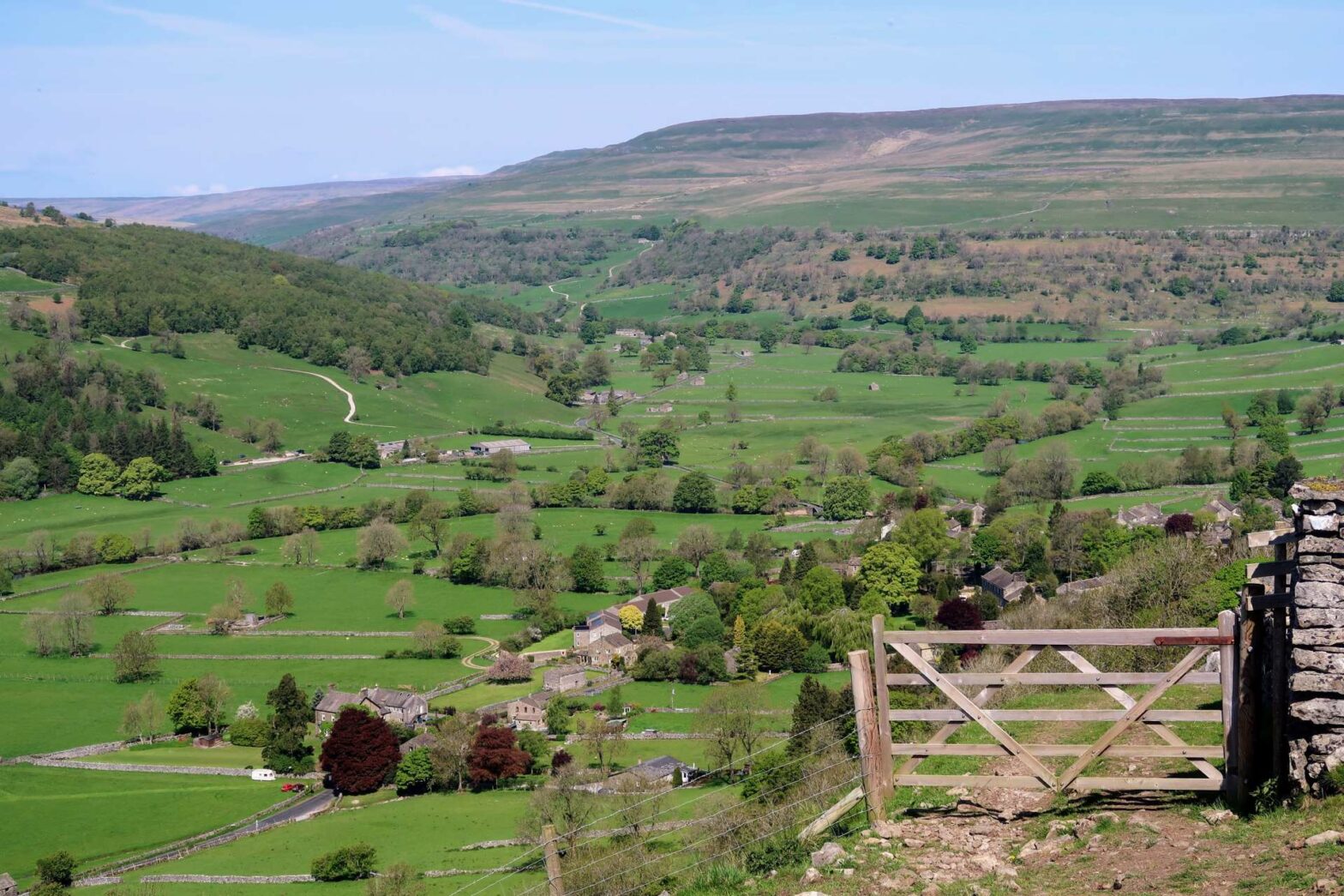
This loop from Buckden village, up Buckden Pike and around Upper Wharfedale is a classic walk in the Yorkshire Dales.
Location
This walk up Buckden Pike and around Upper Wharfedale starts from the Yorkshire Dales National Park car park in Buckden Village. It costs £5.50 for the day, and there are toilets at one end. In the village of Buckden itself there’s a small shop, a pub and plenty of places to stay*.
Buckden Pike and Upper Wharfedale Walking Map
Get the route by downloading the .gpx or .kml file below. For navigation with Maps.me on your mobile phone, simply download the .kml file and open to add it to the Maps.me bookmarks.
Tips
- Take map, compass, sunhat, waterproof jacket, plenty of water, lunch, snacks, and a rucksack.
- There’s a pub in Cray, Hubberholme and Buckden itself.
- The map to take for this hike is the Ordnance Survey Explorer 2 Map SW Yorkshire Dales*.
- The weather can be very variable. Mist can descend quickly, making navigation a lot more tricky, so bring a compass!
- You can find other Yorkshire ideas in our Yorkshire Guide.
Buckden Pike and Upper Wharfedale Walking Route
From the car park in Buckden Village, leave via the path through the gate in the wall above the public toilets. Turn left on the first lane, which leads out into the open land. Cross over the stream and then take the first right, following the track as it contours along the hillside.
The track gradually increases in steepness, until you head almost directly up the slope as the path bends slightly back on itself and still upwards. The path continues alongside some dry stone walls, with great views of Upper Wharfedale Valley.
Soon the fields end and you head out onto rougher open moorland. The route continues as a small path over the slopes until you reach a small valley covered in old mineworkings and piles of stones. Pass through this rocky area and slightly around the corner to reach the path heading right and upwards by a wall.
The Top of Buckden Pike
After a short distance, the path heads right, leaving the wall. The walking route continues upwards until you reach a wall corner. Here you’ll also reach another path that’s paved with large, flat stones.
Turn left to cross the wall and you’ll see the cairn marking the top of Buckden Pike. Admire the glorious views on this side, but don’t forget to peek over the stile across the wall behind you for views of the other side to the northeastern Yorkshire Dales.
When you’re ready, head onwards and follow the path as it leads downloads across the slopes of Buckden Pike. Eventually, you’ll reach a T-junction at a wall. Turn right here and look out for the path leading off to the left in about 600 metres. This path heads downwards and to the village of Cray.
Cray & Upper Wharfedale
Cray is very small but does have a pub – the White Lion Inn. It’s a great spot about halfway around for a refreshing drink or a bite to eat. The walk around Upper Wharfedale continues around the back of the pub, and along the right track through a farmyard.
The walking route now contours around just above a small woodland, with gorgeous views down Wharfedale Valley. Almost 2.5 km you’ll see a lone house on your left and reach a track heading left, back down into the valley. Take this rocky track, which leads through a little farmward and into the fields beyond.
Hubberholme & the River Wharfe
Walk straight through the field and the track leads down to Hubberholme, a tiny village with a church and a pub. The church is worth a look. Most of it is from the 12th century, with extensions from the 16th century. On the inside, look out for the small wooden carved mice, a trademark of famous British furniture maker Thompson of Kilburn.
After looking around the church, cross over the bridge and turn left along the quiet road. This section of the hike is part of the Dales Way and is well-signed. You’ll pass a couple of houses and farms, then the route leads left to the banks of River Wharfe.
After an easy 1 km walking by the river, you’ll come out again on the small road. Turn left across the bridge and you’ll be back in Buckden Village. The village shop is on the other side of the central green triangle (and sells ice cream!), while the car park and the end of the Buckden Peak and Upper Wharfedale Hike is just left from the green.
The Rough Guide to Yorkshire* is a great little guidebook and has a section on Ilkley and things to do nearby. The Yorkshire Dales Pathfinder Guide* has a good collection of short hikes suitable for the entire family and the Guide to North Yorkshire Pub Walks* has some fun walks in the Dales for those who are hungry and thirsty.
For another nearby walk, check out the Ilkley Moor & Burley Moor Hike. Or, for shorter walks, why not walk up Sharp Haw and Flasby Fell, Beamsley Beacon or Embsay Crag.


