By Vicky · Published Jun. 22nd, 2022 · Updated Nov. 21st, 2022
When you buy through links highlighted with an asterisk (*) on this site, we may earn a small affiliate commission at no cost to you.
On this walk from Ilkley to Burley Moor, pass the lower tarn, the Cow and Calf Rocks, the Pancake Stone, several reservoirs, grouse butts, the Twelve Apostles and White Wells.
Location
This walk starts from the Paddling Pool Car Park at the edge of Ilkley Moor. It’s a 35-minute drive from Leeds, or take the convenient train. From Ilkley Train Station it’s an extra 600 metres walk with 45 metres of climb, mainly along quiet roads.
Ilkley Moor Hiking Map
Get the route by downloading the .gpx or .kml file below. For navigation with Maps.me on your mobile phone, simply download the .kml file and open to add it to the Maps.me bookmarks.
Tips
- Take map, compass, sunhat, waterproof jacket, plenty of water, lunch and/or snacks, and a rucksack.
- The moor can be very wet and muddy at times, waterproof boots are recommended.
- The map to take for this hike is the Ordnance Survey Explorer 297 of Lower Wharfedale*.
- There’s a Real Foods Market in Ilkley on the first Sunday of every month, from 10am to 3pm.
- For other hikes nearby, try the Doubler Stones Walk, or shorter hikes up Beamsley Beacon, Almscliffe Crag, Sharp Haw and Flasby Fell, or Embsay Crag.
- For an informative walk through town, check out IlkleyTreeTrails
- You can find other Yorkshire ideas in our Yorkshire Guide.
From the car park head out of the gate onto the moor and left along the paved track to the Lower Tarn. Head along the small path at the far end of the tarn and continue, heading slightly upwards, to Blackstone Beck. There is a wooden bridge across this stream, and on the other side continue to contour along the hillside.
Cow and Calf Rocks
There are nice views over Ilkley to the left and a coniferous wood to your right. A little further along, you’ll see the car park below the famous Cow and Calf Rocks. Head here, and after exploring the rocks, walk up the mud path to the left of the cliffs.
Pancake Stone Ridge
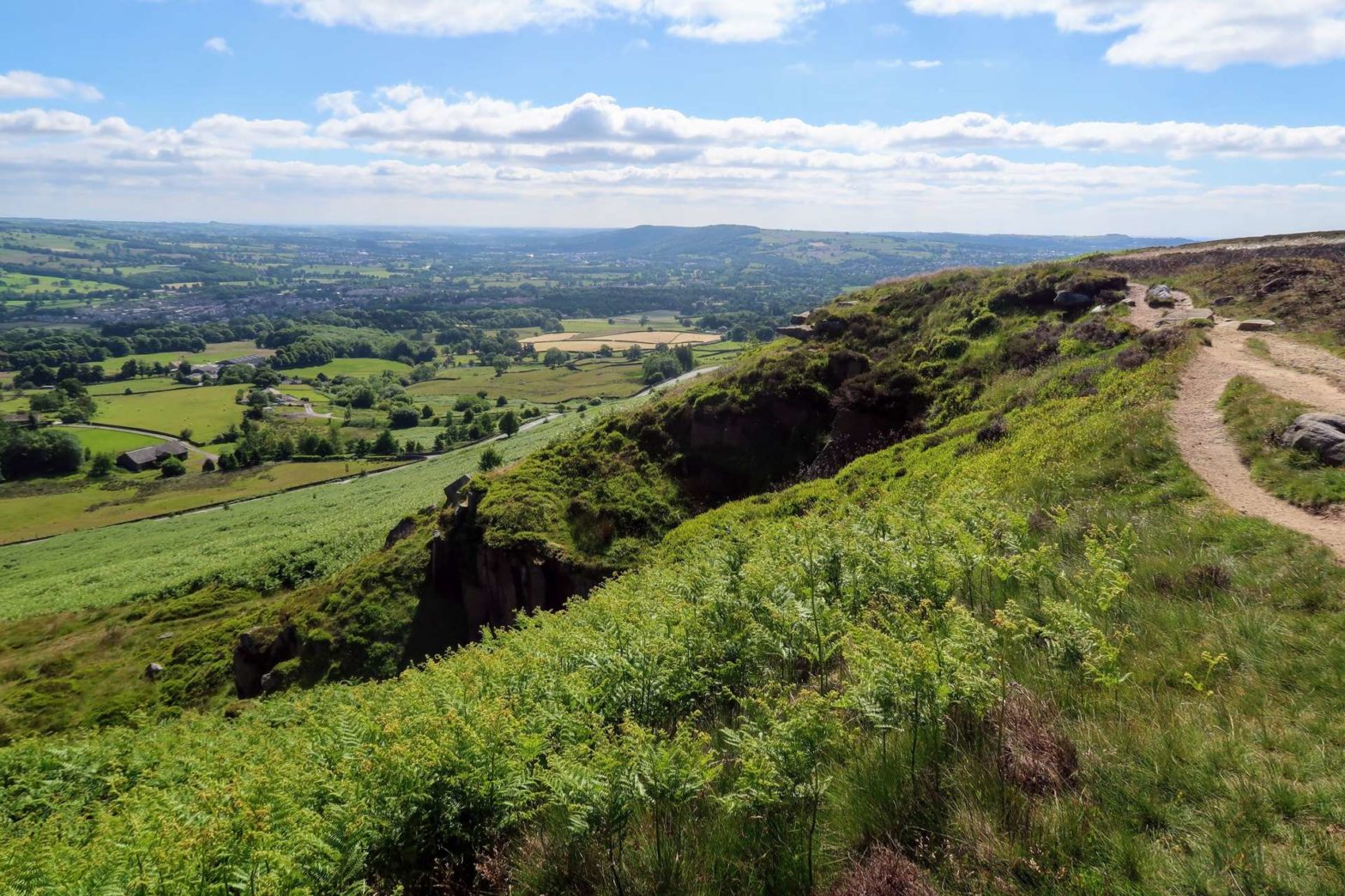
At the grassy, flat junction at the top, head left to walk along a flat path. In roughly 400 metres take a small path on the right to head up a steeper section and reach the top of a small line of cliffs. Turn left. The rock that sticks out here is called the Pancake Stone for obvious reasons. As you continue to head along the path, you’ll enter Burley Moor, and there are great views into Wharfedale, the valley on your left.
Burley Moor
Continue along this path until you reach a quarry, a farm and a gravel track. Turn right along the track to walk up by the wall. You’ll pass some private roads leading to a reservoir on your right, then as the track bends to the left, take a smaller grassy path to the right to cut across to Occupation Lane.
Occupation Lane
Occupation Lane is used by grouse hunters to drive their equipment onto the moor. You’ll notice the camouflaged grouse butts on the right-hand side of this lane – a nice place to take shelter from the wind if it’s cold.
Head along the track until a wooden hut – Grubstones Shooting House. Continue past the building, with some scenic rocks to your left. Stay on Occupation Lane as it bends left at an overlook of a small reservoir.
Twelve Apostles
At the end of the Lane head right, and in a hundred metres you’ll see the Twelve Apostles on your right – an ancient stone circle made up of approximately twelve stones. Continue roughly straight along the path and gently down the moor. After crossing Backstone Beck, quite a small stream, head onwards. Soon you’ll be at the top of what’s called Rocky Valley.
White Wells
Head left and down some rocky steps into the valley. Head left and down to White Wells, an old white cottage on the moor where the Victorians came to dip into the plunge pool. You still can take a dip on New Year’s Day. There’s a cafe at White Wells, though opening times are sporadic.
From the front of White Wells, admire the views over Wharfedale and up to the Yorkshire Dales before heading left. Instead of taking the main gravel track, cut right down a grassy path. Near the bottom before a stream, head right again, then left across a small stone bridge to reach a grassy area. Head right and you’ll soon reach the Paddling Pool, with the car park adjacent.
The Rough Guide to Yorkshire* is a great little guidebook and has a section on Ilkley and things to do nearby. The Yorkshire Dales Pathfinder Guide* has a good collection of short hikes suitable for the entire family and the Guide to North Yorkshire Pub Walks* has some fun walks in the Dales for those who are hungry and thirsty.
For a different long hike on Ilkley Moor, hike across to the Doubler Stones, or for shorter walks try countryside hikes nearby, why not walk up Almscliffe Crag, Sharp Haw and Flasby Fell, Beamsley Beacon, or Embsay Crag.


