By Tom · Published Mar. 3rd, 2021 · Updated Aug. 28th, 2025
When you buy through links highlighted with an asterisk (*) on this site, we may earn a small affiliate commission at no cost to you.
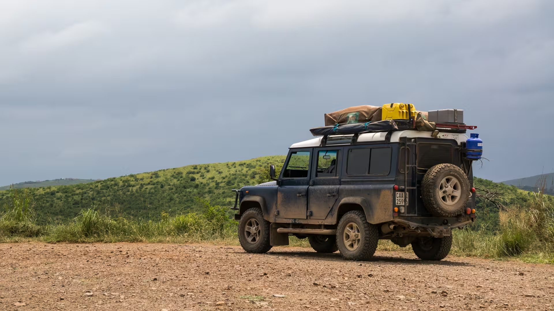
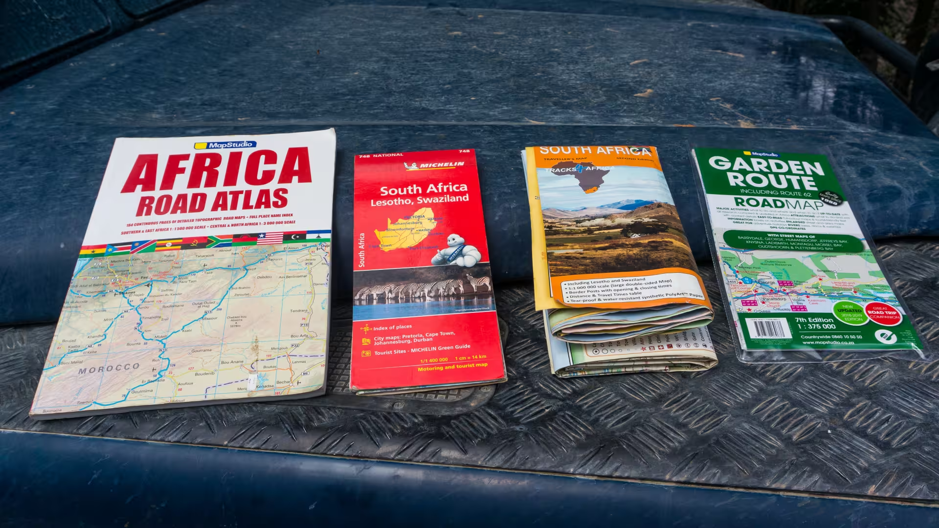
The best companion for a road trip in South Africa is a good paper road map. We have used quite a few different ones on our trip and made a comparison for you here. We tested maps from Michelin, Tracks4Africa and Map Studio.
TLDR: The Tracks4Africa Map* is the best road map of South Africa.
Page Contents:
Michelin
The Michelin motoring and tourist map may be familiar to you as they are published for destinations all over the world. The main features of the South Africa national map 748 are:


- Edition from 2018 on Amazon*
- Scale of 1:1,400,000
- English and French legend
- Unpaved roads and tracks are shown and differentiated from tarred roads
- Zoom-ins of the Major City areas (Cape Town, Johannesburg, Pretoria and Durban).
- Major tourist destinations are indicated on the map
- Index of places and their location on the map on the back cover
- Suggested driving tours on the backside
This is a relatively small-scale map, meaning the overall size of the map is relatively small, and as a result shows less detail. That being said, all the roads are on here, so it is complete.
For South Africa specifically, it’s important to have a map that indicates which roads are unsurfaced. These unpaved gravel roads are found throughout the country and a navigation aid like google maps or a dedicated satnav sometimes directs you via these roads. It depends on your car and the condition of the road whether it is better to take a detour and avoid unsurfaced roads. This Michelin map indicates unsurfaced roads so that is a plus. However, it does not indicate anything about its condition.
Tracks4Africa
Tracks4Africa is a South African map maker for countries in Southern Africa. They are also known for their GPS maps that you can load onto your satnav or mobile phone, but also have paper maps:


- Second edition from 2018* on Amazon
- Scale of 1:1,000,000
- Travel times and distances are shown on most roads
- Unpaved roads and tracks are shown and differentiated from tarred roads
- All border crossings are also indicated with opening and closing times
- Tear and water-resistant paper
- Many points of interest indicated
The scale of this map is large, resulting in a very large map. They use the backside as well to print the entirety of South Africa. As a result of this large scale, the map shows many details. It makes distinctions between many different roads, with four levels of tar roads and also four levels of gravel or untarred roads. It also tells you if the road is restricted and even indicates some riverboats and hiking trails.
Travel Times on Gravel
The best feature of the map is the travel time that is indicated on most roads. This is based on the users of their GPS software and gives you an idea of how long a certain road takes. With our Defender, we are a bit slower than average, so we mainly used it to compare route options and check ‘the quality’ of gravel roads. When the indicated time is very long for a stretch of gravel road, it may be worth avoiding that route. However, road conditions can change quickly and these indicated times are not always realistic anymore.
The map shows many points of interest, from fuel stations to camping. It also distinguishes well between different accommodation options. For example, if a lodging also has camping, the map uses a different symbol colour to those without camping. For the smaller towns, it also indicates what facilities they offer, like shopping, petrol stations and car mechanics.
There are no zoom-ins for city areas, this map is not really useful for cities, and you can better rely on Google maps.
Map Studio
Map Studio is another South African mapmaker. They have a range of maps and atlases that cover South Africa and we have tried three of them: the Africa road atlas, the Garden Route road map, and Cape Town and surrounding attractions road map. They also have a road atlas and road map for South Africa specifically, as well as some other regional maps.
Africa Road Atlas


- Third edition from 2019
- Scale of 1:1,500,000 in Southern and East Africa
- Scale of 1:3,000,000 in Central and North Africa
- Unpaved roads and tracks are shown and differentiated from tarred roads
- Elevation shown by colour contours
- Index of places and location on map in the back
- Some points of interest indicated
This road atlas is especially ideal if you are venturing beyond the borders of South Africa, and the atlas format makes navigating in the small space of a car easier. It makes distinctions between different roads, with three levels of tar roads and also four levels of untarred or gravel roads. The best feature of the atlas is that literally the whole of Africa is in it, although some places in Africa do not have many roads to show…
Because of its relatively small scale, detail is sometimes missing, especially for roads inside some National Parks, for instance, Kgalagadi Transfrontier Park. We have used it during the planning phase of our trip, as you can easily mark routes across borders or draw on potential campsites.
Garden Route Road Map

- Seventh edition from 2018* on Amazon
- Scale of 1:375,000
- 1:20,000 street map zoom-ins of (small) towns
- Unpaved roads and tracks are shown and differentiated from tarred roads
- Detailed descriptions of points of interest
- Some photos of points of interest
- Suggested tourist routes highlighted
If you are not venturing beyond the Garden Route and you don’t want to rely on Google Maps for navigation in town centres, then this is an ideal map. It is a very large scale, especially for the zoom-ins of town centres. These street maps also include street names.
It distinguishes between three levels of tar road and two levels of untarred road. The map indicates all major and most minor points of interest for tourists, but in terms of accommodation, it only shows a few caravan parks.
Cape Town and Surrounds Road Map


- Sixth edition from 2017* on Amazon
- Scale of 1:325,000
- 1:20,000 street map zoom-ins of Cape Town CBD and some surrounding towns
- An extensive description of towns with to-dos on the backside
- Unpaved roads and tracks are shown and differentiated from tarred roads
- Some photos of points of interest
This map is quite similar to the one for the Garden Route, with some differences. It distinguishes between four levels of tar road and two levels of untarred road. It uses a different colour scheme. Unique is the description of the towns on the backside, and smaller places on the front, almost like a small tourist guidebook. It is a good companion to the Garden Route map if you venture to the Garden Route, as you will likely start in Cape Town.
Best Map of South Africa
For a serious road trip through South Africa, my pick would be the Tracks4Africa South Africa map*. The main reasons for this choice are:
- The level of detail in terms of the type of road and indicated points of interest and facilities of towns.
- The indicated travel times on most roads, especially important for the many untarred roads.
These two features mean that you can rely on this map without needing to use your phone, except for in the major cities. If you are travelling beyond the borders of South Africa, Tracks4Africa also makes maps for Mozambique, Botswana, Namibia and even Zambia.
The Map Studio maps of Cape Town and the Garden Route are a nice alternative if you are only visiting these regions.
Once you’ve got a road map, get a guidebook* to start planning your South Africa Trip, or check out our South Africa Guide.
Recommended Guidebook
Pin it
Related Posts


But there appears to be the old names. Not much use for av foreign tourist
Slingsby maps are excellent and exceptionally detailed.
They only cover selected regions of South Africa.
https://slingsby-maps.myshopify.com/
Hello Douglas,
We only have experience with the Slingsby hiking maps, which are really good. I have not evaluated the driving maps, but with the experience of the hiking maps I think they must be good too.
Thanks,
Tom
Hi Tom, thanks for an excellent review of our Tracks4Africa maps. I just thought I would update you that Peter Slingsby retired during 2023 and we acquired his Slingsby Map business. These maps are now for sale on our sites as well and we are updating and expanding his very detailed maps. Feel free to remove this comment if you feel it is not appropriate. The Tracks4Africa country maps also include Zimbabwe now. The Tracks4Africa atlas covers all of Southern Africa at 1:1million scale and South Africa and some parts further north are covered at 1:500k scale to allow for a lot more detail to be shown.
Thanks for sharing this Johann!