By Vicky · Published Jan. 7th, 2024
When you buy through links highlighted with an asterisk (*) on this site, we may earn a small affiliate commission at no cost to you.
The walk to Bronte Waterfalls and Top Withens is a great circular loop across the moorland that inspired Wuthering Heights.
Location
The walk to Bronte Waterfalls and Top Withens starts from Penistone Hill Car Park. If the small car park near the road is full, there’s a larger car park 300 metres further up the track.
Bronte Waterfalls and Top Withens Walking Map
Get the route by downloading the .gpx or .kml file below. For navigation with Maps.me on your mobile phone, simply download the .kml file and open to add it to the Maps.me bookmarks.
Tips
- This route can be boggy and wet year-round so wear hiking boots.
- The map to take for this hike is the Ordnance Survey Map 21 of the South Pennines*.
- Make sure to visit Haworth before or after this walk!
- For other hikes nearby, try the short hikes up Beamsley Beacon, Almscliffe Crag, Sharp Haw and Flasby Fell, or Embsay Crag.
- You can find other Yorkshire ideas in our Yorkshire Guide.
Bronte Waterfalls and Top Withens Walking Route

Bronte Waterfalls & Top Withens: Walking from Haworth
You can easily walk to Bronte Waterfalls & Top Withens from Haworth, rather than the car park at Penistone Hill. It’s an extra 4 km with 1100 metres of climb on fairly well-defined tracks, so allow roughly an extra hour plus time for stops in Haworth. The route leaves from the Bronte Parsonage in Haworth along a lane, then after a short distance along a road heads across Penisonte Country Park. You can return a different route across the moorland.
Walking to Bronte Waterfalls
From the car park, cross over the road and onto the path leading into the moorland by the public footpath sign. There are already great views over the surrounding countryside, but make sure to watch your step as it can be very boggy here.
Keep following the main path as it leads gently downwards to meet a larger track just before a wall. You’ll return here later. For now, turn left along the track. This easy trail contours along the top of a slope before heading downwards into the valley on your right.
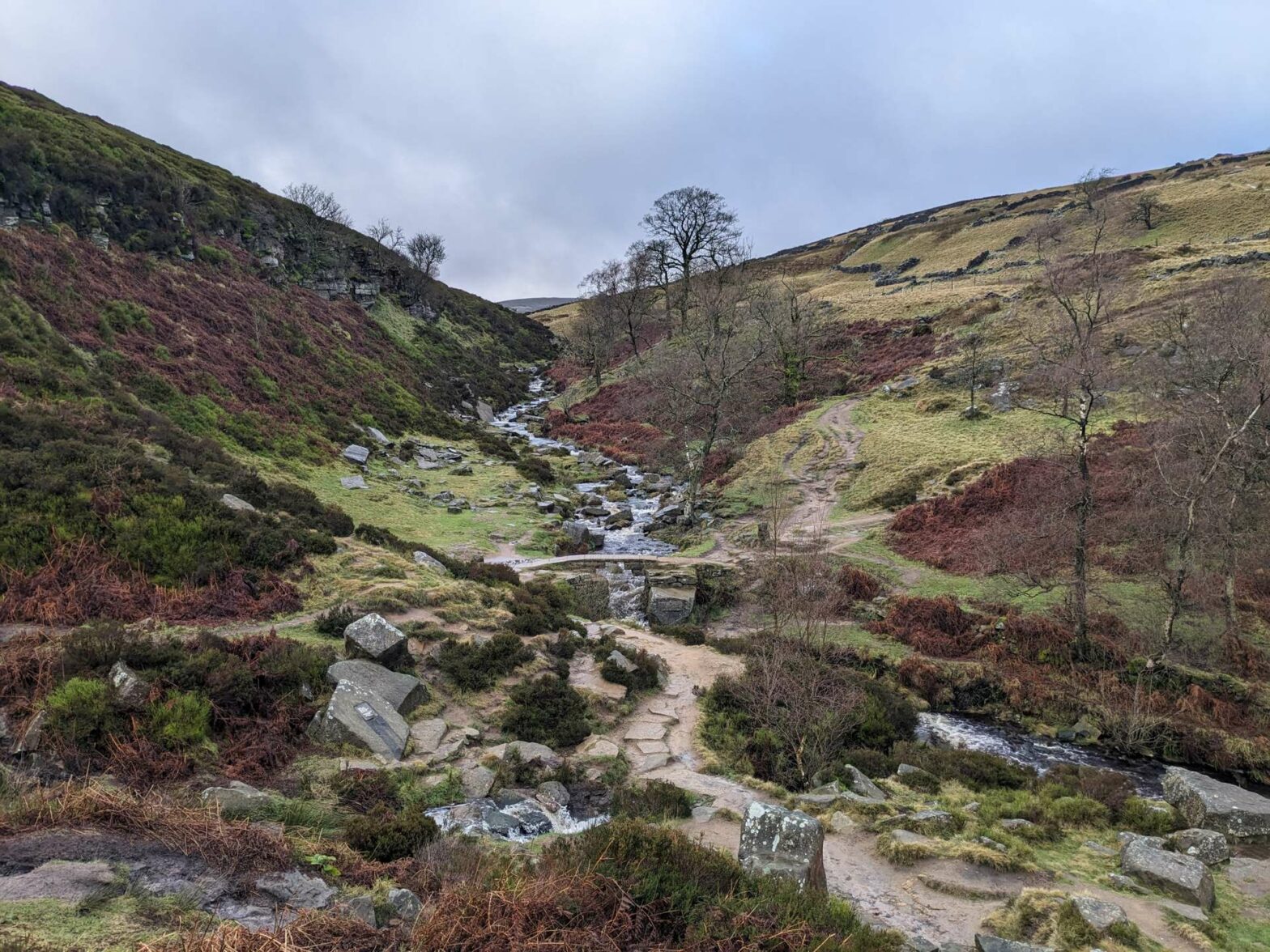
The river at the bottom is Sladen Beck. There’s an elegant stone bridge across this stream, in very scenic surroundings. To your left shortly before the bridge are the Bronte Waterfalls. These are named after the Bronte Sisters, who used to come here to sit and write their famous books.
The Brontë Sisters: Books


The Brontë Sisters (Emily, Charlotte, Anne) are three of the most famous British authors of all time. If you visit Haworth, make sure to read at least one of their books. The one most appropriate to read while in the area is Wuthering Heights*, since this is set on the moors nearby. Jane Eyre* also references the wild countryside, while The Tenant of Wildfell Hall* is another great book to consider reading.
There’s a small path up the side of the little stream towards the waterfalls, but you can’t get all the way up. Take care as it can be slippery here. Once you’ve taken a picture or two, head towards the bridge. This is a lovely place to have a picnic or a snack before continuing the route to Top Withens.
Bronte Waterfalls: A Shorter Walk
If you only want to walk to Bronte Waterfalls and back, then simply retrace your steps once you reach the waterfalls. You can vary the route back slightly by staying on the main track just above the wall all the way to the minor road, then turning right on the road to the car park. This route to Bronte Waterfalls and back is 5 km with 50 metres of climb and takes roughly 1.5 hours.
Walking from Bronte Waterfalls to Top Withens
To continue from Bronte Waterfalls to Top Withens, cross over the stone bridge and head up the other side. Both the steeper steps or the path bending around to the left lead to the same place, so it doesn’t matter which you take.
At the top of the slope head left. The route now leads through some grassy fields before heading back out onto the wild moorland. There are nice views from here of the valley, and the countryside all around you.
Soon the path leads downwards back into the small valley. The path now leads across a stream before heading upwards again. You should already be able to see Top Withens in the distance – a dark ruin next to the distinctive tree on the horizon. It’s uphill but an easy walk up the path to the ruins.
Once you arrive at the dark stone farmhouse, there are several information boards both outside and inside. These tell you about the history of the place. Top Withens has long been imagined as the place that inspired Wuthering Heights, the remote farm cottage where Heathcliff lived. You should definitely read the book* before doing this hike!
The views from here of the wild and windy Yorkshire moors and superb. Take a while to sit and admire the bleak landscape. Imagine Cathy and Heathcliff wandering around the ruins, and living in this remote place with just each other for company.
Top Withens back to Haworth
When you’re ready, return 200 metres back down the path to a signpost. Instead of retracing your footsteps, head left to take a different route back to the car park. The path turns into a track across large stretches of heather, before reaching a few remote farmhouses.
Follow the track as it descends, and eventually becomes a small tarmacked lane. Continue a short distance before taking the signposted path to your right, opposite a farm. This path leads steeply downwards through dome fields to the bottom of the valley. Cross over a bridge here, and up the other side.
The path can be slightly indistinct through the fields, so look out for the gates and stiles in the walls. After a fairly short but steep uphill, you’ll be back on the larger track where you were earlier in the walk. From here, turn left to walk to the paved road. At the road head right and you’ll soon be at the car park and the end of the Bronte Waterfalls and Top Withens Walk.
Guidebooks to explore more of Yorkshire


The Rough Guide to Yorkshire* is a great little guidebook and has a section on Ilkley and things to do nearby. The Yorkshire Dales Pathfinder Guide* has a good collection of short hikes suitable for the entire family and the Guide to North Yorkshire Pub Walks* has some fun walks in the Dales for those who are hungry and thirsty.
Make sure to visit Haworth before or after this walk! For other short countryside hikes nearby, why not walk up Almscliffe Crag, Sharp Haw and Flasby Fell, Beamsley Beacon, or Embsay Crag.
FAQS
The walk to Bronte Waterfalls is 2.5 km each way if you walk from Penistone Hill Car Park, or roughly 4.5 km each way to walk from Haworth.
The easiest and closest place to park to walk to Bronte Waterfalls and Top Withens is from Penistone Hill Car Park, just west of Haworth. Alternatively, you can park in Haworth for this walk, which makes it a bit longer.
The walk to Top Withens via Bronte Waterfalls from Penistone Hill Car Park is 9 km in total with 200 metres of climb and takes 2.5 to 3 hours. If you walk from Haworth, it’s an extra 4 km, or about 1 hour longer.
The Bronte Waterfall Walk starts from Penistone Hill Car Park. Alternatively, you can start the walk from Haworth.
Related Posts


