By Vicky · Published Jan. 1st, 2024
When you buy through links highlighted with an asterisk (*) on this site, we may earn a small affiliate commission at no cost to you.
This circular walk from Malham Tarn to Littondale and back is a beautiful loop through the spectacular scenery of the Yorkshire Dales.
Parking at Malham Tarn
The Malham Tarn to Littondale walk starts from Watersinks Car Park by Malham Tarn. It’s free to park here, but fills up on sunny summer weekends. There’s more space just along the edge of the road.
Malham Tarn Walking Map
Tips
- The map to take for this hike is the Ordnance Survey Map 2 of the Southern & Western Yorkshire Dales*.
- For other hikes nearby, try the short hikes up Beamsley Beacon, Almscliffe Crag, Sharp Haw and Flasby Fell, or Embsay Crag.
- You can find other Yorkshire ideas in our Yorkshire Guide.
Malham Tarn to Littondale Walking Route

From the car park, first read the signs which tell you about Malham Tarn. Then take the grassy path which leads slightly uphill and towards the tarn. You can see one of the nice old buildings on Malham Tarn estate across the other side of the water.
You’ll soon reach the edge of the tarn, where the water flows out. Turn right to keep following the path as it leads slightly away from the water. The route returns to the tarn, with a grassy, limestone hill on your right.
Malham Tarn Circular: A Shorter Walk
If you would like a shorter walk, there’s a nice 7 km loop around Malham Tarn. It’s fairly flat and includes a short, interesting section of boardwalk near the edge of the tarn.
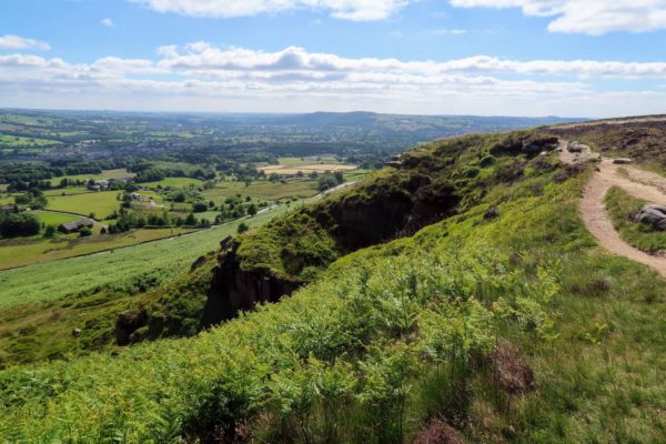
Just before you reach the trees, turn right on the path up the hill. Keep walking along the path, with views over grassy fields, dry stone walls and barns to your right. The path bends left and then right along the edge of the fields. The route continues over the wild open land, with impressive limestone plateaus, and down into a little valley.
Walking down to Littondale
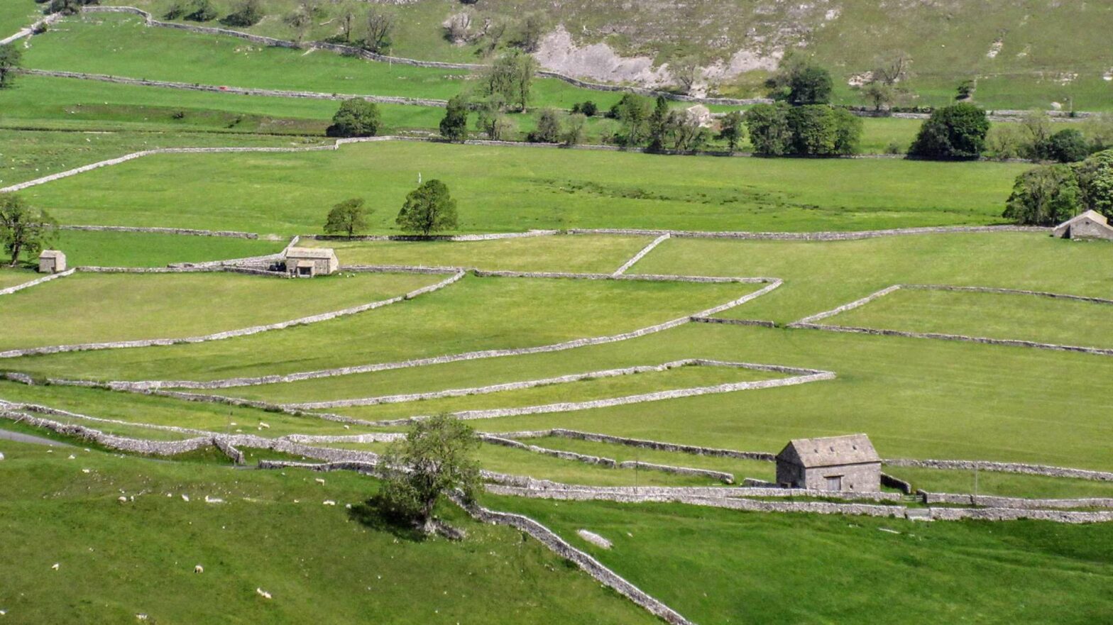
Soon you’ll be able to see Arncliffe in Littondale. This valley is full of fields and dry stone walls, with cute little barns. The path leads down the slopes and down into the centre of Arncliffe. There’s one pub in this small village, The Falcon Inn. This walking route leads across the village green and over towards the River Skirfare on the other side.
Before the bridge, turn right past the trees, with an old church on your left. Continue along this path by the river until you’re almost in the next village, Hawkswick. Before you get to the buildings, turn right to reach a small lane.
Turn right at the larger road for 300 metres before taking a left along a track. This turns into a smaller path and heads upwards back out onto the rough open land. This path leads all the way across the wild, grassy, limestone and towards the tarn. When the route reaches a lane, turn right. It’s 1 km along here to the car park and the end of the Malham Tarn to Littondale walk.
Guidebooks to explore more of Yorkshire


The Rough Guide to Yorkshire* is a great little guidebook and has a section on Ilkley and things to do nearby. The Yorkshire Dales Pathfinder Guide* has a good collection of short hikes suitable for the entire family and the Guide to North Yorkshire Pub Walks* has some fun walks in the Dales for those who are hungry and thirsty.
For other short countryside hikes nearby, why not walk up Almscliffe Crag, Sharp Haw and Flasby Fell, Beamsley Beacon, or Embsay Crag.
Related Posts