By Vicky · Published Jul. 6th, 2022 · Updated Mar. 23rd, 2023
When you buy through links highlighted with an asterisk (*) on this site, we may earn a small affiliate commission at no cost to you.
The Donauwörth Edelweißweg Hiking Trail heads to the hills and forests northeast of Donauwörth, with views to the Alps and peaceful countryside.
Get the route by downloading the .gpx or .kml file below. For navigation with Maps.me on your mobile phone, simply download the .kml file and open to add it to the Maps.me bookmarks.
Page Contents:
Location
This walk starts on the Isle or Reid in the middle of Donauwörth. If you come via train, it’s an additional 700 metres, or 10 minutes walk from the train station to the start of the hike. It’s 20-40 minutes on the train from Augsburg and 50mins-1hr20 from Munich or Nuremberg Central Stations. It’s slightly longer if you decide to drive.
Tips for Edelweißweg Hiking Trail
- Donauwörth town is worth exploring for an hour or two before you start this walk.
- If you get the train to Donauwörth, it’s an extra 700 m to the start of this hike.
- If you do take the train to Donauwörth, it’s 20-40 minutes from Augsburg and 50mins-1hr20 from Munich or Nuremberg.
- Start off following signs for the Historischer Route and then continue on the Edelweiß Route. Sometimes the route signs are quite small and on random lampposts.
- Offline maps app Maps.me works well for this hike.
- Another great hike from Donauwörth leads to Harburg Castle.
- Check out other great hikes on our Germany Hiking Page.
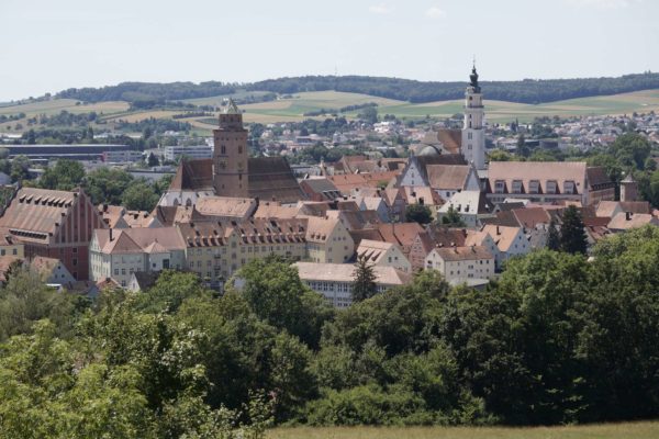
Donauwörth

If you first explore the historic town on the Donauwörth Walking Tour, it will add roughly 5 km to the hike. You can have a refreshing drink or snack in one of the many town restaurants before you start on the Donauwörth Edelweißweg hiking trail.
From the Isle of Reid, head through the Reider Tower (the large red city wall gate) then immediately right along the river. Make your way through town, heading up and over a bridge to cross the highway on the north of town. The signs start marking the Historischer Weg, you’ll meet the Edelweißweg in Zirgesheim.
Donauwörth to Zirgesheim
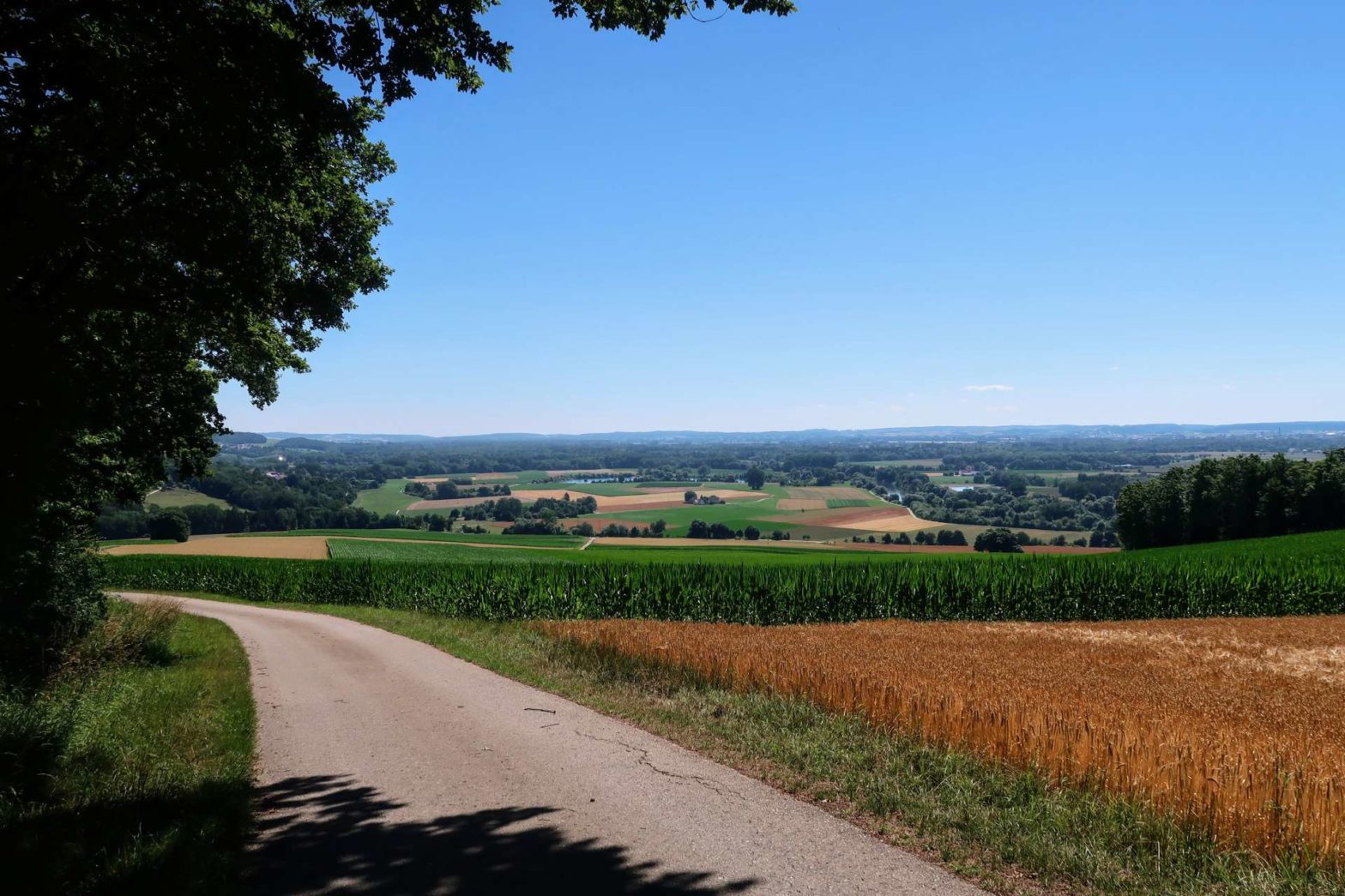
After the highway bridge continue left and then take a right. The trail then heads slightly downhill through a modern suburb of town. At the end of the road, you’ll see a small gate into a field and you’ll suddenly come out into the countryside. Head left up the field’s edge and then right.
From the track corner you’ll see the small town of Zirgesheim in the valley below. Above Zirgesheim you’ll reach a cross with great views over the surrounding countryside. This is the Wichtelesberg, where legend has it, gnomes live in the caves deep below. From the cross, head left then right into Zirgesheim town. Pass the church and then head left, now with signs for the Edelweißweg.
Views of the Alps and the Glider’s Club
Continue up and out of town to the right, aiming for the small chapel on its own in a field above town. On clear days you can see all the way to the Alps from here.
Continue into the forest, remaining high, and soon you’ll reach the corner of the forest where you make a sharp turn left. Look to the south once more for the last views of the Alps, then continue left around the forest.
On the weekends you may now see glider planes at the glider’s club in the distance. There’s also a photogenic row of trees following a road up the side of the plateau below. Walk around the glider’s club and then through countryside at the edge of the forest.
Through the Forest
The path has a few turns and soon enters the forest proper. There are both deciduous and pine trees in the woods here. The path heads to a main track, which you follow to the right. You’ll pass some cute forest huts, open in winter for shelter when there are cross-country ski trails through the forest.
Look out for the small path heading left, which wiggles through the wood, past clearings and different types of trees. You soon bend around to the left and eventually reach a road. Walk up the road a little way and then left by the side of a forest. Watch out for the small path on the right that leads a few metres into the forest.
Back towards Donauwörth
The path continues on the edge of the forest for a while, past some well-located tennis courts. You then reach a housing estate – head left through the car park and continue on the track through the fields. Soon you’ll be at the road again. Continue downwards until the new swimming pool complex on the right-hand side.
There’s a signed path towards the centre of town – take this downwards, across the highway and past a chapel. Turn left by the stream and you’ll reach the Donauwörth Promenade. Finally, head left to the tourist information and back across to the Isle of Ried where you started. From here it’s 700 metres to the train station.
Pin it
Related Posts