By Vicky · Published Sep. 18th, 2022 · Updated Nov. 24th, 2022
When you buy through links highlighted with an asterisk (*) on this site, we may earn a small affiliate commission at no cost to you.
The Palmiet Trail is an easy stroll in the foothills of the Hottentots Holland mountains. You pass through fynbos and beautiful pools.
Location
The Palmiet Trail is in Hottentots Holland Nature Reserve. It starts from Nuweberg, by the Cape Canopy Tour. The entrance is well-signed from the R321. It’s about 1hr-1hr15 from Cape Town, east along Highway 2 and then north along the R321 just past Grabouw.
On the way to the car park you pass through the main entrance gate to Hottentots Holland Nature Reserve. Pay park fees or show your WildCard here. It’s then 1.5 km drive along a good dirt track to the car park.
Map of Palmiet Trail Hike
Get the route by downloading the .gpx or .kml file below. For navigation with Maps.me on your mobile phone, simply download the .kml file and open to add it to the Maps.me bookmarks.
Tips for Palmiet Trail
- This hike is in Hottentots Holland Nature Reserve, managed by Cape Nature. Entry is R50/30 per adult/child, or free with a WildCard.
- The Reserve is open from 7 am to 5 pm every day.
- You’re not allowed to start this trail after 2 pm to make sure you’re back before dark.
- For navigation on this hike you can use the offline maps app Maps.me.
- For more hikes in South Africa, see our South Africa Hiking Guide.

The Palmiet Trail is a short and easy hike, suitable for beginner hikers and families alike. There’s another trail in nearby Kogelberg Nature reserve called the Palmiet River Trail, but the one described here is in Hottentots Holland Nature Reserve. It is actually the same river, but in the Hottentots Holland it’s a lot smaller since it’s much nearer the source.
Leave the car park northward, towards the mountains. At the track, you’ll see the Palmiet Trail continuing as a small path through the fynbos. In the distance, you can see the rocky mountains with a large green pine forest covering the valley in the foreground.
The smaller path soon joins a larger track through the forest. About 1.5 km from the start, you’ll see a sign saying Palmiet Trail pointing along a small path up to the right. Take this path, and you’ll return back to this point later along the main track.
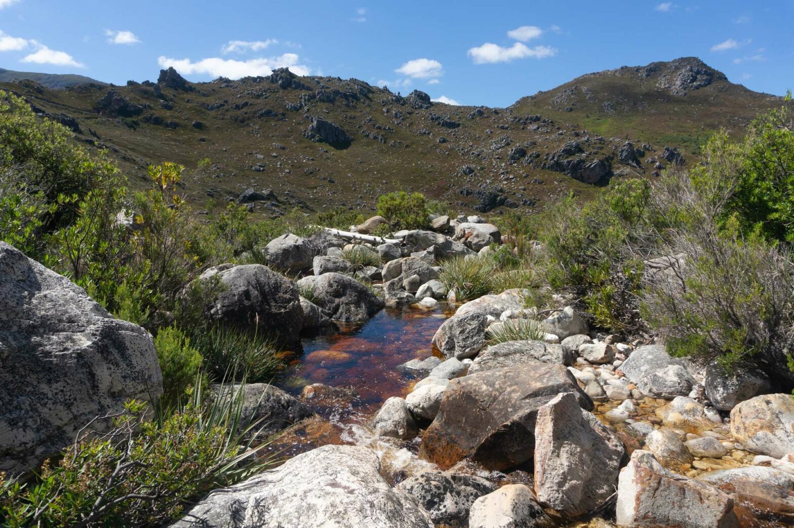
The Palmiet River
The path heads through vegetation, contouring around a hillside. Soon you’ll reach the upper section of the Palmiet River, where here it’s more of a stream. There are some beautiful pools here, in the dark reddy brown water. Another name for this valley is Theewaterskloof, or Tea Water Valley. The water isn’t dirty but picks up dark tannins released into the soil by the fynbos.
Shortly after crossing the river, the path meets the main track again. Turn left here to walk back down the valley along the Palmiet River. You’ll soon come to where the smaller path left, and then return through the forested area and back to the car park.
For more easy hikes nearby, try the Harold Porter Botanic Gardens Trail or Hangklip Lighthouse Trail. For many more hikes in South Africa, see our South Africa Hiking Guide.
Related Posts


