By Vicky · Published Jul. 28th, 2022 · Updated Nov. 21st, 2022
When you buy through links highlighted with an asterisk (*) on this site, we may earn a small affiliate commission at no cost to you.
The Mount Catur hike starts in Candikuning town in the Lakes Area of Bali. It’s an out-and-back hike with nice views in good weather.
Mount Catur Hike Map
Get the route by downloading the .gpx or .kml file below. For navigation with Maps.me on your mobile phone, simply download the .kml file and open to add it to the Maps.me bookmarks.
Location
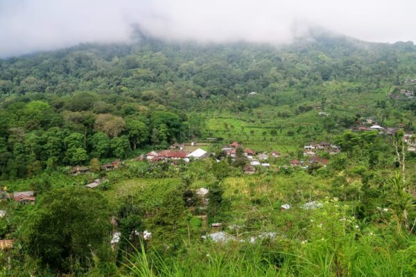
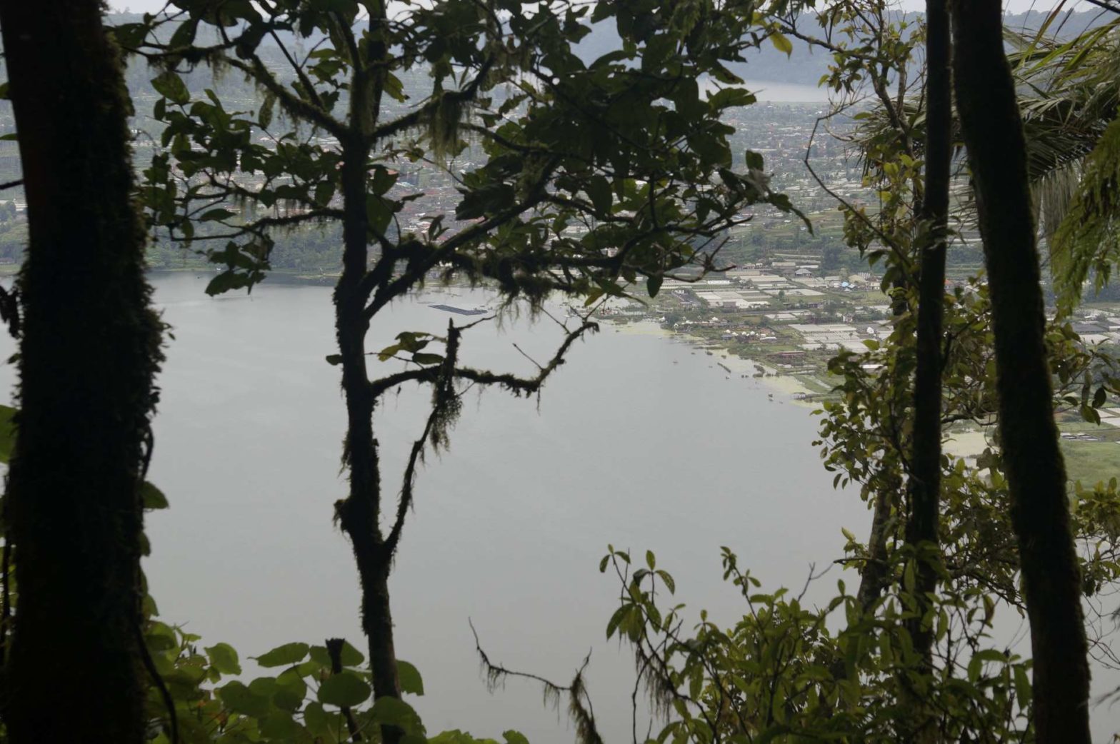
This walk up Mount Catur (Gunung Catur) starts in the middle of Candikuning town in the Lakes Area of Bali.
Tips for Gunung Catur Mountain Hike
- Set off early to avoid the heat of the day, and for the best chance of having a clear view at the top.
- Take snacks and water, there’s not much food to buy along the route.
- We stayed in ECO Bedugul Adventure Camp* in central Candikunung before and after this hike.
- Head to the Strawberry Shop at the end of this hike for some tasty strawberry-related food.
- For another hike from Candikuning, check out our Bali Lakes Area Hike, or find other activities on our Hiking Bali page.
Hiking Route up Mount Catur

We started walking up Mount Catur from the centre of Candikuning town, not far from the famous Ulun Danu Beratan Temple. From here, walk along the main road through town. You’ll reach the edge of Lake Baratan and pass a little market along the edge of the road on your left.
Just before the large road bridge, there are some steps off to the left leading to a little path. This path parallels the road by the lakeside. Walking along here saves walking along the main road (though there’s space for pedestrians on the main road too, so that route is also ok). The small path route can be a little wet in places.
The Small Path up the Mountain
Rejoin the road again and take the first on the left. This is a small road that leads towards the countryside. After 700 metres there’s a small track to the left into the jungle. This is the Catur Trail which heads up the mountain. Continue on this small path.
You’ll pass a few shelters on the way up the mountain. There are also a few spots where you get a view over Lake Baratan below, however mostly it’s just walking upwards through the jungle. In some places the path can be a bit slippery.
If you’re interested in Bali discover more….
It was very wet when we hiked and we did get a few leeches – watch out for these! If it’s dry leeches shouldn’t be a problem. Spraying insect repellent on your lower legs and ankles helps keep them away.
The Top
The path keeps on going and eventually you’ll reach the top, where there’s a temple called Pura Pucak Mangu and a small shelter. Unfortunately the mist had come down by the time we made it there, and we couldn’t see anything at all!
The hike back down Mount Catur heads back exactly the same way. At the end we headed to the Strawberry Shop to have a drink and some snacks. We then returned to ECO Bedugul Adventure Camp* where we were staying.
Guidebooks to explore more of Bali & Lombok


For another hike from Candikuning, check out our Bali Lakes Area Hike, or find other activities on our Hiking Bali page.
FAQS: Mount Catur Hike
Mount Catur is 2096 metres high. It’s the fourth highest mountain in Bali.
Yes, you are free to hike up Mount Catur without a guide.
A roundtrip hike up and down Mount Catur is 12.5 km from the centre of Candikuning town.
Related Posts