By Vicky · Published Jul. 5th, 2023 · Updated Aug. 13th, 2023
When you buy through links highlighted with an asterisk (*) on this site, we may earn a small affiliate commission at no cost to you.
The Anello del Vallon Popera Hike is a spectacular yet relatively easy walk up to a mountain hut, around a gorgeous valley and to a fun peak.
Vallon Popera Loop Hiking Map
Get the route by downloading the .gpx or .kml file below. For navigation with Maps.me on your mobile phone, simply download the .kml file and open to add it to the Maps.me bookmarks.
Location
The Vallon Popera hike starts from the car park at Rifugio Lunelli, at the end of Val Grande. At the end of the road, keep left and head through the horizontal metal poles forming the cattle barrier. The signs on the left tell you to drive slowly and the poles won’t damage your car. The main section of the car park can fill up early, but there is more space along the edge of the road.
Tips
- This walk has very low technical difficulty, though it does have a fair amount of climb.
- Rifugio Berti al Popera, or Bertihütte, where the loop part of this hike starts, is famous for fried donuts/pancakes, which are very delicious. Open from late June to late September.
- For more walks and hikes, check out our Italy Hiking Page.
Anello del Vallon Popera Hiking Route
Hiking up to Rifugio Berti al Popera

From the car park at Rifugio Lunelli, head to the hiking sign and along the track. Initially it’s quite a wide trail but slightly rocky, and leads through open forest and grassy areas sometimes grazed by cows.
After crossing a steam running down through some scree, the path becomes narrower and steeper. The many zigzags begin, which means the path is never too steep. It follows up by the streams, which contain several lovely waterfalls. In early summer, you’ll notice there’s more water in the streams in the afternoon than in the morning, due to snow melt.
Eventually the zigzags end and you’ll be able to see Rifugio Berti al Popera to the right at the top of the cliffs. It’s not so far now, and you’ll cross over a couple of streams. At one stream there are a couple of metal staples incase the water level is high and the rocks underneath are slippery.
At an unmarked path junction, keep right along the main trail. Following this, very soon you’ll be at Rifugio Berti al Popera and be able to enjoy a rest. However, it makes more sense to hike the Anello del Vallon Popera (Popera Valley Loop) first before returning to the hut and enjoying some delicious snacks.
Hiking on to Popera Lake
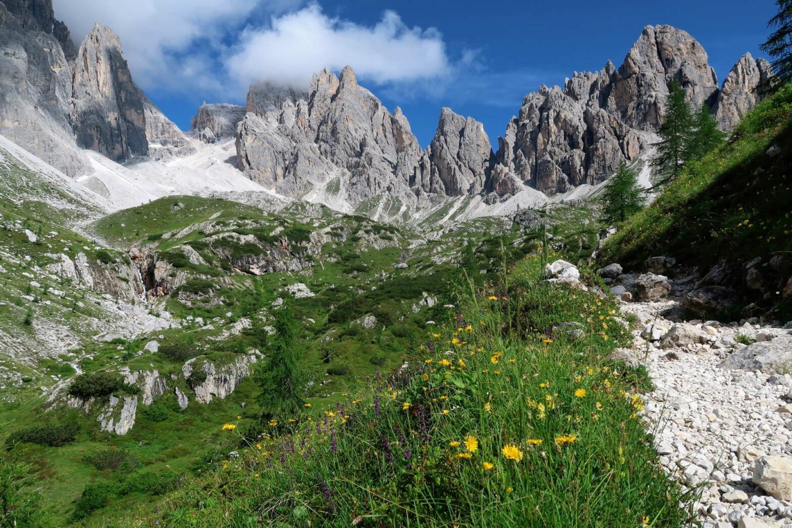
Continue from Rifugio Berti on the path to the right-hand side of the hut that leads down a grassy and flowery gully. This lovely path heads up through the dramatic bowl, known as Vallon Popera. You’ll see a semi-circle of steep, rocky mountains in front of you, but the walking itself is fairly easy through the grassy valley.
There aren’t any route choices on this path, so just continue walking gradually upwards, admiring the wildflowers and views. For most of this section, you can also see the cute Rifugio Berti perched just in front of the cliffs. After a slightly steeper climb heading upwards by a stream and waterfall, you’ll reach Popera Lake.
On the left you’ll see a small trail leading down to the lake’s edge. It heads to a secluded little beach, which should have both sunny and shady areas. It’s the perfect place to sit and relax, or if you’re brave to test the waters. Bear in mind, it’s mostly snow melt! Though on hot sunny days it looks very inviting.
Popera Lake to Croda Sora i Colesei Hike
After enjoying Popera Lake, walk back to the main path and left to the hiking signposts at the junction. Turn right here. The route contours along the edge of the bowl, and slightly downhill. After 600 meters, you’ll come to the first junction, with no hiking sign but a clear path to the left. Here you can decide to continue walking up to Croda Sora i Colesei Peak, or to take the shortcut back to Rifugio Berti.
If you’re taking the shortcut, head straight on then keep right to reach the path back down to Rifugio Berti. If you’re continuing to the top of Croda Sora i Colesei Peak (also known as Arzalpenkopf in German), then take the path to the left. This is a cut across to the main hiking trail, and saves a bit of descent and ascent. After a few hundred meters you’ll be back on the main trail.
At Forcella Popera
Turn left to follow the path as it zigzags upwards to Forcella Popera. This is the saddle on the ridge, with a rocky mountain pillar to the left and the impressive Croda Sora i Colesei Peak with an obvious summit cross to the right.
Apart from the great views from Forcella Popera, both of Vallon Popera and Sexten Valley far down below, there’s some interesting history here dating from the First World War. You can see trenches here, cutting across the saddle, and remains of a concrete bunker. To the right, you can also find a passageway cut into the rock which contains openings to great views of the countryside.
After enjoying the view and the historic features, head right along the small path. Just around the corner the landscape becomes extremely friendly, as the path continues through a flat grassy area. Soon you’ll meet a small junction, with a path heading left.
Hiking to the Summit of Croda Sora i Colesei
The path to the left is a fairly short out-and-back to the top of Croda Sora i Colesei Peak. You can already see the cross at the top, and it takes about 10 minutes to walk there. Again there are great views from here, plus a tunnel dug into the rock just below the peak with a window opening on the other side.
Take your time at this high point, then head back down and back to the path junction where you came from. Don’t take the path earlier on your left – this leads to a tricky Via Ferrata!
Completing the Vallon Popera Loop Hike
Once back at the junction, turn left signposted Rifugio Berti. The easy path leads downwards, with great views all around. At the path junction, turn left to reach the old Rifugio Sala. This rifugio is no longer in use, but it has a fun design cut right into the cliffs.
In the flat area in front of Rifugio Sala head right. The left route also leads eventually back down to Rifugio Lunelli where this hike started. However, it is moderately difficult and has short sections of Via Ferrata (no specialist equipment needed on these sections, but they do require a head for heights and sure-footedness).
The path to the right is an easy trail, though at one point is slightly close to the cliff edge (there’s a chain to hold if you need it). Eventually you’ll be back at Rifugio Berti, where you can reward yourself with delicious donuts/pancakes/frittatas and a drink.
From Rifugio Berti back to Rifugio Lunelli
Rifugio Berti is the end of the Anello del Vallon Popera, or the loop section of this hike. From here, the route back to the car park is the same as you walked up. Take the trail down in front of the hut, follow the zigzags, and walk along the final flatter section of trail through the trees and back to Rifugio Lunelli.
Guidebooks for Exploring the Dolomites


For more mountain hikes, check out our Italy Hiking Page.
Related Posts


