By Vicky · Published Sep. 6th, 2023 · Updated Sep. 13th, 2023
When you buy through links highlighted with an asterisk (*) on this site, we may earn a small affiliate commission at no cost to you.
The walk along Schoolhouse Ridge over Beinn a’ Bheithir includes two Munros, plus fantastic views and a small amount of easy scrambling. It’s a classic Scottish ridge walk.
Location
The Schoolhouse Ridge & Beinn a’ Bheithir Walk starts at a car park in the woods by Glenachulish. The walk ends at the Visitor Centre in Ballachulish. To get back, there are several buses that leave from just outside the Visitor Centre and then head to Glenachulish. Another option is to walk back, an extra 6 km.
Schoolhouse Ridge & Beinn a’ Bheithir Map
Get the route by downloading the .gpx or .kml file below. For navigation with Maps.me on your mobile phone, simply download the .kml file and open to add it to the Maps.me bookmarks.
Tips
- The weather can change very quickly, so make sure to take a waterproof jacket, warm jacket, hat and gloves – even in summer!
- The route down Beinn a’ Bheithir to Ballachulish is rocky and you have to do some easy scrambling in places.
- Wear hiking boots and take a paper map, plus it’s useful to have a digital map app such as Maps.Me.
- The map to take for this hike is the Ordnance Survey Explorer Map 384 of Glen Coe & Glen Etive*.
- This walk ends a the tourist information in Ballachulish, which serves delicious cakes.
- After the walk, take a stroll around Ballachulish Quarry, just opposite the tourist information.
- For other walks in the UK, see our UK Hiking Guide.
Schoolhouse Ridge & Beinn a’ Bheithir Walking Route

From the car park in the woods, head south along the track up the valley. Head left across the stream at the first junction, then turn immediately right on the other side along the smaller path. Continue up the path as the route starts to ascend. Keep on the smaller path, which zigzags in a few large bends upwards. Ignore the larger tracks.
Soon the forest ends and you’ll cross over and out onto the open moorland. The path continues to head up the side of the slopes, then aims towards the end of the valley as it narrows into a bowl. At the end of the bowl, continue along the path as it becomes fairly steep and makes the final ascent to Schoolhouse Ridge. Before you know it, you’ll be at a saddle at the top of the ridge, with glorious views all around.
Sgorr Dhonuill Peak
From the saddle, head right (west) for the out-and-back almost 1 km walk to the top of Sgorr Dhonuill. This is the first Munro on the Schoolhouse Ridge walk, and one of the two subpeaks that make up Beinn a’ Bheithir mountain.
At the top of Sgorr Dhonuill Peak there are great views, as long as the weather is clear. If you look east, you can see Sgorr Dhearg Peak and the rest of Schoolhouse Ridge that you follow on the walk down. After a break, continue back down to the saddle and onward along the ridge.
Sgorr Dhearg Peak
The final climb now begins, to the top of Sgorr Dhearg Peak. At 1024 m high, this is the tallest peak along Schoolhouse Ridge and the second Munro that makes up the broader Beinn a’ Bheithir mountain. The views from here are equally impressive.
If the weather is poor, it makes sense to return back the way you came rather than heading onwards from here. The way down from Sgorr Dhearg Peak along the rest of Schoolhouse Ridge to Ballachulish involves some scrambling, and in places, the path is not clear. In bad weather, the rocks will be slippery and you may not be able to find the path.
If the weather is good, continue onwards along Schoolhouse Ridge. The path now descends, before a small ascent to Sgorr Bhan. Keep walking along the ridge past the minor peak. After about 400 metres from the top of the minor peak, the path heads right, following a fork in the ridge.
The Descent from Schoolhouse Ridge
The first few hundred metres of the route down from here involve a small amount of easy scrambling. The path keeps right on the spine of the ridge, so don’t deviate too much from here. Soon the difficult bit is over and the rest of the descent is quite steep, but involves simply walking downwards.
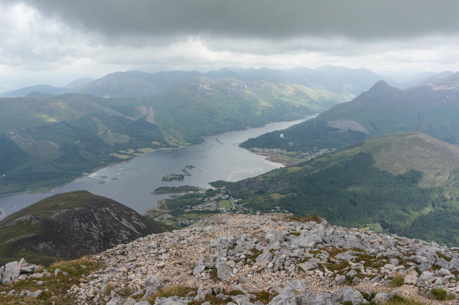
After a while, you leave the ridge to the right, and the path continues to flatten out through a broad expanse of heather. You then reach a larger path, or track, where you turn left. This track heads onwards straight towards the small town of Ballachulish. Once you meet the road, turn right and this will bring you to the Visitor Centre. Apart from having leaflets and information about the surrounding area, there’s also a cafe inside serving delicious cake. This is the end of the Schoolhouse Ridge & Beinn a’ Bheithir Walk.
If you still have a little energy, head over the road into the quarry opposite. It’s only a couple hundred metres to have a look around. To return to Glenachulish and the start of this walk, buses leave from outside the Visitor Centre. Alternatively, you can walk back, an extra 6 km.
Grab a Hiking Guide to Scotland


Scotland’s 100 Best Walks* is a great book to get for hiking inspiration when you’re planning your trip to Scotland. The Cicerone Guide to Ben Nevis and Glen Coe* is the perfect book if you’ve decided to stay in this area, one of the best hiking areas in Scotland. Finally, The Munros* is the definitive guide to the routes up Scotland’s Munros (peaks over 3,000 feet, or 914.4 m).
For other walks in the UK, see our UK Hiking Guide.
FAQS: Schoolhouse Ridge & Beinn a’ Bheithir Walk
Beinn a’Bheithir is the obvious mountain to the southwest of Ballachulish. This massif is made up of two subpeaks, Sgorr Dhonuill and Sgorr Dhearg, both of which are Munros.
Walking along Schoolhouse Ridge itself is easy as the path is simple and the ridge is fairly broad. However, the route east off the top of the ridge involves a small amount of easy scrambling, which may not be suitable for everyone.
Related Posts


