By Vicky · Published Sep. 6th, 2023
When you buy through links highlighted with an asterisk (*) on this site, we may earn a small affiliate commission at no cost to you.
This circular ridge walk in the Mamores Mountains heads up over Stob Ban and Mullach nan Coirean with fantastic views of the surroundings.
Location
The Stob Ban & Mullach nan Coirean Walk starts at the Lower Falls car park, 15 minutes drive southeast of Fort William.
Stob Ban & Mullach nan Coirean Map
Get the route by downloading the .gpx or .kml file below. For navigation with Maps.me on your mobile phone, simply download the .kml file and open to add it to the Maps.me bookmarks.
Tips
- Parts of the route, especially on the way down, are a bit rocky and can also be quite wet, so wear decent hiking boots.
- The weather can change very quickly, so make sure to take a waterproof jacket, warm jacket, hat and gloves – even in summer!
- There are no refreshments on this hike so take all the food and water you need.
- The map to take for this hike is the Ordnance Survey Explorer Map 392 of Ben Nevis & Fort William*.
- After the hike, visit the nearby waterfall (Lower Falls), just by the car park. You can swim in the pools nearby, but it will probably be very cold!
- For other walks in the UK, see our UK Hiking Guide.
Stob Ban & Mullach nan Coirean Walking Route

This circular ridge walk starts from the Lower Falls Car Park. Leave the car park and turn right on the small road. Before the bridge, take a right along the track. This track becomes smaller and leads upwards through the open countryside, paralleling a stream.
The route is fairly easy to follow as you just keep on walking up the valley. Don’t forget to check out the views behind you every so often! As the valley narrows near the top, the path bends left and heads more steeply upwards.
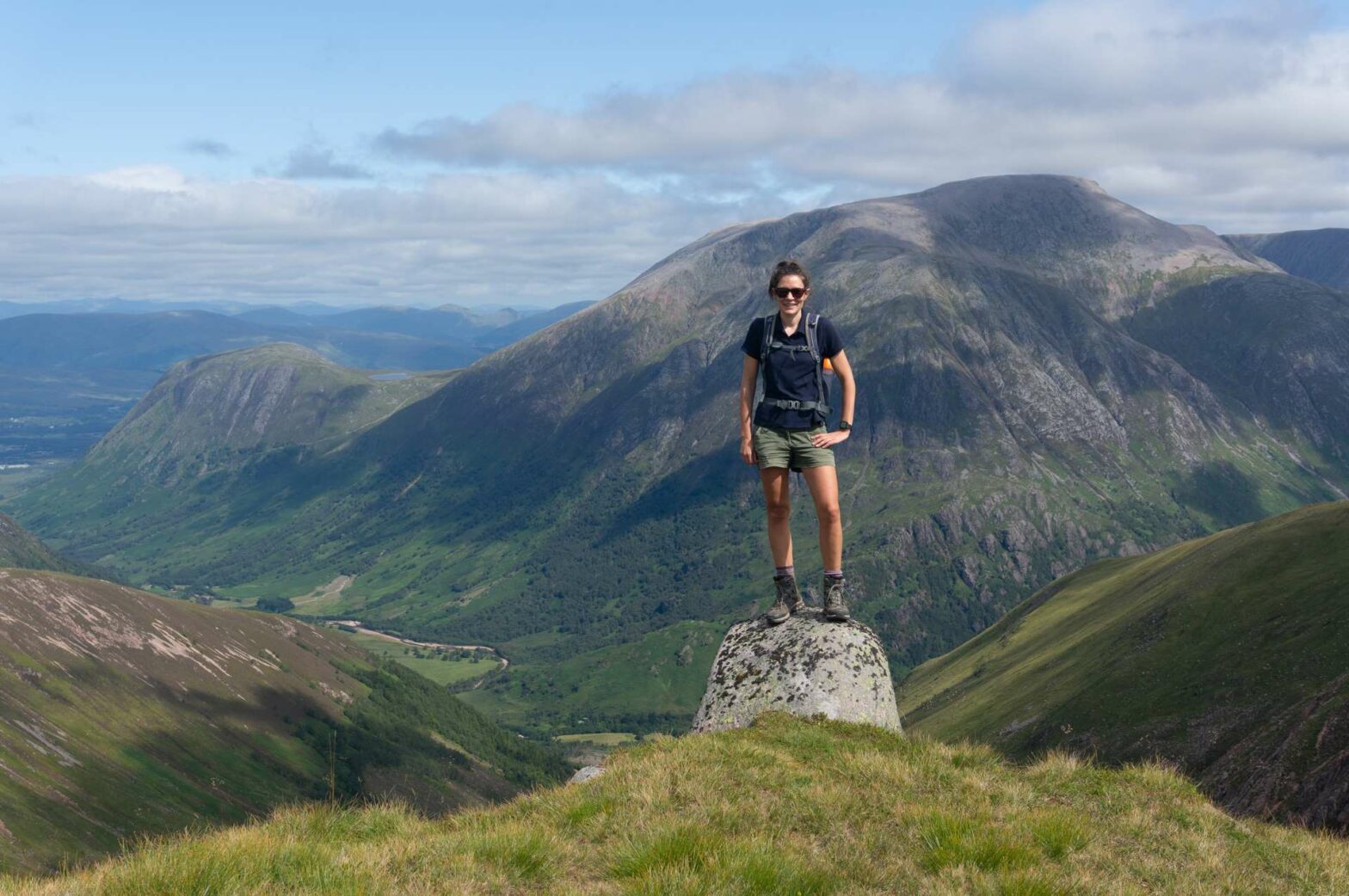
The route then continues around the small bowl and you return to the stream, where you cross over it. After a few more zigzags, you’ll reach the top ridge of the Mamores Mountains. From here there are amazing views, with Ben Nevis where you came from and many more mountains in the opposite direction.
The circular ridge walk now continues right, towards Stob Ban and Mullach nan Coirean Peaks. Again, the route isn’t hard to follow as you stick to the top of the ridge. However, if it’s bad weather with poor visibility, don’t attempt to walk along the ridge but head back down the way you came.
Stob Ban
There’s still a little bit of climb to Stob Ban peak, but there are great views all around and you’re almost at the highest point of this walk. Stob Ban is 999 metres high, just shy of 1000 m. However, a Munro is officially defined as a mountain over 3000 feet, which is only 914 metres, so Stob Ban is comfortably a Munro.
Soon you’ll be at the top of Stob Ban with more amazing views. This is the high point of the walk in all senses, so take a while to relax and have something to eat.
Mullach nan Coirean
From the top of Stob Ban the ridge undulates over a couple of minor peaks. There’s one final down and up again before you get to the top of Mullach nan Coirean. At 939 metres high, it’s also a Munro, so the second and final one on this walk. Again there are great views from the peak, and now it really is almost all downhill from here.
From the top, continue along the path, which bends right and heads down the spine of Mullach nan Coirean. It’s a little rocky and steep here, and some sections can be a bit wet after the rain. Make sure to keep following the top of the broad ridge downwards, then follow the path as it bends left.
Soon you’ll come to the edge of a woodland area. The path heads right over a style into the trees and continues downwards. After about half a kilometre, the small path meets a much larger track. Turn right here. This track leads gently across the forested slope to the other side.
At the bend in the track, take the path heading directly downwards. You’ll soon be back at the small road you drove in on. Turn right and the car park is very close by. This is the end of the Stob Ban & Mullach nan Coirean Walk.
Lower Falls
After the hike, head the few meters from the car park to the Lower Falls. They’re not overly impressive, but are nice nonetheless. You can even swim here in nearby pools, but it will be very cold!
Another good option is just to go paddling, so remember to bring a towel with you in the car.
Grab a Hiking Guide to Scotland


Scotland’s 100 Best Walks* is a great book to get for hiking inspiration when you’re planning your trip to Scotland. The Cicerone Guide to Ben Nevis and Glen Coe* is the perfect book if you’ve decided to stay in this area, one of the best hiking areas in Scotland. Finally, The Munros* is the definitive guide to the routes up Scotland’s Munros (peaks over 3,000 feet, or 914.4 m).
For other walks in the UK, see our UK Hiking Guide.
FAQS: Stob Ban & Mullach nan Coirean Circular Walk
The circular walk along the ridge over Stob Ban & Mullach nan Coirean is 14 km with 1100 metres climb. It takes about 5-6 hours.
Stob Ban means ‘White Peak’.
The hike up to Stob Ban is not that hard as there are no technical difficulties. It does, however, require a moderate level of fitness and navigation skills. The hike up Stob Ban shouldn’t be attempted in heavy rain or poor visibility.
Related Posts