By Vicky · Published Sep. 3rd, 2023
When you buy through links highlighted with an asterisk (*) on this site, we may earn a small affiliate commission at no cost to you.
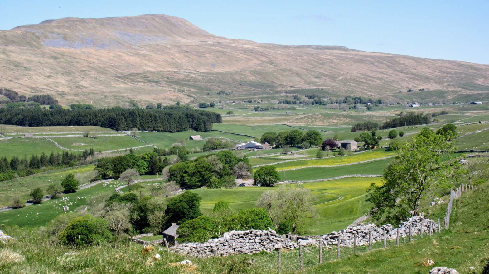
The Yorkshire Three Peaks Walk is a brilliant day hike through the best of the Dales, with the challenge to complete the walk within 12 hours.
Page Contents:
Location
The Yorkshire Three Peaks Walk is circular and there are several places where you can start (and end) the hike. The most popular options are Horton-in-Ribblesdale, Ribblehead or Chapel le Dale. There’s plenty of parking in Horton-in-Ribblesdale, and this is probably the most popular location to start the walk. Parking costs £4-5.50 for the day, and it tends to get busy on sunny summer days. There’s an official National Park car park, or slightly cheaper parking can be found in the fields nearby.
Ribblehead (near the famous viaduct) offers some limited free parking, as does Chapel le Dale.
Yorkshire Three Peaks by Public Transport
It’s actually very easy to take the train to Horton-in-Ribblesdale and start the Three Peaks walk directly from the train station. It’s 1hr20 on the train from Leeds, or 30 minutes from Skipton. Unfortunately, on the weekends the first trains arrive at Horton-in-Ribblesdale at 10:20am, which is too late to start the walk. However, on weekdays you can leave Leeds station at 7:30am and arrive by 9am, giving you just enough time to complete the walk in daylight in summer.
If you catch the train from Skipton, there are weekday trains arriving at 6:30am to Horton. Alternatively, the train also reaches Horton-in-Ribblesdale from Carlisle, a lovely ride through the heart of the Yorkshire Dales.
Yorkshire Three Peaks Map
Get the route by downloading the .gpx or .kml file below. For navigation with Maps.me on your mobile phone, simply download the .kml file and open to add it to the Maps.me bookmarks.
Tips
- The weather can change very quickly in the Yorkshire Dales, so make sure you take warm clothes and a rain jacket even on a day that starts sunny with blue sky.
- There are a few pubs on this hike, each in the valleys between each peak – in Horton-in-Ribblesdale, in Ribblehead and in Chapel le Dale.
- The map to take for this hike is the Ordnance Survey Explorer OL2 of the SW Yorkshire Dales*.
- Some areas of this hike can become very wet and boggy after it has rained, so wear decent hiking shoes.
- Why not stay nearby for a relaxing recovery after your long hike? Broad Croft House* is right on the route in Horton-in-Ribblesdale and includes a delicious full English breakfast with gorgeous views.
- For other hikes nearby, try the short hikes up Beamsley Beacon, Almscliffe Crag, Sharp Haw and Flasby Fell, or Embsay Crag.
- You can find other Yorkshire ideas in our Yorkshire Guide.
Yorkshire Three Peaks Walking Route
As mentioned, you can start the Yorkshire Three Peaks Walk from several locations, since it’s circular, but the most popular starting point is Horton-in-Ribblesdale. You can also walk either clockwise or anticlockwise. Here we describe the clockwise route, which is the slightly less popular version. This has the advantage that you’ll be walking with fewer people, and it saves the easiest peak, Pen-y-Ghent, for last.
Whether you park in Horton or catch the train, first head to the train station. Take the steps up to the platform, then cross the rails, making sure to look carefully for trains before you cross. Continue along the small path on the other side, and it will soon lead you into some fields.
Ingleborough

If it’s clear weather, you’ll already be able to see Ingleborough peak in front of you slightly to the right. The route to the top is very simple as there is basically only one, fairly large path. The route gets steeper as you come to the end of the fields and reach the wild moorland proper. You’ll see your first example of limestone pavement here, with much more coming later on the walk.
After a short climb, the path flattens again as you walk across the grass and limestone towards Ingleborough. Roughly two kilometers later, the path steepens again as you begin the main ascent of the hill. The path cuts upwards and across the grassy slopes and soon you’ll get to the ridge at the top.
Turn left to reach the final summit, a few hundred meters away. There are several cairns and plenty of rock circle shelters here in case it’s poor weather. There are also great views over the Yorkshire countryside and in clear weather you can see both Whernside and Pen-y-Ghent, the other two summits on the Three Peaks walk.
Walking on to Whernside
After a break, return a few hundred metres the way you came and continue on the ridge past the path you came up on. At the wall junction, take the left to head steeply down the slopes of Ingleborough.
Towards the bottom there’s some beautiful heather and limestone pavement within a little nature reserve (Southerscales Nature Reserve). You’ll also have great views of Whernside in front and back to Ingleborough.
After the nature reserve, you’ll reach a road and the hamlet of Chapel le Dale. From here you can see the famous Ribbleshead Viaduct in the distance to your left, but will walk right beneath it later on the walk. Turn left on the road then take the first right shortly after The Old Hill Inn along the small road over the cattle grid.
Whernside
Now you’ll start walking up the second, and highest of the Three peaks, Whernside, at 736 metres high. After heading through the fields, the lane bends left and starts to ascend. You’ll soon be heading out onto the moorland again, where the path gets steeper and steeper until you reach the top ridge.
At the top of the ridge, turn right for the final climb up to the top of Whernside. From here there are great views, and you’ll be able to see the other two of the Yorkshire Three Peaks if the weather is clear. After a break at the top, and perhaps lunch, it’s time to continue.
Ribblehead Viaduct
Head onwards along the ridge, and take the path to the right as it bends downwards and around a small lake. After walking across this large grassy area, you’ll come to a T-junction. Turn right here to head down into the valley. You’ll cross the railway tracks and follow the path parallel to the railway until you reach the famous Ribblehead Viaduct.
After looking around the viaduct, and perhaps waiting to see a train cross, continue towards the small road. You can sometimes find an ice cream van here in summer, or the Station Inn to your right is always open. Feeling a little refreshed, continue along the small road straight across and start the long slog to the final hill, Pen-y-Ghent.
Pen-y-Ghent
This part of the walk can be quite tough as you may already be quite tired, yet there’s still quite a way to go (about 9 miles, or 15 km). Don’t be dispirited, as once you’re at the top of Pen-y-Ghent, which is the shortest of the three peaks, it’s just a short distance downhill until the end.
After almost 2 km along the small lane, the route continues on a track to the left, past a few houses. The track makes a fairly sharp bend and continues out onto the open hills. You’ll walk through a mix of moorland and fields on the approach towards Pen-y-Ghent.
You then take a path almost ninety degrees to the left, straight up towards the ridgeback of Pen-y-Ghent. Before the path here was made a bit industrial, the path was small and led through a large area of Black Moss. If you weren’t careful you could end up neck-deep in a bog and have to be rescued. Today there’s little danger of this.
At the top & almost back
Turn right once you’re almost at the top plateau and you’ll soon be at the final peak of the three peaks. Take a while to admire the view, and peer down on Horton-in-Ribblesdale far below where the walk ends. It’s now not too far, only about 2.5 miles or 4.5 km. Additionally, it’s all downhill.
Head over the top of the summit and steeply down the other side. Turn right where the wall also turns, just after the steep bit. This path leads you off the high moorland and back through the fields into Horton-in-Ribblesdale. You’ve finally reached the end of the Yorkshire Three Peaks Walk.
Kit List for the Yorkshire Three Peaks Challenge
The weather can change very quickly in the Yorkshire Dales, with brilliant sunshine turning into fog and heavy rain before you know it. In addition to the items mentioned below, it’s a good idea to have a change of clothes (and especially socks and shoes) waiting for you in the car when you get back.
Essentials


- Hiking Boots: Since it’s a long walk, boots with ankle support and good cushioning really help. The soles of the feet becoming tired is one of the most common complaints on the Three Peaks Walk.
- Yorkshire Three Peaks Map* and a compass. Additionally, a phone app such as Maps.Me is very useful.
- Waterproof Jacket*: It can rain anytime in the UK. A decent waterproof jacket is essential, else you can become very cold and wet very quickly.
- Rucksack* & Rain Cover*: You’ll need to take enough food and water for the day, plus layers of clothing to take off, so a day rucksack (20-30 litres) is a must. Additionally, a rain cover for your rucksack is a lifesaver if it starts chucking it down.
- Food and Water: There are a couple of places for refreshments on the hike, but you might not want to stop for too long. Sandwiches, cereal bars, chocolate, nuts and dried fruit are great options to keep your energy levels up. Take at least 2 litres per person of water.
- Basic First Aid Kit: Blisters are a common occurrence on long hikes, so make sure your kit includes some blister plasters*. Normal plasters, bandages and cleansing wipes are also great to have in case of any nasty cuts and scrapes.
Optional
- Waterproof Trousers: I hate waterproof trousers, but they can be useful if it’s raining hard and you’re out in the open. The more expensive versions are definitely more comfortable than the cheaper ones, but any will do the job.
- Hat & Gloves: You lose most of your heat through your head, so a hat is a small yet super useful item that will keep you warm. Freezing fingers are not pleasant, so gloves are useful too. These items are essentials outside of summer.
- Sunglasses, sunhat, sunscreen: Don’t underestimate the sun, which can be very strong if you’re out walking in it all day. A sunhat can be a lifesaver on a hot summer day.
- Walking Poles*: These can really take the pressure off your knee and hip joints so you’ll still feel ok towards the end of the walk.
- A thermos flask full of hot tea!
Guidebooks to explore more of Yorkshire


The Rough Guide to Yorkshire* is a great little guidebook and has a section on Ilkley and things to do nearby. The Yorkshire Dales Pathfinder Guide* has a good collection of short hikes suitable for the entire family and the Guide to North Yorkshire Pub Walks* has some fun walks in the Dales for those who are hungry and thirsty.
For other hikes nearby, why not walk up Almscliffe Crag, Sharp Haw and Flasby Fell, Beamsley Beacon, or Embsay Crag.
FAQS: Yorkshire Three Peaks Walk
The Yorkshire Three Peaks is 24 miles, or 39 kilometers long with roughly 1500 m of ascent.
The aim of the Three Peaks Challenge is to complete the walk within 12 hours. To make this time, you have to walk on average 2 miles per hour (3.25 km/hr), including breaks. A normal walking speed on flat ground is 3 mph (or 5 km/hr). However, going uphill takes longer, and long stops make a large difference.
If you walk fast and don’t have too many breaks, you can complete the route in 10 hours. This means averaging almost 2.5 mph (or 4 km/hr).
There’s a large car park in Horton-in-Ribblesdale, which is where most people start the hike. Additionally, there are smaller car parks in both Ribblehead and Chapel le Dale, alternative start locations.
The Yorkshire Three Peaks Walk is not technically difficult, and the route finding is fairly simple. However, you do need a decent level of fitness. If you’ve not done any long walks before, you will need to train for several months to complete the 3 Peaks. Over this time you should gradually build up in distance to at least 20 miles.
Ingleborough is 723 m high, Whernside is just taller at 736 m high, and Pen-y-Ghent is the lowest at 694 m high.
You can bring your dog on the walk, but they have to be kept on the lead for a large part of it since it’s through farmland. Like yourself, your dog also needs to be in decent shape.
If there are cows on the route, try and stay well clear of them. If the cows start running towards you, let go of the lead and let your dog go. The cows will most likely chase your dog, which has a high chance of outrunning them. There are a couple of incidents in the Dales every year where dog walkers are killed by cows. This mainly occurs when owners don’t let go of the lead.
Related Posts


