By Vicky · Published Dec. 21st, 2022 · Updated Mar. 23rd, 2023
When you buy through links highlighted with an asterisk (*) on this site, we may earn a small affiliate commission at no cost to you.
The Wolfskopf Peak Hike is a fairly easy walk mainly along tracks up through fields and forest to the top ridge and the peak itself. This route is also possible in the snow.
Get the route by downloading the .gpx or .kml file below. For navigation with Maps.me on your mobile phone, simply download the .kml file and open to add it to the Maps.me bookmarks.
Location
The Wolfskopf Peak Hike starts from a small car park by the side of a track near Trauchgau village. If the last section of the road is covered in the snow, you can park in the village and walk an extra ~1 km each way to the start of the Wolfskopf hike. It’s about 20 minutes drive from both Hohenschwangau, where Neuschwanstein castle is, and Füssen town.
Tips for Wolfskopf Peak Hike
- If hiking in snow, hiking poles* are useful as are crampon micro-spikes* if the route is heavily trodden or vehicles have driven on the tracks, making the route easy but slippery.
- For more hikes, check out our Germany Hiking Page.
Wolfskopf Peak Hiking Route

From the small car park, head along the track and follow it as it bends left. Soon you’ll see a wooden hut with a hiking signpost at the junction. Turn right just before the hut and follow the track up through the fields.
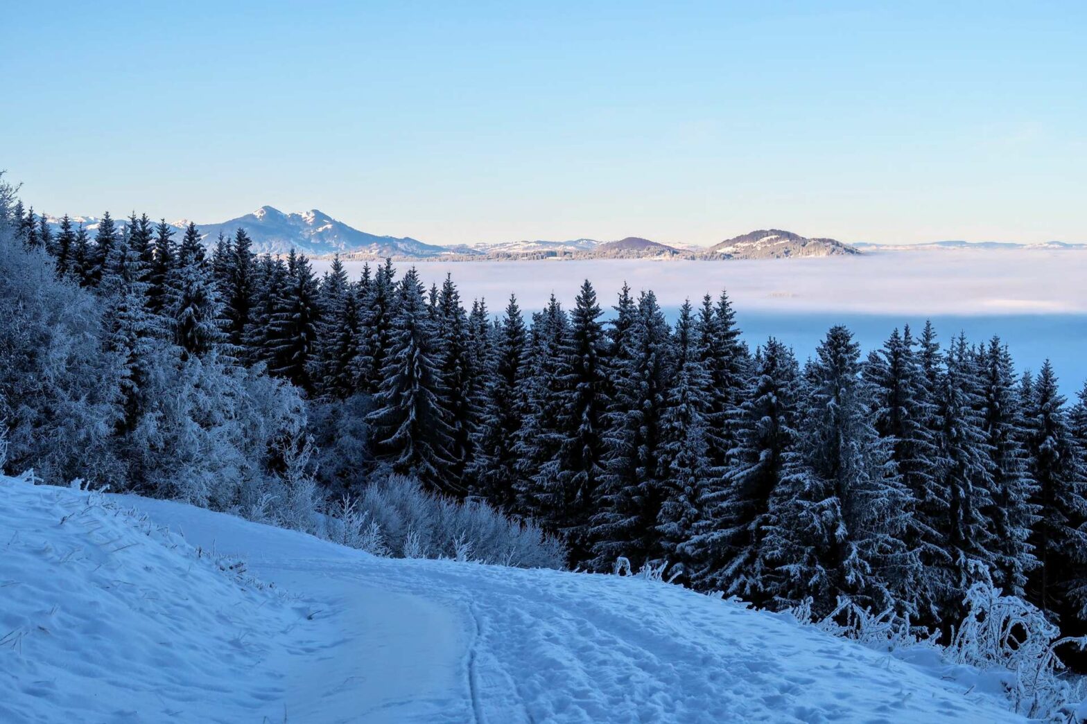
Keep left at the first junction, following the signs to Wolfskopf Peak, and the track continues through fields before heading into woodland. Follow the track left up the hill, and keep on going. Every now and then, you’ll reach an opening in the trees and have great views down into the valley. The track winds gradually upwards, and eventually the track ends and becomes a smaller path.
On the Top Ridge
The route gets slightly steeper, but after a short distance you’ll reach the top ridge, in a clearing within the forest. There’s a signpost here, which points you left towards the top of Wolfskop Peak. After the clearing, you’ll re-enter the forest on the ridge. At the first junction, take the path to the left, which is fairly steep, to walk via a great viewpoint.
From this viewpoint you can see some of the high Alps in the distance. You can actually see more of the mountain range from here than at the top, so it’s worth walking this route. After admiring the view, continue along the path and you’ll join a slightly more main track below.
Wander along this track, and soon you’ll be at the top of Wolfskopf. There’s a large wooden cross here along with a couple of benches. It’s in a bit of a clearing, so you can see all the way down to the valley below, and across the flat countryside.
Other Hikes in the Snow


Hiking Back Down Wolfskopf Peak
After having a rest on the benches, continue along the path. In the snow, this is the least obvious section if nobody has been this way beforehand. Head away from the viewpoint, and then left steeply downwards through the forest. Soon the path should become clearer, and in a short distance you meet a larger track.
Hiking downwards, you’ll come across a cute wooden cabin at a junction on a saddle. On some maps, a path is marked here heading straight down to the left, but in reality, it barely exists. Head straight onward along the track instead, which is just slightly longer.
The track continues to wind its way downwards. Near the bottom, you’ll meet another track where you turn left towards the starting point. From here, it’s a mix of woodland, clearings and farmlands as you approach back to your car.
About 500 metres from the end, as you round a corner on the track, you have an option of detouring to Almstube Trauchgau. This would add an extra 1.2 km to your hike. Alternatively, you can return to your car and drive around. The Almstube is a cosy restaurant that serves soups, sandwiches and meals, along with hot drinks and cakes.
If not going to the Almstube, continue along the track and soon you’ll be back at the mountain hut near the beginning. Just around the corner is your car, and the end of the Wolfskopf Peak Hike.
Guidebooks to explore more of Germany


For another walk in the snow, try the nearby walk to Kenzenhütte or climb the Seekarkreuz Peak. Alternatively, check out our Germany Hiking Page for more great hikes nearby and for walking tours of the famous Bavarian cities.
Pin it
Related Posts

