By Vicky · Published Sep. 22nd, 2023 · Updated Sep. 27th, 2023
When you buy through links highlighted with an asterisk (*) on this site, we may earn a small affiliate commission at no cost to you.
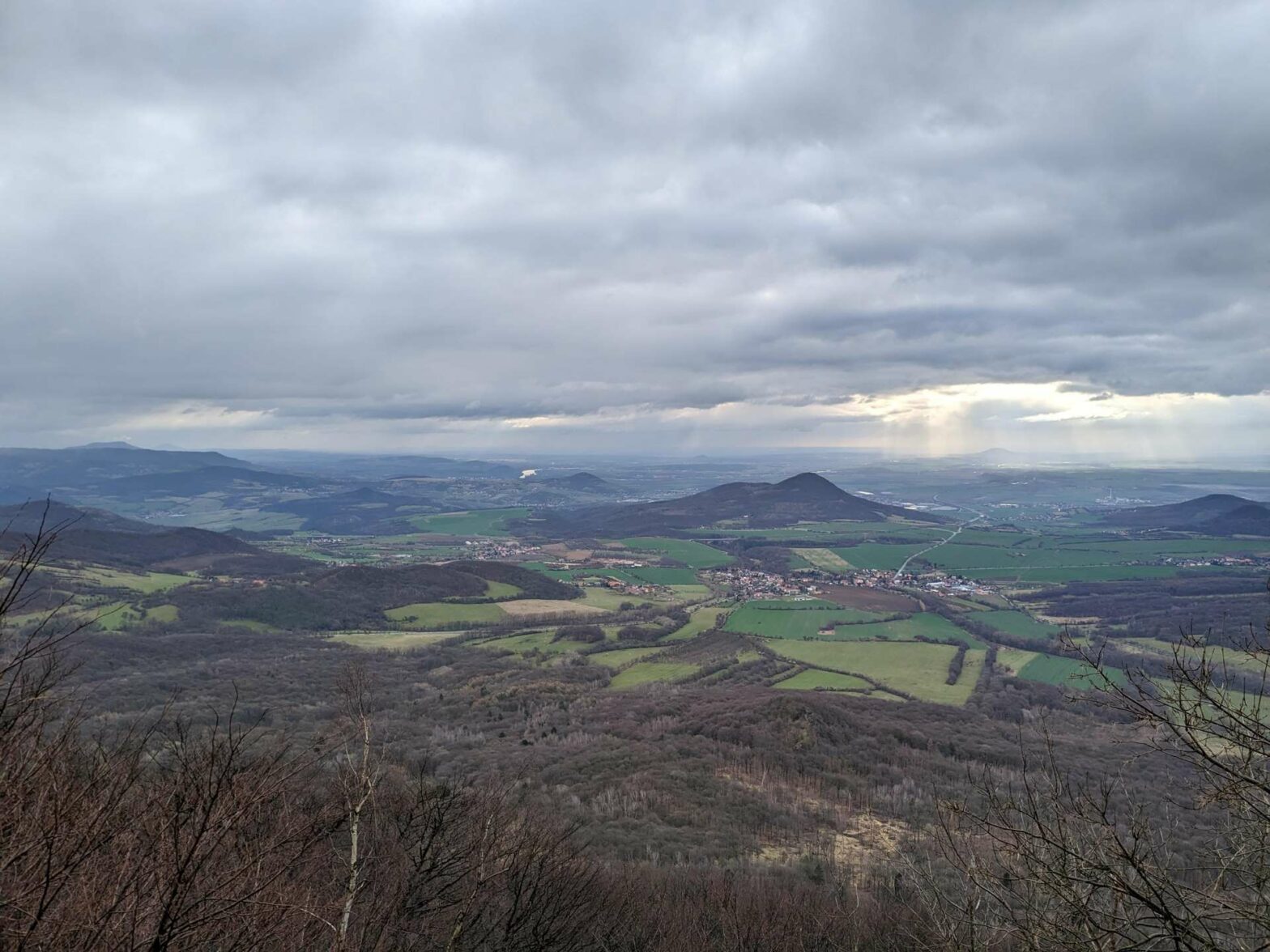
The hike up Milešovka Peak brings you to the top of the highest mountain in the Central Bohemian Uplands, with great views at the top.
Milešovka Peak Hiking Map
Get the route by downloading the .gpx or .kml file below. For navigation with Maps.me on your mobile phone, simply download the .kml file and open to add it to the Maps.me bookmarks.
Location
The walk to Milešovka Peak starts from a small car park on the edge of a main road. As an alternative starting point, you can park in a paid parking lot in Bílka.
Tips for Milešovka Peak Hike
- There’s a restaurant at the top which is open from 10am-4pm on the weekends.
- For another nearby peak hike, check out the walk up Bořeň Peak, or discover more walks on our Czech Hiking Page.
Milešovka Peak Hiking Route
From the car park, head along the track into the fields. The first section of this walk is mainly in the open with some gentle ups and down. After almost 1 km, head left along the path contouring around the lower slopes of Milešovka Peak, which you can see in the distance to your left.

Soon you’ll enter the little village of Bílka. Turn left up the road in the centre of the village, in front of the water trough and the grand ruined building. In about 600 metres you’ll reach the lower station of the little cable car. This takes goods, not people, up to the top of the mountain.
Shortly after this the road ends and you head straight onward onto a path heading quite steeply upwards through the woodland. Another trail joins from the right where there’s a cute little shelter and table on the left. Continue upwards and follow the path as it bends right around the back of the hill.
At the top of Milešovka Peak
After a few hundred metres, keep left for the last uphill of the hike and one final zigzag to the top of Milešovka Peak. Don’t take the first left at the top, but continue straight onwards around the back of the buildings. On your left is the Milešovka Observatory, which has been measuring the weather for decades. If it’s open, you can head to the viewing deck halfway up the tower.
On your right is the restaurant, open from 10am to 4pm on the weekends. Head past the restaurant and right to get to the terrace at the front. From here there are great views over this side of the hill. There are also several tables and benches at the top, together with an information sign about the region (in Czech but with pictures).
When you’re ready, continue onwards out of the other side and follow the path as it bends left. Take the first right to start the quick descent of Milešovka Peak. The path gradually flattens and heads to the right. Soon you’ll reach a T-junction and another sheltered table.
Turn left and wall through the woodland until you reach a large, open, sloping field. Turn right here and along the edge of the trees all the way to the small road at the bottom near the highway. Head left and you’ll soon be back at your car and the end of the Milešovka Peak Hike.
Guidebooks to explore more of the Czech Republic


For another nearby peak hike, check out the walk up Bořeň Peak, or discover more walks on our Czech Hiking Page.
Related Posts


