By Vicky · Published Sep. 19th, 2023 · Updated Oct. 24th, 2023
When you buy through links highlighted with an asterisk (*) on this site, we may earn a small affiliate commission at no cost to you.
The Rochers des Mourres are fantastic rock formations near the cute town of Forcalquier, and a walk is the best way to explore them both.
Get the route by downloading the .gpx or .kml file below. For navigation with Maps.me on your mobile phone, simply download the .kml file and open to add it to the Maps.me bookmarks.
Location
The hike to the Rochers des Mourres starts from a car park in central Forcalquier. It’s about 1hr30mins drive north of Marseille, or just over 2 hours on a direct bus. You can also take a bus to Forcalquier from elsewhere in Provence.
Tips for Rochers des Mourres Walk
- If you want a shorter walk, you can start from the car park directly by Rochers des Mourres.
- For more hikes, check out our France Hiking Page.
Forcalquier to the Rochers des Mourres Hiking Route

From the car park in the middle of Forcalquier, head along Avenue Fontauris, leading away from the centre. Take a left at a Y-junction to follow Chemin des Moureisses and continue along the track when the path ends. The route leads through some open valleys and woodland, and soon you’ll have your first glimpse of the Rochers des Mourres across the valley to your right.
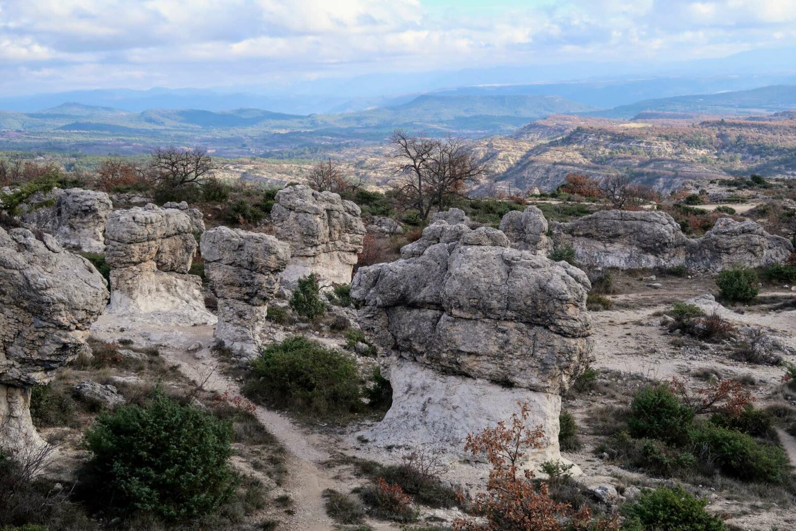
Rochers des Mourres
The Rochers des Mourres are composed of limestone and have been sculpted over millennia by erosion caused by water, wind, and other natural forces. The result is a series of strange and fantastic rock formations, some resembling towers, fairy chimneys, and other astonishing shapes.
Follow the path as it heads into the rocks. There are some lovely viewpoints, and the path bends upwards to cross a road. Follow the track on the other side of the road. When you reach the second large bend, head along one of the smaller paths into the main section of the Rochers des Mourres.
Take your time to wander through this natural labyrinth of rocks and discover panoramic views of the surrounding landscape. There are many little paths, with no set route, just go where the rocks take your fancy.
After a while, begin to head upwards and out to a track. Turn left and left again along a track heading back towards Forcalquier. This track takes you all the way back to the outskirts of the town. Make your way through the quiet suburbs and past the car park to the main street of Forcalquier.
Walking around Forcalquier
Forcalquier is known for its picturesque and historic character, as well as its scenic surroundings. The town is also famous for its traditional Provencal market (Monday mornings), where visitors can find a variety of local products, including lavender, herbs, cheeses, and crafts.
You’ll come out on the main street opposite the Cathedral. From here, take a short stroll to the right and then back up on the other side. Turn right behind the cathedral to walk up to Parc de la Citadelle. This is a distinctive hill with a viewpoint on the top. Return back down follow the streets to the right and then make your way back to the main street and car park. This is the end of the Forcalquier to the Rochers des Mourres Hike.
Guidebooks for Exploring & Hiking in Southern France


If you’re going to southern France, there are several guidebooks that cover either only Provence & Côte d’Azur (Avignon and east), or Languedoc-Roussillon (Nîmes/Montpellier and west). Because we explored both areas, we opted for Lonely Planet’s France Guide, which apart from including all of France was only slightly more expensive than an individual regional guide.
For other great hikes nearby, check out our France hiking page.
Related Posts


