By Vicky · Published Sep. 18th, 2023 · Updated Sep. 21st, 2023
When you buy through links highlighted with an asterisk (*) on this site, we may earn a small affiliate commission at no cost to you.
This walk leads from Glanum Ruins up through the forest to a panoramic trail on the ridge and the fun Rocher des Deux Trous rock formation.
Get the route by downloading the .gpx or .kml file below. For navigation with Maps.me on your mobile phone, simply download the .kml file and open to add it to the Maps.me bookmarks.
Location
The Rocher des Deux Trous Walk starts from the car park at Glanum Ruins (expensive at 5 € an hour). Alternatively, you can combine this walk with the short walk from nearby Peirou Lake where there’s free parking. If you stay in the lovely Saint-Rémy-de-Provence it’s roughly 20 minutes walk from the centre of town to the Glanum Ruins.
Tips for Rocher des Deux Trous Walk
- You can visit the Monastery Saint-Paul de Mausole* on this walk, where van Gogh spent some time. There’s now a little museum to him inside (open every day 9am-7pm, €7 per person).
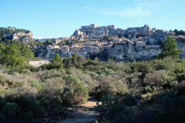
- Combine this hike with a walk around Lake Peirou, or walk elsewhere in Luberon such as in Buoux Gorge or around Les Baux de Provence.
- For more hikes, check out our France Hiking Page.
Rocher des Deux Trous Walking Route
From the car park at Glanum Archeological Ruins, turn left along the road then right down the lane towards the Monastery Saint-Paul de Mausole. Along this road, you can see paintings by van Gogh in front of the landscape that he actually painted in these pictures.

If you want to visit the Monastery Saint-Paul de Mausole, walk straight ahead into the monastery. To continue with the walk, head right and follow the lane as it bends around the monastery. This little lane continues through trees and passes Domaine De Métifiot, a posh winery surrounded by vines.
Just after the winery, keep left, then when the track bends left take a right. This shady lane heads uphill past some posh villas with olive groves, tennis courts and swimming pools. When the lane ends, this walk continues straight onward along a smaller track. The path leads through the trees with some glimpses of the impressive surrounding rocks. The track winds upwards and finally you reach the ridge at the top.
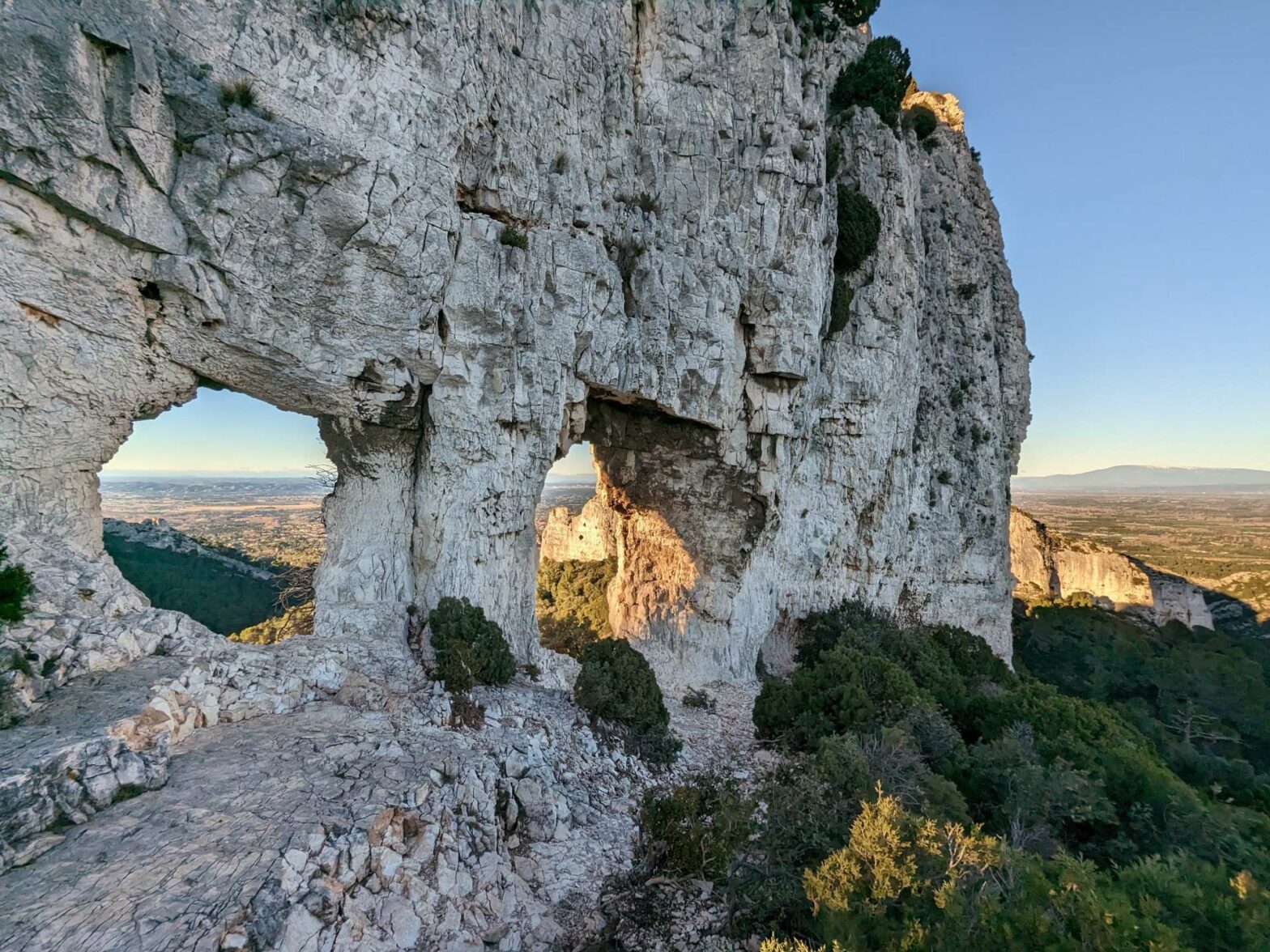
The Rocher des Deux Trous
There are great views from the top here. Turn right to keep on the track by the edge of the trees, and head to the right of the small hill. This track leads downwards to the Rocher des Deux Trous (Rock of the Two Holes). From the open area, there’s a small path that leads to the right of the large cliff-like rock. Walk along here to get to the holes in the rock.
After admiring the view, return along the little path. Take the smaller trail from the open area to head up the small hill in front of you. Again from the top here, there are some lovely views over the surrounding hills and countryside.
Head over the other side of the top and bend right. When you reach the quiet road, take the right along a track leading downhill through the forest. This route heads all the way back to the Monastery Saint-Paul de Mausole. On the way you’ll see a little chapel in the forest, a narrow rock passageway and the Glanum Ruins on your left.
At the monastery turn left and out to the road to return to your car. This is the end of the Rocher des Deux Trous Walk.
Guidebooks for Exploring & Hiking in Southern France


If you’re going to southern France, there are several guidebooks that cover either only Provence & Côte d’Azur (Avignon and east), or Languedoc-Roussillon (Nîmes/Montpellier and west). Because we explored both areas, we opted for Lonely Planet’s France Guide, which apart from including all of France was only slightly more expensive than an individual regional guide.
For other great hikes nearby, walk around Lake Peirou, through Buoux Gorge or around Les Baux de Provence. Alternatively, check out our France hiking page.
Related Posts