By Vicky · Published Apr. 9th, 2024 · Updated Apr. 21st, 2024
When you buy through links highlighted with an asterisk (*) on this site, we may earn a small affiliate commission at no cost to you.
Hike up to Hörnlehütte, a lovely mountain hut, then onward over the Hörnle Hills to Stierkopf Peak for great panoramas of the Alps.
Location
The walk up to Hörnlehütte and Stierkopf Peak starts from a large car park near the base of the Hörnlebahn cable car. Parking is €5 for up to 4 hours, or €7 for the entire day. You could complete this hike in under 4 hours, but you might be rushed. You can pay either in cash or using the EasyPark App, or scan the QR code on the signs to pay online outside of any app. It’s just over 1 hour’s drive from Munich. Alternatively, you can reach the car park in 2 hours from Munich on public transport.
Stierkopf Peak & Hörnlehütte Hiking Map
Tips
- The Hörnle Hut (Hörnlehütte) is normally open in summer and serves traditional Bavarian food and drink.
- If you want to shorten the hike, you can take the Hörnle Schwebebahn (Hörnle Cable Car) up to the Hörnlehütte. This means you skip about 450 metres climb, making the rest of the walk a very pleasant stroll. It’s €17/10 per adult/child both ways or €12/7 one-way.
- While in the area, hike up the more challenging Pürschling & Teufelstättkopf Peaks, walk through spectacular Partnachklamm Gorge or take a gentle stroll on the Badersee & Grainau Panorama Walk. Alternatively, find other great hikes on our Germany Hiking Page.
Stierkopf Peak & Hörnlehütte Walking Route

Head to the top of the car park and turn right along the hiking trail at the top. The route leads a short distance through some trees before heading across a field and into the tiny village of Sonnen. Turn left up the signed track in the middle of the village.
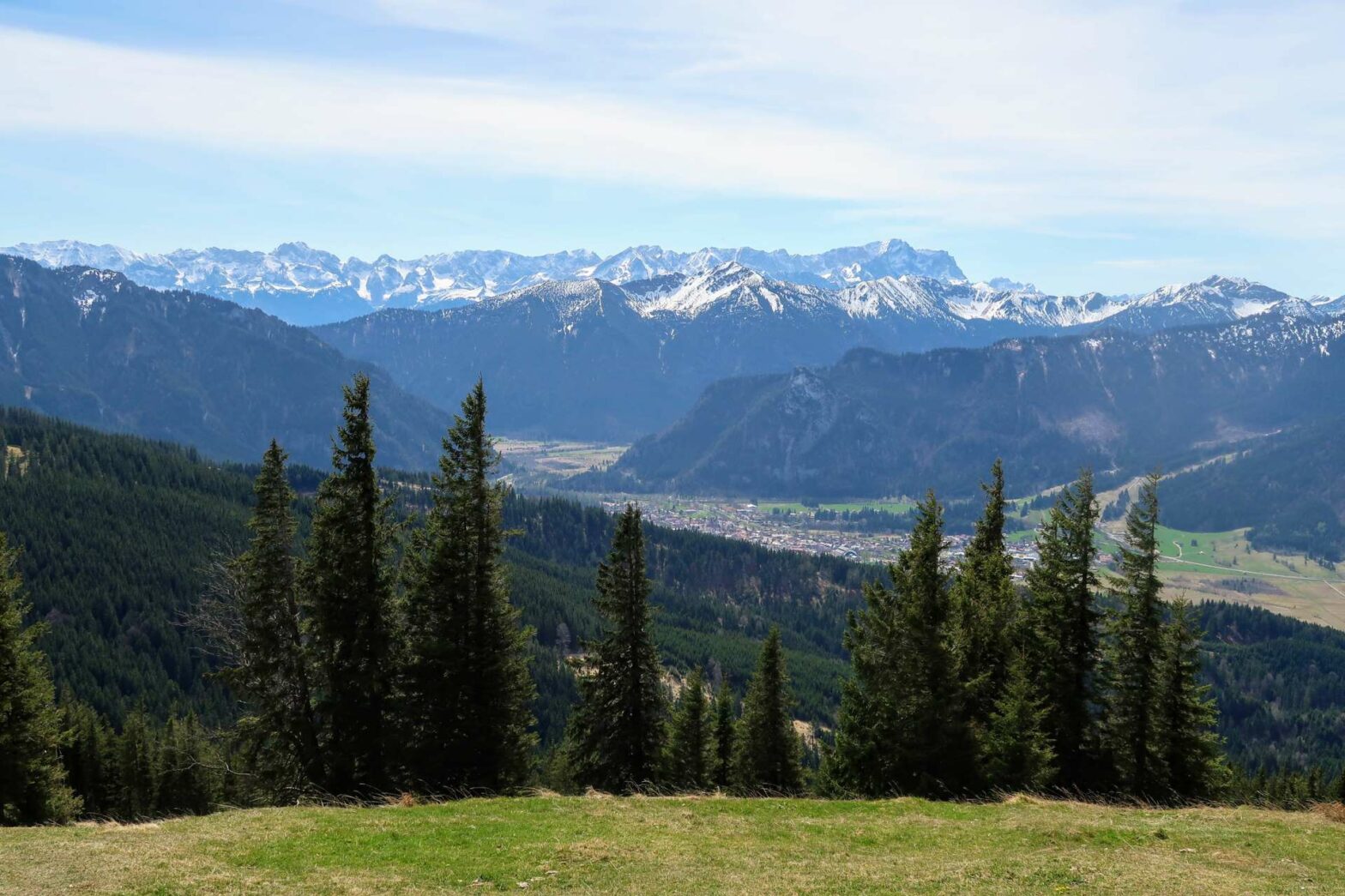
From here, the route to Hörnlehütte at the top is fairly simple. Keep walking up, sometimes quite steeply, along the track, following the hiking signs. You’ll pass through a mix of trees and open areas, and soon you’ll have the first views of the high Alps to the south.
At Hörnlehütte and the Top Plateau
After about 3 km and 450 metres uphill from the car park, you’ll be at Hörnlehütte and on the top plateau. There’s still some more uphill from here, but only short stretches. It’s very open so you have great views most of the time. Have a break at the hut, or continue to the viewing area, full of many benches.
The next part of the route leads through the open, gentle ridge and up the three Hörnle Peaks. These are Vorderes Hörnle, Mittleres Hörnle and Hinteres Hörnle (front, middle and back Hörnle). It’s worth going up these three peaks even though you could save uphill and walk around. They each have different views from the top and it’s very rewarding.
Stierkopf Peak
After Hinteres Hörnle, the highest of the peaks on this hike at 1548 metres, continue down and then slightly up again to Stierkopf Peak. There are lovely panoramas of the Alps from here, and Zugspitze, the highest mountain in Germany, can easily be seen.
From the top of Stierkopf Peak, begin by retracing your steps. This time, instead of hiking over Hinteres Hörnle you can walk around the easy flat track. On the other side of Hinteres Hörnle, before you get to the saddle this side of Mittleres Hörnle, take the track down to your right. This is signposted Hörnlebahn Talstation (Valley Station).
This easy track leads through a mix of forest near the beginning and open fields closer to the bottom. Unlike the way up, it’s not too steep but winds gradually downwards. Near the bottom, the path crosses underneath the Hörnlebahn. After this, take the first right. You’ll soon reach the car park and the end of the Stierkopf Peak & Hörnlehütte Hike.
Guidebooks for Hiking in the Alps


While in the area, hike up the more challenging Pürschling & Teufelstättkopf Peaks, walk through spectacular Partnachklamm Gorge or take a gentle stroll on the Badersee & Grainau Panorama Walk. Alternatively, find other great hikes on our Germany Hiking Page.
Related Posts


