By Vicky · Published Jul. 3rd, 2023 · Updated Aug. 13th, 2023
When you buy through links highlighted with an asterisk (*) on this site, we may earn a small affiliate commission at no cost to you.
The great, easy hike up and around the Col Quaternà Loop includes a peak with 360-degree views and is full of Alpine flowers.
Col Quaternà Loop Hiking Map
Get the route by downloading the .gpx or .kml file below. For navigation with Maps.me on your mobile phone, simply download the .kml file and open to add it to the Maps.me bookmarks.
Location
The Col Quaternà Loop starts from the car park at Malga Coltrondo, a mountain hut. It’s 15 minutes (6 kms drive) along a narrow road with a few potholes up from the main road southeast of Sexten.
Tips
- Most of this walk is very easy, along a wide track. The out-and-back to the top is a smaller path, slightly steep in places. Part of the route back is also a small path but with few difficulties.
- Malga Coltrondo where this hike starts serves food and drink, perfect for post-hike recovery. It’s open in summer from mid-June, 9am to 18.30 every day.
- For more walks and hikes, check out our Italy Hiking Page.
Col Quaternà Loop Hiking Route

From the car park at Malga Coltrondo, head along the flat track behind the building. Follow a zig-zag, heading upwards then slightly downwards, until the road reaches Rifugio Rinfreddo, another mountain hut with great views.
From here, head left to keep walking along the track, which then bends right and into the forest. After not too long, the track leaves the forest and you’ll reach a junction with a wooden table and many hiking signs.
Take the track left heading up towards Col Quaternà, which you should already be able to see far up above. When we hiked this route in early July, the mountainside was covered in Alpine Rose, a type of small rhododendron, which created a pink carpet on the slopes.
The track zigzags gently upwards towards the top ridge. Shortly before the saddle at the top, a path comes in from the right. Keep left along the track here and soon you’ll have reached the saddle itself.
Hiking to the top of Col Quaternà
From the saddle, there’s an out-and-back path leading to the top of Col Quaternà. It’s not too difficult, but in some places the path is slightly steep and leads across some scree. Hiking poles* are useful here, but not essential. Keep your eye on the painted red and white hiking signs to stay on the path.
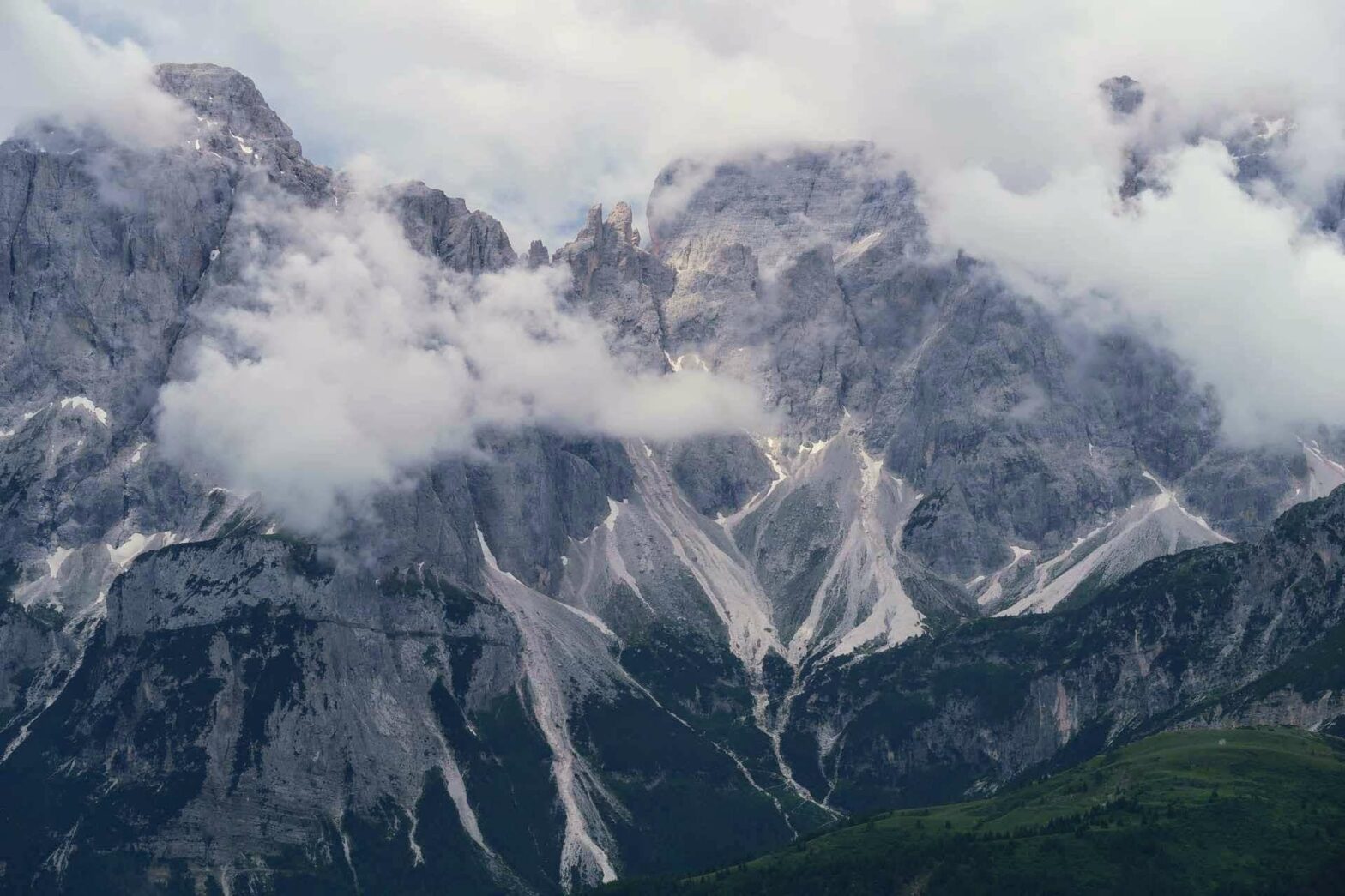
At Col Quaternà summit there’s a large cross and 360-degree views. It’s well worth the climb. Looking to the south you can see a long ridge of Dolomites across the valley, and to the north the ridge forms the border with Austria.
Walking back down Col Quaternà
Once you’ve admired the view, return back to the saddle. This time, hike onwards to the left, over to the other side of Col Quaternà. The slightly rocky trail heads downwards to another saddle which is a meeting point of several paths. From here, take the track to the left.
After several hundred metres you’ll reach another hiking sign. This points left along a path, signposted Malga Coltrondo. This path is a lovely walk through flowers and open forest. There are a couple of slightly steep ups and downs, and in one location you have to climb over a 1-metre-high cliff, but it’s not difficult. The alternative option is to continue down the main track, then take the track left back to the hut, though this option is longer and slightly less nice.
The path route contours across the hillside and then leads down through forested meadows until you meet a track. Turn left here and you’ll soon be back at Malga Coltrondo and the end of the Col Quaternà Loop Hike.
Guidebooks for Exploring the Dolomites


For more mountain hikes, check out our Italy Hiking Page.
Related Posts


