By Vicky · Published Jun. 16th, 2023 · Updated Aug. 13th, 2023
When you buy through links highlighted with an asterisk (*) on this site, we may earn a small affiliate commission at no cost to you.
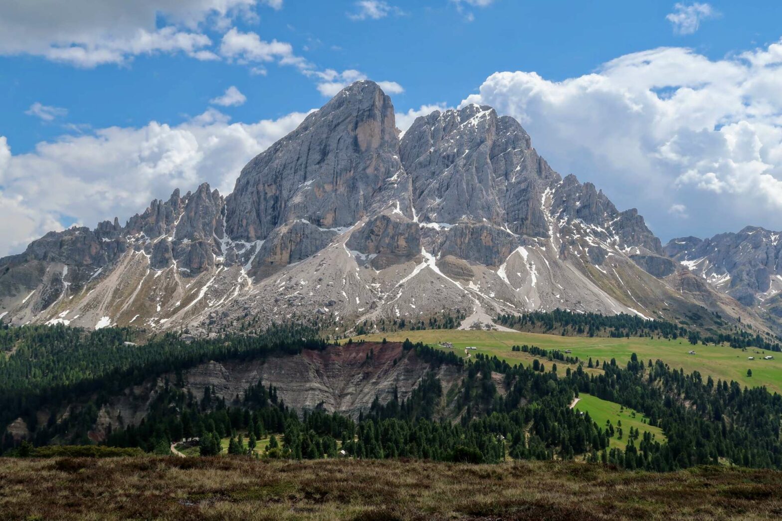
The loop hike from Würzjoch around Peitlerkofel (Sass de Putia in Italian) is one of the top hikes in the Dolomites, a must-do in the area.
Peitlerkofel Loop Hiking Map
Get the route by downloading the .gpx or .kml file below. For navigation with Maps.me on your mobile phone, simply download the .kml file and open to add it to the Maps.me bookmarks.
Location
The hike around Peitlerkofel starts from a car park in Würzjoch. This is a mountain pass, also known as Passo delle Erbe, at the northern edge of Puez-Odle Nature Park. In high season, you have to pay €5 per day to park here, and it still fills up very early. Aim to arrive before 9 am if possible!
Tips
- You can stay at a gorgeous lodge in Würzjoch* where this hike begins. It also makes a great base for exploring other areas!
- Peitlerkofel is known as Sass de Putia in Italian, which could be translated as something like ‘Chisel Head’ in English.
- There are several cute mountain huts serving food and drink around the Peilterkofel loop and at Würzjoch where this hike starts. On the loop, the huts are open from late May/mid-June to roughly mid-October.
- If you’re feeling full of energy and have some surefootedness, you can take the out-and-back trail up to Kleiner Peitlerkofel (2831 m). See the box below for details.
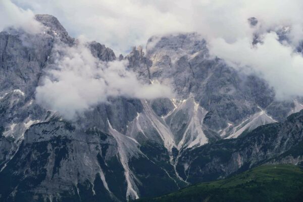
- We walked the Peitlerkofel Loop Hike in early June, when just a couple of small snow patches lay in the gully on the way up to the first ridgeline.
- For more hikes, check out our Italy Hiking Page.
Peitlerkofel Loop Hiking Route

Take the wide path leaving the far end of the smaller car park behind the information signs and just to the right of Ütia Ćir, a mountain restaurant (open year-round, closed Mondays). You can see that some people have made small detours to the left for views of Peitlerkofel. However, hardly any distance further the path itself reaches a great viewpoint with a very scenic bench.
The path also joins the main track here. Turn left to walk up the track as it winds upwards, bringing more splendid views of the rocky Peitlerkofel range. After about 1 km from the car park, you’ll reach a junction, with Munt de Fornella (another mountain hut serving delicious food – open end-May to mid-October) just to your left.
Starting the Peitlerkofel Loop
At this junction you have to decide which way around to walk the loop around Peitlerkofel. We chose to hike anticlockwise, so heading right, to get the most difficult section out of the way near the beginning. If you’re attempting to hike up Kleiner Peitlerkofel (see box below), this way is definitely recommended since it’s shorter to the top. The hiking route around the mountain is signed ‘Roda de Putia’, which means Loop of Putia (the Italian name for Peitlerkofel).
At first, the walk heads along a wide track, with glorious views in front and to your left. As you round the corner, the track becomes a smaller path and starts heading upwards. The path follows across a fairly steep, scree slope, so you have to watch your footing here, and it’s not for those who are very afraid of heights. That said, there isn’t much difficulty, you just have to be sure-footed.
After crossing the rocky slopes, the path bends further around the corner and into a narrow valley. Now the climb really starts as you hike up by a stream, aiming for the saddle at the top. We walked around Peitlerkofel in early June, and there were still a few patches of snow to cross in this gully. They were not very steep, and there were many footprints before us, so it wasn’t scary.
Several little zigzags later, and you’ll reach the saddle, and several benches with glorious views of the other side. This is also where the out-and-back path to the top of Peitlerkofel leads off from.
Hiking up Peitlerkofel Summit
If you’re feeling full of energy and have some surefootedness, you can take the out-and-back trail up to Kleiner Peitlerkofel (2831 m), the lower summit of Peitlerkofel itself. This route has no real difficulty, while the main summit has a via ferrata near the top. This will add an extra 4km and 400 m climb to the route.
There are two summits at the top of the mountain – Kleiner Peitlerkofel and main Peitlerkofel itself. As the name suggests, the first is lower, however it is a lot easy to reach than the main peak. Kleiner Peitlerkofel is just walking up a path, while main Peitlerkofel involves a via ferrata.
Walking up Kleiner Peitlerkofel (2831 m)
The walk up to Kleiner Peitlerkofel summit is not that difficult, with a grading of T2 (Mountain hiking). There is a footpath all the way, and all you need is some surefootedness and a head for heights. This extension will add an extra 4 km and 400 m climb to the Peitlerkofel Loop hike, so the total will be 17 km and 1000 m climb.
Via Ferrata up Main Peitlerkofel (2875 m)
Attempting the main Peitlerkofel summit is not recommended except for those with mountaineering experience. This includes having the correct knowledge and equipment for using a Via Ferrata. That being said, it’s not a difficult via ferrata, basically just a cable to hold for the last few hundred metres.
Walking around the far side of Peitlerkofel
When you’re ready to move on from the saddle, follow the nice path straight ahead leading downwards into the valley. There are lovely views from here of grassy meadows dotted with barns – you’ll be walking here later.
From now on the path is wide, or a gravel track, apart from a small section of easy narrower path near the end. You wind your way down to the grassy meadows, with Peitlerkofel peak looming above on the left-hand side.
As you continue along the track, make sure to keep looking backwards for great views of the valley you just walked down, plus over to the mountains on the left. These include the distinctive Forchetta (trident), over 3000 metres high with three semi-distinct blobs at the top, hence its name.
Soon you’ll reach some downhill, followed by a small amount of uphill again. This leads you to a new grassy area with several huts. One of these is the Utia Vaciara hut (open mid-June to mid-October), which serves basic food and drink. It’s a great place to stop for a refreshing apfelschorle. The route continues around the valley and gradually up to the ridgeline, here less dramatic than the ridge earlier. At the saddle you’ll find some information boards labelling the surrounding mountains, and a great view.
The Final Stretch
After relaxing here, it’s almost all downhill until the end of the hike. The path leads down through lovely woodland, then along through a magical area of large boulders. These have fallen down from Peitlerkofel peak above. You then leave the forest to reach some meadows. Here you can find Ütia de Göma hut, which also offers food and drink.
From here it’s not far now, with just a small down and up through a forest before you reach the meadows again. And in no time, you’re back at Munt de Fornella hut. Highly recommended here are the spinatknodel – three different varieties of spinach and cheese dumplings. For desert, try kaiserschmarrn – a bit like scrambled fluffy pancakes and enough for at least two people! From here, it’s a quick 20 minutes back to the car park along the track, and the end of the Peitlerkofel Loop Hike.
Peitlerkofel Loop Hike Short Extension
If you still have energy, it’s worthwhile to head up the little hill on the other side of the road. From the top there are even more views of Peitlerkofel and the surrounding mountains.
It takes about 20 minutes to walk to the top along an easy route, and there’s a great table at the top to sit at. It’s also much quieter than the other side. If you’re staying at Ütia De Börz Lodge*, the short walk to this viewpoint is an excellent early morning walk before breakfast to see the morning light hit the mountain.
Guidebooks for Exploring the Dolomites


For more mountain hikes, check out our Germany Hiking Page or Italy Hiking Page.
Related Posts