By Vicky · Published Aug. 21st, 2023 · Updated Aug. 22nd, 2023
When you buy through links highlighted with an asterisk (*) on this site, we may earn a small affiliate commission at no cost to you.
Meinweg National Park, at the border of the Netherlands and Germany, is a lovely wild area with some great walks.
Meinweg National Park Map
Get the route by downloading the .gpx or .kml file below. For navigation with Maps.me on your mobile phone, simply download the .kml file and open to add it to the Maps.me bookmarks.
Location
This walk through the national park starts at the Wandel Parkeerplaats (Hiking Car Park). It’s near the popular Venhof Cafe, where you can grab a bite after the hike. Alternatively, you can stay overnight (glamping and chalets) at Huttopia de Meinweg* and start the walk directly from the campsite.
Tips for Meinweg National Park Walk
- Most of this walk is on slightly sandy trails through open areas. Bring a sunhat if it’s sunny.
- The app Maps.Me is very useful for this hike because there are many path choices.
- For a shorter hike, take the shortcut – this walk is 11 km and you still see the best parts of Meinweg National Park.
- For another hike in a lovely wilderness area of the Netherlands, check out our Loonse and Drunense Dunes National Park Hike.
- Find other walks and hikes on our Netherlands Hiking Page.
Meinweg National Park Walking Route

From the car park, walk down the road and left. At the next road junction, turn right, then take the first track on the left into the forest. The first section of this walk takes you through a mix of forest and open fields.
After passing close to a golf course, the trail heats through a large section of woodland, around a loop and to the German border. On the other side of the border, you walk around a more open area and slightly uphill into the forest before returning back to the border.
Look out for small trenches in the woodland here, now partly filled in. These were part of a German defensive system of trenches. Many were situated near the water, so the German troops could look out over the lakes and see if any enemy troops were coming.
Just by the trenches at the border, you can see Melickerven Lake. This is a lovely place for a sit-down and a rest. When you’re ready, continue along the trail, which leaves the forest into some fields, and then bends left.
Explore more of the Netherlands on our other walking tours
- Delft Walking Tour – near Rotterdam
- Leiden Walking Tour – not far from Amsterdam
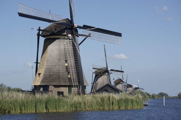
- Kinderdijk Windmills Walk – near Rotterdam
- Amsterdam Walking Tour – Amsterdam
- Wassenaar Dunes Hike – not far from The Hague
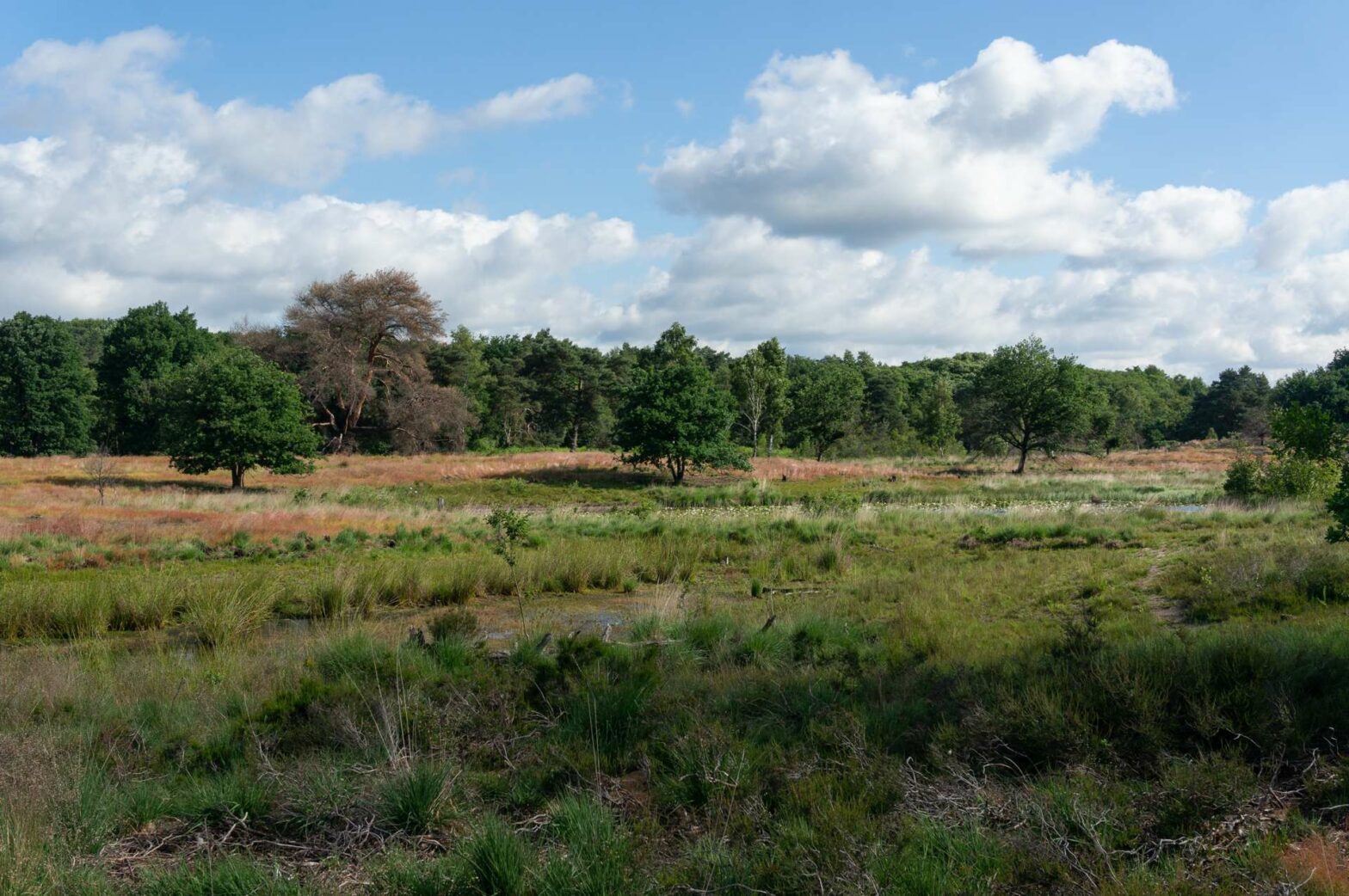
The Dunes & Moorland of Meinweg National Park
This next section is one of the most beautiful areas of Meinweg National Park. The trail leads through a large open area covered with sand and moorland plants such as heather. At the far end of the park, there are also some more watery areas within the open land.
The route returns via a mix of open areas and forest, with some boardwalks, small paths, and larger tracks. Soon you’ll leave the main park area and pass the boundary of the Huttopia de Meinweg holiday park. Turning right shortly after this, you’ll return to the car park and the end of the Meinweg National Park Walk.
Guidebooks to explore more of the Netherlands


Check out the nearby Brunssummerheide Walk, or discover our Netherlands Hiking Guide for more great walks in the Netherlands.
Related Posts