By Vicky · Published Sep. 15th, 2023 · Updated Sep. 18th, 2023
When you buy through links highlighted with an asterisk (*) on this site, we may earn a small affiliate commission at no cost to you.
This circular walk from Seathwaite heads up Scafell Pike before returning via a glorious ridge walk between Allen Crags and Glaramara.
Location
This walk starts from Seathwaite Car Park. Parking costs £5 for the day, or there’s limited free parking along a small country lane that leads to Seathwaite Farm. The earlier you arrive, the closer you’ll be able to park to the farm itself. If you’re coming by public transport, there’s a bus from Keswick to Seatoller Car Park. From here you can start the walk from the northern end.
Scafell Pike Walking Trail Map
Get the route by downloading the .gpx or .kml file below. For navigation with Maps.me on your mobile phone, simply download the .kml file and open to add it to the Maps.me bookmarks.
Tips
- There are toilets at Seathwaite Farm where this walk starts.
- The weather can change very quickly in the mountains, so take a waterproof jacket and warm clothing even if when you set off it’s warm and sunny.
- It’s a long walk with a lot of up and down so wear decent hiking books. Hiking poles* can also be very useful to save your knees.
- Take enough food and water for the day.
- It’s useful to have a paper map for this walk – you’ll need the Ordnance Survey Explorer OL6 of The English Lakes: South-West*.
- This walk describes the ‘Corridor Route’ up Scafell Pike, perhaps the most scenic way up, and a longer descent along a broad ridgeline. A shortcut on the way down is also suggested.
- There are no technical difficulties on the walk up Scafell Pike, but you do need a reasonable level of fitness. If the clouds and mist come down, navigation can be difficult so some map reading skills are needed.
- There are a couple of small lakes you can swim in along the route, though the water is always cold, even in summer.
- For other great walks in the Lake District, check out Walla Crag, the Fairfield Horseshoe, or our UK Hiking Page.
Scafell Pike Walking Route
From your car, head towards Seathwaite Farm. If you need to, go to the toilet here as there are no opportunities later on. Head through the farm area and out the other side onto the main track.
Corridor Route from Seathwaite
The track ascends gradually alongside a small stream. About 1 km later you’ll see another smaller valley leading off to the right. A few hundred metres later, the track bends left across a stream. From here, take the path heading straight on up the valley to the right, don’t turn left.
The path now heads up more steeply and there are a few wiggles as you make your way up the hillside. Soon you’ll be in the centre of the next valley and again the path continues upwards alongside a stream.
Towards the top of the valley you’ll pass a lake. You can swim here if you like, but it will be very cold! At the next junction, turn left, and 300 metres later take a right to contour along the mountainside.
The path gets steeper and eventually you come to the top of a stream and a slightly flatter area where the path bends right. Continue straight along the main trail, ignoring the path off to the left. In about half a kilometre you’ll reach another main trail. Turn left on the path here, towards the top of Scafell Pike.
Now the path heads directly upwards and there are no more route choices. In less than 1 km, but with still about 200 metres of climb to go, you’re almost there. It’s one final push and then you’re at the top.
At the top of Scafell Pike
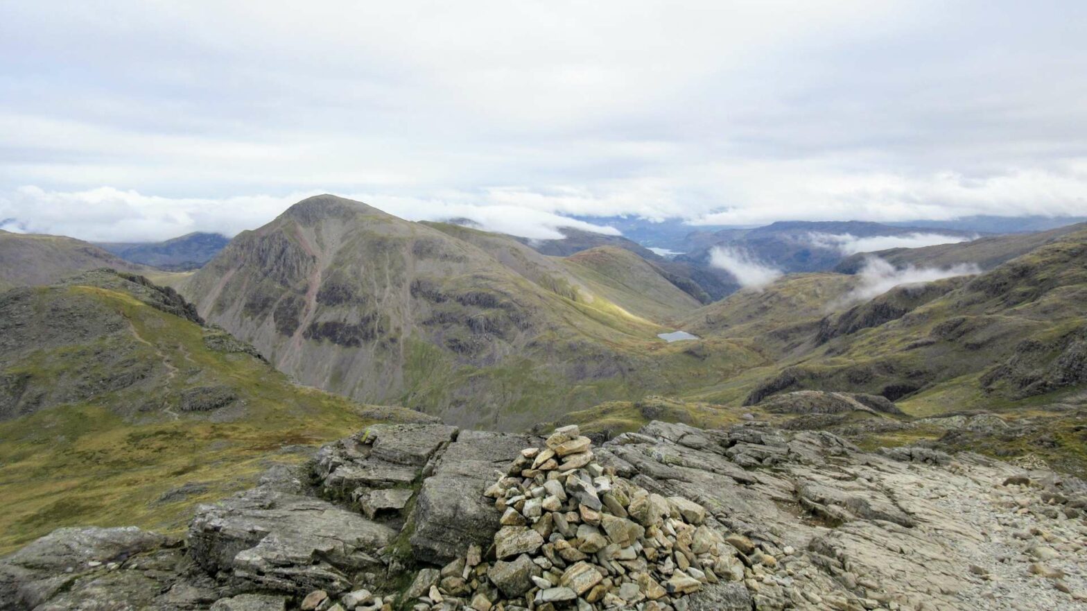
Scafell Pike is the tallest mountain in England, at 978 m high. From here there are superb views of the Lake District on a clear day. It’s quite rocky at the top, so watch your footing. Hiking poles can be useful here. You’ll find a very large cairn, the trig point, and probably a few other people on the summit.
Once you’ve had a break and enjoyed the view, it’s time to start the descent. Head onwards, leaving the summit of Scafell Pike in a northeasterly direction. Especially if it’s misty at the top, make sure to orient yourself and be certain that you are heading down the way you think you are.
The Descent from Scafell Pike
After the initial descent, you’ll arrive at a col, or small saddle between peaks. From here, head straight on up the small ascent towards the next peak. You’ll pass Broad Cairn on your left, and then Ill Crag on your right.
When the path descends again, keep right along the main track to reach another col, or saddle between two peaks. If you want a shortcut from here, read the box below. If not, then head straight onward up the minor hill in front of you to the top of Allen Crags.
Quickest Route down from Scafell Pike
If you’re feeling tired or the weather is poor, the quickest and easiest route down off Scafell Pike and back to Seathwaite heads off to the left here. The fairly large trail follows a stream, then bends right into a larger valley and gently descends all the way back to Seathwaite Farm.
From the saddle where this shortcut deviates from the main route described, it’s 4.5 km with no uphill back to the car. If you take the longer route described here over Glaramara Ridge, it’s 9 km with almost 200 metres of uphill back to the car.
Ridge from Allen Crags to Glaramara Peak
Between Allen Crags and Glaramara Peak there’s a lovely, broad, undulated ridge walk. It’s an easy path, though slightly smaller and less busy than the ones used so far on this walk. There’s also lots of boggy ground, mainly off the path but you may end up walking through some water, so waterproof hiking boots are a good idea.
The largest pond, or tarn, you’ll pass is High House Tarn, about 1 km after Allen Crags on your right. After this, there’s a small ascent to Red Beck Top before a down and up again to Glaramara Peak itself.
From the top of Glaramara, the walk is basically all downhill. The path continues northward along a broad ridge that descends towards the towns of Seatoller and Borrowdale. Near the end of the ridge, the path turns right into a small valley. You’ll pass a few trees and bend slightly left and over the hill.
Follow the main track as it bends sharply left and reaches a minor road. The route now continues in a fairly straight line along the valley and back to Seathwaite without many choices of path. After a couple of kilometers, you’ll reach the farm, turn right and find your car. This is the end of the Scafell Pike & Glaramara Ridge Walk.
Hotels near Scafell Pike
There are a few lovely hotels and hostels near the start of the Scafell Pike hike, which make a convenient and relaxing base for hill walking in the Lake District.
Youth Hostels are great places to stay, as they’re specially designed for hill walkers and are good value. You can cook your own food in the shared kitchen and they all have drying rooms for wet boots! You can often choose between staying in a dormitory or in a smaller room for two. There are several Youth Hostels near Scafell Pike:
- YHA Borrowdale* is in a gorgeous location less than 10 minutes drive from the start of the Scafell Pike Walk. There are great common areas and nice outdoor seating.
- YHA Buttermere* is another hostel in a great location between two lakes, 20 minutes drive from the start of this walk.
- YHA Keswick* is also about 20 minutes drive from the start of the walk. It’s located in the middle of the bustling town of Keswick, rather than the countryside like the other two.
If you’re looking for more luxury, Glaramara Hotel* has the perfect location in Borrowdale just a couple of minutes drive from the start of the Scafell Pike walk.
Walking Guides to the Lake District
For other great walks in the Lake District, check out Walla Crag, the Fairfield Horseshoe, or our UK Hiking Page.
FAQS: Scafell Pike & Glaramara Walk
There are a few different walking routes to the top of Scafell Pike, so how long it takes to hike up depends on what route you choose and how fast you walk. From Seathwaite it’s 7.5km with 850 m of climb and takes 2.5-4 hours. From Wasdale it’s only 4 km but with similar climb, and takes roughly 1.5-3 hours.
The walk up Scafell Pike has at least 850 metres of uphill with a distance of 10 km or more. This means it’s not suitable for beginners who don’t have much experience walking in the mountains. While there is no technical difficulty, the length of the walk means you need at least a decent level of fitness. Map-reading skills are also important.


