By Vicky · Published Apr. 21st, 2023 · Updated Apr. 3rd, 2024
When you buy through links highlighted with an asterisk (*) on this site, we may earn a small affiliate commission at no cost to you.
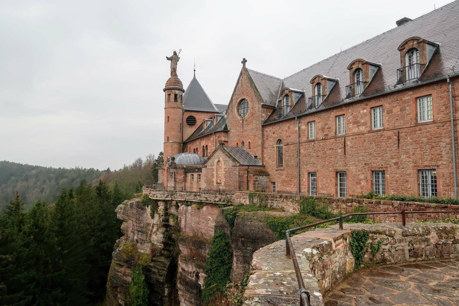
This fun hike starts at Mont St Odile with great views over Alsace, then leads via the Pagan Wall path to two ruined castles.
Get the route by downloading the .gpx or .kml file below. For navigation with Maps.me on your mobile phone, simply download the .kml file and open to add it to the Maps.me bookmarks.
Location
This hike starts from the car park at Mont St Odile. The route starts from parking P1, though if this is full there are several other car parks slightly further down the road.
Tips for Mont St Odile Hike
- You can stay in the monastery* – a great base for starting a hike in the area and not too expensive.
- If you don’t want to walk so far, you can halve the distance to around 3.5km if you miss out the loop to Château du Hagelschloss.
- There’s a cafe/restaurant at the monastery for refreshments, but nothing else on the route.
- Be careful at the castle ruins, the stones can get slippery when wet.
- For more hikes, check out our France Hiking Page.
Mont St Odile Hiking Route

From the car park, this hike first leads into Mont St Odile, an old monastery on the top of the hill. There are great views from the monastery, and you can also explore the little chapels inside. If you want an audio guide, you can rent one from the small shop on the right when you enter the first courtyard.
Once you’ve looked around the monastery, return towards the car park and take a right once you’ve left the complex, down towards a road. Cross over the road and take the steps leading down into the woods by an information board. This walk mainly follows the Mur Païen, or Pagan Wall trail.
Mur Païen
The Mur Païen is an enigmatic wall from the late 7th century. It’s 11 km long in total, encircling the top plateau of Mont St Odile, and made up of very large stone blocks. In places, it’s almost entirely disappeared, but elsewhere it still reaches its original 3 metres height. Nobody really knows why it was built, but think it could be for either defensive or religious purposes.
At most junctions there are signs pointing out the direction of the Mur Païen route, so look out for these. At the very first junction, just below the road, the road takes a right, continuing downwards. You’ll get your first glimpse of the Pagan Wall and follow it along the wooded hillside.
The trail passes a little valley to reach another path, but head straight across up through the cliffs. Turn right at the top to a viewpoint on top of a large rock. Continue onwards and you’ll soon meet a junction with many signs and ways. You’ll return here later, so if you want to shorten the route, you could now head straight to Château de Dreistein.
To continue with the main walking route, take the path to the right leading onwards. It takes you along beneath a large cliff face, which in this location partly replaces the Mur Païen. After a lovely walk along the trail by the rocks, take the path heading sharply left and up a gap in the cliffs. Cross over a main track through the forest and follow the path as it begins the descent towards Château du Hagelschloss.
Château du Hagelschloss
Soon you’ll come to a path junction in a little flat area. The Château du Hagelschloss is to the right from here. Not much remains of this castle, apart from a section of wall and a mysterious bridge. To see these, walk along the little path that circles the second small rocky plateau. The best views of the bridge are from the far backside.
Continue around the rocky plateau and back up to return to the path junction. Now continue following the signs for the Mur Païen route. This walk now contours, heading slightly upwards, through the lovely woodland. After about 1km, look out for the Porte Koeberle on your right. This is a little gate or gap in the wall on the right-hand side.
Château du Dreistein
Head onwards, bending round to the right. This hike now deviates from the Mur Païen route to visit Château de Dreistein, a much more impressive castle. Take the track to the right, then the smaller path down to your right, signposted towards the castle. Soon you’ll reach the castle, or rather three castles on three separate rocks, hence the name ‘Dreistein’, which means three stones in German.
Only two of the ruined castles are obvious. First loop around the far castle, which is the most complete. Be careful if you go inside since the rocks can be slippery and the walls are not maintained. There are some great views over the Alsatian forest from here, and of the other castle. Continue to the next castle, then walk around this back to where you started.
Return uphill on the same route you came down on. Once you return to the same junction, continue straight across to the larger junction with many signs you saw near the beginning of this hike.
Turn right here, and then left up through a field to return to Mont St Odile. The climb goes back quickly and soon you’ll be back at the car park and the end of the Mont St Odile Hike.
Guidebooks & Maps for Exploring Alsace


For other nearby hikes, see our France Hiking Page.
Related Posts


