By Vicky · Published Nov. 16th, 2022 · Updated Aug. 13th, 2023
When you buy through links highlighted with an asterisk (*) on this site, we may earn a small affiliate commission at no cost to you.
The hike up Monte Sagro takes you high into the Apuan Alps, with amazing views over the mountains and beyond for relatively little effort.
Monte Sagro Hike Route Map
Get the route by downloading the .gpx or .kml file below. For navigation with Maps.me on your mobile phone, simply download the .kml file and open to add it to the Maps.me bookmarks.
Location
This hike starts from the Belvedere Campocecina Car Park, above the main Carrara Quarries. It’s a 45-minute drive from the centre of Carrara, with a narrow windy road leading to the top.

Tips
- Bring sunglasses and a sunhat, but also a woolly hat, gloves, and rainjacket as the weather can be very variable, and much colder at the top of Monte Sagro (1753 m high).
- Bring enough water and snacks. though there’s a Restaurant at the Rifugio near the end of the hike.
- You can shorten the hike by driving along a gravel track to a car park closer to the mountain, but you’ll miss out on some views of the quarries and countryside.
- We used the 4LAND Alpi Apuane 1:25,000 hiking map* for this hike. It covers the main section of the Apuan Alps and can be found in most bookshops in Lucca or Carrara.
- Offline maps app Maps.me works well for this walk.
- For other walks in the Apuan Alps, try hiking up Pania della Croce or Monte Tambura.
- Find other nearby hikes on our Italy Hiking Page.
After admiring the views from the car park, which are already pretty great, turn right along the road past the marble sculpture. It’s pretty flat, easy walking and the road is very quiet. To your left you can see the largest of the Cararra Marble quarries. They dominate the hillside and are both ugly and beautiful at the same time.
After about one kilometre, the road becomes a dirt track. Five hundred metres further you’ll reach a junction of tracks and a little car park. You can shorten the hike by about 4 km and reduce the amount of climb by roughly 200 metres if you start here, but you miss out on views of the quarries and a nice walk back through woodland and meadows.
Continuing from the far car park
Head right at the track junction and take the small path on the left at the edge of the car park. This leads to a little ridge. From here you can easily see the top of Monte Sagro, the large grassy mountain in front of you. Just to the left, you can see a small, very white marble quarry. Turn right to walk along the top of the ridge until you reach a path junction where the ridge ends.
We turned left here to walk the loop in a clockwise direction. We chose to hike up Monte Sagro this way round so that the ascent would be steep and the descent more gradual. It also meant we had great views of the ocean when walking downwards.
The path heads around the corner above the quarry and into a valley. Keep an eye on the route here as it’s easy to be distracted by the beautiful valley and continue into it. There initially seems to be a trail, but this is only an animal track. The correct hiking route turns slightly downwards and left to keep walking around the edge of the quarry.
Now the real climb begins. The path starts steep and gets steeper, but there’s no technical difficulty. Just keep on hiking upwards towards the top of Monte Sagro, which gradually gets closer. As you start hiking up a broad ridge, you get your first views of the cool mountains beyond, and the views only become better.
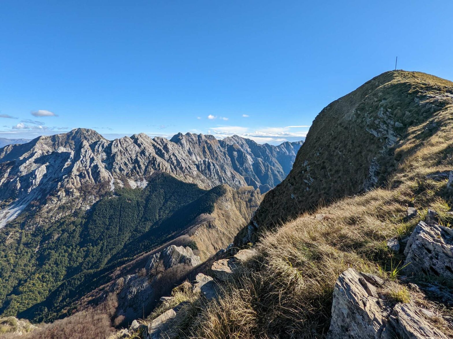
Hiking the final stretch to the top of Monte Sagro
There’s a junction near the top, with the route back down contouring right across the hillside. For now, head straight upwards. Soon you’ll be at the top of Monte Sagro, where there’s a cross and a circular map labelling mountains in the distance. We were very lucky when we were there as it was super clear. We could see all the way to the snowy Alps in the northwest, across to Corsica in the southwest, and even through a gap in the Apennines to the Julian Alps in the northeast.
Hike a little further along the ridge and past the cross. From here, you get even better views of the nearby Apuan Alps. The mountains are very rocky and steep near the top, though become more gentle as they turn into forested foothills leading down to the Mediterranean.
Walking back down Monte Sagro
When you’ve spent enough time admiring the view, head back down to the first path junction. Turn left to continue the loop, following the path as it gently descends across the grassy hillside. There are some really beautifully shaped grassy mounds and rocky knolls, and still great views over to the ocean and Apuan Alps.
Continue following the path as it bends the corner and descends to reach the same ridgeline path near the far car park. This time, walk along the path and instead of going back down to the car park, continue along the ridge. Soon the path crosses the other track and ascends gently on the other side.
You head into woodland and walk along the easy path. There are good views back to Monte Sagro and the mountains beyond. Soon you’ll reach a beautiful meadow, and shortly after that you pass back into the wood and arrive at Rifugio Carrara. This mountain hut has accommodation for hikers and also offers a restaurant, with the outdoor tables having very picturesque views.
Bend sharply left at the Rifugio and the path leads down to a little road. The car park, and the end of the Monte Sagro hike, is just to your left. Take a final look at the views before driving back down the small road to Carrara, the cute hilltop village of Fosdinovo, or beyond.
Guidebooks to explore more of Tuscany & the Apuan Alps


The Cicerone Walking in Tuscany Guidebook* describes three hikes in the southern end of the Apuan Alps, while their Walking in Cinque Terre Guidebook* has some great hikes at the coast nearby. The Lonely Planet Florence & Tuscany Guidebook* has a short section on the Apuan Alps focussed around Carrara.
For other walks in the Apuan Alps, try hiking up Pania della Croce or Monte Tambura. Additionally, check out our other walks nearby in Italy.
Related Posts


