By Vicky · Published Jul. 14th, 2023 · Updated Apr. 3rd, 2024
When you buy through links highlighted with an asterisk (*) on this site, we may earn a small affiliate commission at no cost to you.
The hike through Tanet-Gazon du Faing Nature Reserve and past the lakes below is a refreshing walk with varied vegetation and great views.
Get the route by downloading the .gpx or .kml file below. For navigation with Maps.me on your mobile phone, simply download the .kml file and open to add it to the Maps.me bookmarks.
Location
The Tanet-Gazon du Faing Lakes Hike starts from the car park at the Station du Lac Blanc. There’s free parking and it’s 40 minutes in the car west of Colmar, a lovely drive with beautiful views.
Tips for Tanet-Gazon du Faing Walk
- You can swim in the lakes if it’s warm enough!
- There’s a small mountain hut on the route, Chalet Erichson, just uphill past the first lake. It’s open every day except Fridays May-Aug, and on weekends Sep-Oct.
- There’s another restaurant at the start of the hike (L’auberge des Crêtes), at the second-last lake (Auberge du Lac Noir), and also by the last lake (le Mille Mètres).
- For more hikes, check out our France Hiking Page.
Tanet-Gazon du Faing Hiking Tour

From the car park, head along the track to the left of the restaurant and into the forest. There are quite a few tracks and paths here, and open areas cut through the forest to make skiing routes. Keep left and follow the track about 200 metres into the open grassland. Turn right just before the forest and follow the trees to the end of the open area.
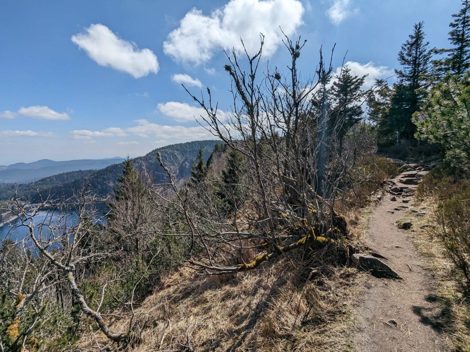
Continue straight onwards back into the trees, and take the most left path to reach the edge of the cliffs. From this path there are great views over Lac Blanc far below, with its surrounding steep cliffs and vegetation. Follow the path until the corner when it makes a sharp bend left. Instead of turning left, take the path to the right which will bring you back to the main track.
Tanet-Gazon du Faing Nature Reserve
Once you reach the track you’ll be on the edge of a large open moorland area. This is the Réserve Naturelle de Tanet-Gazon du Faing and it’s a great hiking area. Turn left on the track and continue straight onwards until you reach a large junction just before the cliffs.
Turn right at the junction, then keep left to follow the smaller paths along the tops of the cliffs for the best views. From here you’ll be able to see another, smaller lake, Lac des Truits (Trout Lake). Later on the hike you’ll walk right past this much lower down. For now, continue along the path and keep admiring the views.
Keep following the leftmost path until you pass an indistinct summit, Ringbuhlkopf, which will be on your right. After this, contour around the spur and follow the path as it bends left and begins the descent towards the edge of the trees.
The Descent to the Lakes
At the next junction, and before the road, take the path left to head steeply downwards. The hiking trail crosses a larger track a few times as they both wind their way down the hillside. Eventually, you’ll also be on a track. Follow it downwards to Lac Vert.
At the junction by the lake you can head to the water’s edge, and perhaps have a swim if it’s warm enough. After enjoying the views, or perhaps a refreshing dip, return to the junction and take the trail opposite, which bends left.
This trail soon leads into an open area. Now there’s a short section of quite steep uphill. Look forward to reaching Chalet Erichson at the top, where you can buy a cool drink. After the Chalet, the path leads right and still slightly upwards. At the next corner, take the path that contours straight onward along the slope and through small areas of open.
Lac des Truites, Lac Noir and Lac Blanc
Soon you’ll notice a decent and you’ll come out at Lac des Truites, the lake you saw earlier on the hike from the top of the cliffs. Cross the dam and keep left along the path through the forest. Head straight across the next junction and soon you’ll zigzag down again to another lake, Lac Noir. This lake is hidden from the top of the Tanet-Gazon du Faing reserve, so you haven’t seen it previously on the hike.
Head across the car park by the lake and take the path up into the forest. There’s a short uphill followed by a final section of contouring around the wooded hillside. Eventually the path comes out at the final lake, Lac Blanc. From here, the trail leads off to the left after the car park and parallels the road.
After reaching the end of Lac Blanc, the path heads upwards to the right and back to the top. Soon you’ll be back at the car park and the end of the Tanet-Gazon du Faing Lakes Hike.
Guidebooks & Maps for Exploring Alsace


For other nearby hikes, see our France Hiking Page.
Related Posts