By Vicky · Published Jun. 24th, 2023 · Updated Jun. 27th, 2023
When you buy through links highlighted with an asterisk (*) on this site, we may earn a small affiliate commission at no cost to you.
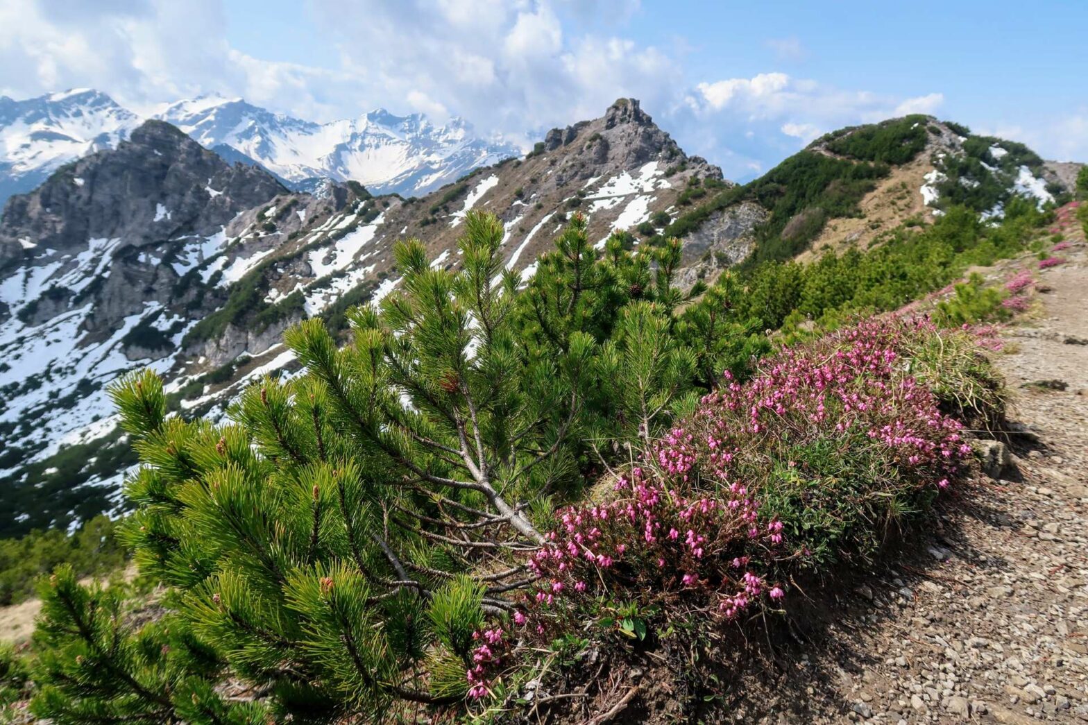
The hike up Schönberg Peak from Malbun is one of the most beautiful hikes in Liechtenstein, with dramatic views and gorgeous wildflowers.
Schönberg Peak Hiking Map
Get the route by downloading the .gpx or .kml file below. For navigation with Maps.me on your mobile phone, simply download the .kml file and open to add it to the Maps.me bookmarks.
Location
The Schönberg Peak hike starts from any of several car parks in Malbun, a cute village in a remote valley of Liechtenstein. There are several car parks on the way into the village, first on your right, then a small one on your left. These car parks are free and it doesn’t matter which one you choose. Alternatively, you can take the bus to Malbun Jöraboda bus stop.
Tips
- It’s very convenient to stay in Malbun, the village where this hike starts. Hotel Falknerei Galina* is one of the most popular and best-value hotels in town.
- There are no refreshments on this walk, only in Malbun at the start/end of this hike.
- For more hikes nearby, try Rappenstein Peak or Kuhgrat Peak, or check out our Liechtenstein Hiking Page.
Schönberg Peak Hiking Route
Whichever car park you find space in, walk upwards to Malbun Centre Tourist Information. Head past here and left at the hiking signs (signpost Schönberg). The track leads through the playground, then take a left to cross the small river.
Forscherweg (Explorer Path) Malbun

The first part of the Schönberg Peak Hiking Route follows the Forscherweg, or Explorer Path. This is a fun 1.5km one-way trail for children (and adults). You can spot animals hidden in the trees along the route, there are several benches, and it ends by a lake with a viewpoint and telescope.
Route finding on the Forscherweg is easy, since you simply follow the track. There is a small amount of uphill, mainly through a lovely forest with interesting depressions in the landscape. After 1.5km, you reach Sass Seelein, a small pond. Just beforehand you can climb the small knoll to your left to reach the endpoint of the Forscherweg. Here there are benches, a telescope and it’s a great viewpoint.
Continue walking past the lake and you’ll eventually reach a larger track just above a cute mountain hut. You’ll return here later, but for now take the right up the hill. In a few hundred metres you’ll reach some benches and a hiking signpost. Schönberg Peak is left along the path from here.
Hiking up Schönberg Peak
The path first crosses a lovely meadow, with great views back down to Malbun. You soon cross over to the other side of the ridge and get completely new views of a large grassy valley, the opposite side of which is Austria.
At the next path junction, the loop to Schönberg Peak starts. I’d recommend heading first left on the upper trail, walking in a clockwise direction around the loop. This makes the uphill steeper and the downhill less steep and on an easier trail.
Snow while Hiking up Schönberg Peak
We walked up Schönberg Peak in late May, and on the upper trail there were still several patches of snow. These were quite steep, though well-trodden by previous hikers. It’s highly recommended to have hiking poles* for these snow crossings, as it makes you much more secure.
Walking across the snow isn’t too difficult, but you must have sure footing and not be afraid of heights. If you find it too scary crossing the first snow patch, bear in mind that the subsequent snow patches are slightly worse. It would be best to return and walk the lower, easier path up to the peak. Additionally, if there is too much snow, the lower path to the peak through the bowl is much easier.
To the Top of Schönberg
After climbing upwards along the path, you eventually reach the top ridge. From here it’s fairly easy walking, with great views over both sides of the ridge. Soon, there’s just the final climb to the summit of Schönberg. The views from here are definitely worth the hike up. You can see the Drei Schwestern Ridge, down to Malbun Valley and over a large part of Liechtenstein. It’s not called Schönberg (Beautiful Mountain) for nothing!
The Hike back down Schönberg Peak
Once you’ve had a rest and enjoyed the view, it’s time to head down. This route is easy, but the path can be slightly tricky to find in the initial stages. The path marked on Maps.Me and other maps is no longer the main route (though will bring you to the same place).
Once you’ve left the top, head down the grassy slope to the bottom of the bushes where there’s a hiking sign. This is in contrast to the older route which heads through the bushes in the middle of the slope. At the hiking sign at the bottom, the path bends right.
The route now continues through the grassy bowl and back to the junction you left earlier. From the junction there’s some overlap with the way up, and you return back to the cute hut in the grassy meadow. Now, follow the track around to the right. This leads you downwards and all the way to the road at the bottom.
At the road, take a left to walk along the track next paralleling the road. Unfortunately it’s uphill and a little tiring, though you’re very almost back! Soon you’ll come to the car park and the end of the Schönberg Peak Hike.
Guidebooks for Hiking in the Alps


If you’re looking for more peaks to climb in Liechtenstein, try Kuhgrat Peak or Rappenstein Peak. Or, for a lovely shorter and very easy hike nearby, why not walk through hay meadows and barns? Alternatively, check out our Germany Hiking Page for more great hikes nearby and for walking tours of the famous Bavarian cities.
Related Posts


